 |
|
|
|
|
|
Location
& QuickFacts
|
FAA
Information Effective: |
2006-09-28 |
|
Airport
Identifier: |
9CA6 |
|
Longitude/Latitude: |
118-05-42.3930W/37-52-08.7490N
-118.095109/37.869097 (Estimated) |
|
Elevation: |
4960 ft / 1511.81 m (Estimated) |
|
Land: |
0 acres |
|
From
nearest city: |
29 nautical miles N of Bishop, CA |
|
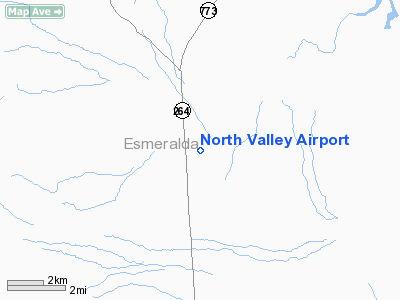
Location: |
Esmeralda County, NV |
|
Magnetic Variation: |
15E (1985) |
Owner
& Manager
|
Ownership: |
Privately owned |
|
Owner: |
Combined Metals Reduction Co. |
|
Address: |
Fishlake Valley
Tonopah, NV 89049 |
|
Phone number: |
702-572-3282 |
|
Manager: |
Richard Bogenreif |
|
Address: |
Fishlake Valley
Tonopah, NV 89049 |
|
Phone number: |
702-572-3282 |
Airport
Operations and Facilities
|
Airport
Use: |
Private |
|
Wind
indicator: |
Yes |
|
Segmented
Circle: |
No |
|
Control
Tower: |
No |
|
Attendance
Schedule: |
UNATNDD |
|
Landing
fee charge: |
No |
|
Sectional
chart: |
San Francisco
AIRPORT IS 10 MILES INTO NEVADA. THE CLOSEST ASSC CITY IS
BISHOP, CA - AND IS CORRECTLY CHARTED ON SAN FRANCISCO SECTIONAL. |
|
Region: |
AWP - Western-Pacific |
|
Boundary
ARTCC: |
ZOA - Oakland |
|
Tie-in
FSS: |
RNO - Reno |
|
FSS
on Airport: |
No |
|
FSS
Phone: |
775-858-1300 |
|
FSS
Toll Free: |
1-800-WX-BRIEF |
|
Runway Information
Runway 16/34
|
Dimension: |
5300 x 100 ft / 1615.4 x 30.5 m |
|
Surface: |
DIRT, |
|
|
Runway 16 |
Runway 34 |
|
Traffic
Pattern: |
Left |
Left |
|
Radio Navigation
Aids
|
ID |
Type |
Name |
Ch |
Freq |
Var |
Dist |
|
BIH |
VOR/DME |
Bishop |
033X |
109.60 |
15E |
32.3 nm |
|
OAL |
VORTAC |
Coaldale |
124X |
117.70 |
17E |
17.4 nm |
|
MVA |
VORTAC |
Mina |
098X |
115.10 |
17E |
42.0 nm |
Remarks
- FENCE
ON EAST SIDE OF STRIP.
- E111;
VFR; PVT USE.
Based Aircraft
|
Aircraft
based on field: |
2 |
|
Single
Engine Airplanes: |
1 |
|
Multi
Engine Airplanes: |
1 |
North Valley Airport
Address:
Esmeralda County, NV
Tel:
702-572-3282
Images
and information placed above are from
http://www.airport-data.com/airport/9CA6/
We
thank them for the data!
| General
Info |
| Country |
United
States |
| State |
CALIFORNIA
|
| FAA ID |
9CA6
|
| Latitude |
37-52-08.749N
|
| Longitude |
118-05-42.393W
|
| Elevation |
4960 feet
|
| Near City |
BISHOP
|
We don't guarantee the information is fresh and accurate. The data may
be wrong or outdated.
For more up-to-date information please refer to other sources.
|
|


