 |
|
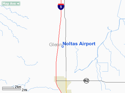
Location
& QuickFacts
|
FAA
Information Effective: |
2006-09-28 |
|
Airport
Identifier: |
98CL |
|
Longitude/Latitude: |
122-12-03.9390W/39-34-44.5730N
-122.201094/39.579048 (Estimated) |
|
Elevation: |
145 ft / 44.20 m (Estimated) |
|
Land: |
0 acres |
|
From
nearest city: |
3 nautical miles N of Willows, CA |
|
Location: |
Glenn County, CA |
|
Magnetic Variation: |
17E (1985) |
Owner
& Manager
|
Ownership: |
Privately owned |
|
Owner: |
Hugh Gregg Molta |
|
Address: |
Po Box 1246
Willows, CA 95988 |
|
Phone number: |
916-934-3971 |
|
Manager: |
Hugh Gregg Nolta |
|
Address: |
Box 1246
Willows, CA 95988 |
|
Phone number: |
916-934-3971 |
Airport
Operations and Facilities
|
Airport Use: |
Private |
|
Wind indicator: |
Yes |
|
Segmented Circle: |
No |
|
Control Tower: |
No |
|
Attendance Schedule: |
UNATNDD |
|
Landing fee charge: |
No |
|
Sectional chart: |
San Francisco |
|
Region: |
AWP - Western-Pacific |
|
Boundary ARTCC: |
ZOA - Oakland |
|
Tie-in FSS: |
RIU - Rancho Murieta |
|
FSS on Airport: |
No |
|
FSS Phone: |
916-354-0161 |
|
FSS Toll Free: |
1-800-WX-BRIEF |
Airport
Services
|
Airframe
Repair: |
NONE |
|
Power
Plant Repair: |
NONE |
|
Runway
Information
Runway N/S
|
Dimension: |
1900 x 85 ft / 579.1 x 25.9 m |
|
Surface: |
GRAVEL, |
|
|
Runway N |
Runway S |
|
Traffic
Pattern: |
Right |
Right |
|
Radio Navigation
Aids
|
ID |
Type |
Name |
Ch |
Freq |
Var |
Dist |
|
OVE |
NDB |
Oroville |
|
212.00 |
16E |
27.3 nm |
|
PBT |
NDB |
Proberta |
|
338.00 |
16E |
32.2 nm |
|
MY |
NDB |
Halow |
|
222.00 |
16E |
36.9 nm |
|
LOP |
NDB |
Lampson |
|
217.00 |
16E |
47.3 nm |
|
BAB |
TACAN |
Beale |
023X |
|
16E |
44.3 nm |
|
CIC |
VOR/DME |
Chico |
035X |
109.80 |
16E |
20.7 nm |
|
MYV |
VOR/DME |
Marysville |
045X |
110.80 |
16E |
41.1 nm |
|
MXW |
VORTAC |
Maxwell |
037X |
110.00 |
18E |
15.7 nm |
|
RBL |
VORTAC |
Red Bluff |
104X |
115.70 |
18E |
31.3 nm |
|
ILA |
VORTAC |
Williams |
091X |
114.40 |
18E |
31.6 nm |
Remarks
- ESTABLISHED
PRIOR TO 1959.
Noltas Airport
Address:
Glenn County, CA
Tel:
916-934-3971
Images
and information placed above are from
http://www.airport-data.com/airport/98CL/
We
thank them for the data!
| General
Info |
| Country |
United
States |
| State |
CALIFORNIA
|
| FAA ID |
98CL
|
| Latitude |
39-34-44.573N
|
| Longitude |
122-12-03.939W
|
| Elevation |
145 feet
|
| Near City |
WILLOWS
|
We don't guarantee the information is fresh and accurate. The data may
be wrong or outdated.
For more up-to-date information please refer to other sources.
|
|


