 |
|
|
|
|
|
Location
& QuickFacts
|
FAA
Information Effective: |
2006-09-28 |
|
Airport
Identifier: |
1Q4 |
|
Longitude/Latitude: |
121-17-58.7870W/37-40-44.7460N
-121.299663/37.679096 (Estimated) |
|
Elevation: |
62 ft / 18.90 m (Estimated) |
|
Land: |
394 acres |
|
From
nearest city: |
7 nautical miles SE of Tracy, CA |
|
Location: |
San Joaquin County, CA |
|
Magnetic Variation: |
16E (1985) |
Owner
& Manager
|
Ownership: |
Publicly owned |
|
Owner: |
City Of Tracy |
|
Address: |
325 East Tenth St
Tracy, CA 95376 |
|
Phone
number: |
209-831-4330 |
|
Manager: |
Rod Buchanan
CITY OF TRACY COMMUNITY SERVICES SUPERVISOR.
AIRPORT
AND TRANSIT MANAGEMENT. |
|
Address: |
400 East Tenth Street
Tracy, CA 95376 |
|
Phone number: |
209-831-4330
FAX: (209) 831-4121. |
Airport
Operations and Facilities
|
Airport
Use: |
Open to public |
|
Wind
indicator: |
Yes |
|
Segmented
Circle: |
No |
|
Control
Tower: |
No |
|
Attendance
Schedule: |
UNATNDD |
|
Landing
fee charge: |
No |
|
Sectional
chart: |
San Francisco |
|
Region: |
AWP - Western-Pacific |
|
Traffic
Pattern Alt: |
800 ft |
|
Boundary
ARTCC: |
ZOA - Oakland |
|
Tie-in
FSS: |
RIU - Rancho Murieta |
|
FSS
on Airport: |
No |
|
FSS
Phone: |
916-354-0161 |
|
FSS
Toll Free: |
1-800-WX-BRIEF |
|
NOTAMs
Facility: |
RIU (NOTAM-d service avaliable) |
|
Federal Agreements: |
P |
Airport
Communications
Airport
Services
|
Airframe
Repair: |
NONE |
|
Power
Plant Repair: |
NONE |
|
Bottled
Oxygen: |
NONE |
|
Bulk
Oxygen: |
NONE |
|
Runway Information
Runway 12/30
|
Dimension: |
3530
x 60 ft / 1075.9 x 18.3 m
PAVED RUNWAY SAFETY AREA RY 12/30. |
|
Surface: |
ASPH, Fair Condition |
|
|
Runway 12 |
Runway 30 |
|
Elevation: |
56.00 ft |
61.00 ft |
|
Traffic
Pattern: |
Left |
Left |
|
Markings: |
Basic, Good Condition |
Basic, Good Condition |
|
Runway
End Identifier: |
No |
No |
|
Centerline
Lights: |
No |
No |
|
Touchdown
Lights: |
No |
No |
|
Radio Navigation
Aids
|
ID |
Type |
Name |
Ch |
Freq |
Var |
Dist |
|
TCY |
NDB |
Tracy |
|
203.00 |
15E |
6.9 nm |
|
LV |
NDB |
Reiga |
|
374.00 |
16E |
18.3 nm |
|
NUQ |
TACAN |
Moffett |
123X |
|
17E |
39.0 nm |
|
SUU |
TACAN |
Travis |
113X |
|
17E |
45.8 nm |
|
TZZ |
VOR |
Travis |
|
116.40 |
17E |
46.7 nm |
|
MOD |
VOR/DME |
Modesto |
093X |
114.60 |
17E |
16.6 nm |
|
SJC |
VOR/DME |
San Jose |
088X |
114.10 |
16E |
35.8 nm |
|
CCR |
VOR/DME |
Concord |
117X |
117.00 |
17E |
41.7 nm |
|
ECA |
VORTAC |
Manteca |
107X |
116.00 |
17E |
11.1 nm |
|
LIN |
VORTAC |
Linden |
095X |
114.80 |
17E |
27.6 nm |
|
OAK |
VORTAC |
Oakland |
115X |
116.80 |
17E |
44.0 nm |
|
SAC |
VORTAC |
Sacramento |
099X |
115.20 |
17E |
47.5 nm |
|
OSI |
VORTAC |
Woodside |
086X |
113.90 |
17E |
49.9 nm |
Remarks
- MODEL
AIRCRAFT ACTIVITY ON ABANDONED RY WKENDS.
- ESTABD
PRIOR TO 15 MAY 59.
Operational Statistics
|
Aircraft
Operations: |
77/Week |
|
General
Aviation Itinerant: |
100.0% |
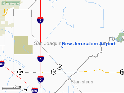
New Jerusalem Airport
Address:
San Joaquin County, CA
Tel:
209-831-4330
Images
and information placed above are from
http://www.airport-data.com/airport/1Q4/
We
thank them for the data!
| General
Info |
| Country |
United
States |
| State |
CALIFORNIA
|
| FAA ID |
1Q4
|
| Latitude |
37-40-44.746N
|
| Longitude |
121-17-58.787W
|
| Elevation |
62 feet
|
| Near City |
TRACY
|
We don't guarantee the information is fresh and accurate. The data may
be wrong or outdated.
For more up-to-date information please refer to other sources.
|
|


