 |
|
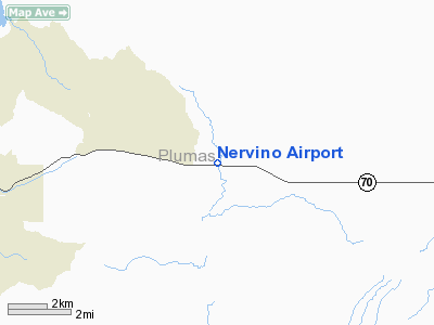
| Nervino Airport |
| IATA: none – ICAO: none – FAA LID: O02 |
| Summary |
| Airport type |
Public |
| Operator |
Plumas County |
| Location |
Beckwourth, California |
| Elevation AMSL |
4,900 ft / 1,493.5 m |
| Coordinates |
39°49′07″N 120°21′10″W / 39.81861°N 120.35278°W / 39.81861; -120.35278Coordinates: 39°49′07″N 120°21′10″W / 39.81861°N 120.35278°W / 39.81861; -120.35278 |
| Runways |
| Direction |
Length |
Surface |
| ft |
m |
| 7/25 |
4,651 |
1,418 |
Asphalt |
Nervino Airport (FAA LID: O02) is a public airport located one mile (1.6 km) east of Apple Valley, serving Plumas County, California, USA. The airport is mostly used for general aviation.
Facilities
Nervino Airport covers 99 acres (400,000 m) and has one runway:
- Runway 7/25: 4,651 x 75 ft (1,418 x 23 m), Surface: Asphalt
The above content comes from Wikipedia and is published under free licenses – click here to read more.
Location
& QuickFacts
|
FAA
Information Effective: |
2006-09-28 |
|
Airport
Identifier: |
O02 |
|
Longitude/Latitude: |
120-21-10.2000W/39-49-06.7000N
-120.352833/39.818528 (Estimated) |
|
Elevation: |
4900 ft / 1493.52 m (Surveyed) |
|
Land: |
99 acres |
|
From
nearest city: |
1 nautical miles E of Beckwourth, CA |
|
Location: |
Plumas County, CA |
|
Magnetic Variation: |
15E (2005) |
Owner
& Manager
|
Ownership: |
Publicly owned |
|
Owner: |
Plumas County |
|
Address: |
555 Main St.
Quincy, CA 95971 |
|
Phone
number: |
530-283-6210 |
|
Manager: |
John Mcmorrow
DIRECTOR OF PLANNING DEPT. |
|
Address: |
555 Main St.
Quincy, CA 95971 |
|
Phone
number: |
530-283-7011
PLANNING DEPT OFFICE IN QUINCY; FBO PHONE (520) 832-6940. |
Airport
Operations and Facilities
|
Airport
Use: |
Open to public |
|
Wind
indicator: |
Yes |
|
Segmented
Circle: |
Yes |
|
Control
Tower: |
No |
|
Attendance
Schedule: |
ALL/ALL/0800-1900 |
|
Lighting
Schedule: |
DUSK-DAWN
ACTVT MIRL RY 07/25 - CTAF. |
|
Beacon
Color: |
Clear-Green (lighted land airport) |
|
Landing
fee charge: |
No |
|
Sectional
chart: |
San Francisco |
|
Region: |
AWP - Western-Pacific |
|
Traffic
Pattern Alt: |
1000 ft |
|
Boundary
ARTCC: |
ZOA - Oakland |
|
Tie-in
FSS: |
RNO - Reno |
|
FSS
on Airport: |
No |
|
FSS
Phone: |
775-858-1300 |
|
FSS
Toll Free: |
1-800-WX-BRIEF |
|
NOTAMs
Facility: |
RNO (NOTAM-d service avaliable) |
|
Federal Agreements: |
NGY |
Airport
Communications
|
CTAF: |
122.800 |
|
Unicom: |
122.800 |
Airport
Services
|
Fuel
available: |
100LL |
|
Airframe
Repair: |
MAJOR |
|
Power
Plant Repair: |
MAJOR |
|
Bottled
Oxygen: |
NONE |
|
Bulk
Oxygen: |
NONE |
|
Runway Information
Runway 07/25
|
Dimension: |
4651 x 75 ft / 1417.6 x 22.9 m |
|
Surface: |
ASPH, Good Condition |
|
Weight
Limit: |
Single wheel: 12000 lbs. |
|
Edge
Lights: |
Medium |
|
|
Runway 07 |
Runway 25 |
|
Longitude: |
120-21-39.9208W |
120-20-40.3267W |
|
Latitude: |
39-49-06.7256N |
39-49-06.6163N |
|
Elevation: |
4899.00 ft |
4891.00 ft |
|
Alignment: |
90 |
127 |
|
Traffic
Pattern: |
Right |
Left |
|
Markings: |
Basic, Good Condition |
Basic, Good Condition |
|
Crossing
Height: |
0.00
ft |
44.00 ft |
|
VASI: |
|
2-light PAPI on left side |
|
Visual
Glide Angle: |
0.00� |
3.00� |
|
Runway
End Identifier: |
No |
No |
|
Centerline
Lights: |
No |
No |
|
Touchdown
Lights: |
No |
No |
|
Obstruction: |
15 ft road, 510.0 ft from runway, 160 ft right
of centerline, 20:1 slope to clear |
3 ft fence, 270.0 ft from runway, 23:1 slope
to clear |
|
Radio Navigation
Aids
|
ID |
Type |
Name |
Ch |
Freq |
Var |
Dist |
|
AHC |
VOR/DME |
Amedee |
027X |
109.00 |
17E |
28.5 nm |
|
SWR |
VOR/DME |
Squaw Valley |
079X |
113.20 |
16E |
38.6 nm |
|
FMG |
VORTAC |
Mustang |
126X |
117.90 |
16E |
36.6 nm |
Based Aircraft
|
Aircraft
based on field: |
28 |
|
Single
Engine Airplanes: |
23 |
|
Multi
Engine Airplanes: |
4 |
|
Helicopters: |
1 |
Operational Statistics
|
Aircraft
Operations: |
44/Day |
|
General
Aviation Local: |
37.5% |
|
General
Aviation Itinerant: |
62.5% |
Nervino Airport
Address:
Plumas County, CA
Tel:
530-283-6210,
530-283-7011
Images
and information placed above are from
http://www.airport-data.com/airport/O02/
We
thank them for the data!
| General
Info |
| Country |
United
States |
| State |
CALIFORNIA
|
| FAA ID |
O02
|
| Latitude |
39-49-07.334N
|
| Longitude |
120-21-06.136W
|
| Elevation |
4895 feet
|
| Near City |
BECKWOURTH
|
We don't guarantee the information is fresh and accurate. The data may
be wrong or outdated.
For more up-to-date information please refer to other sources.
|
|


