 |
|
Natividad Medical Center Heliport |
|
|
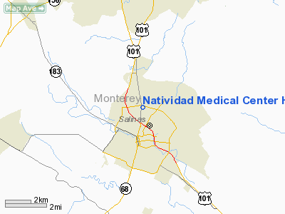
Location
& QuickFacts
|
FAA
Information Effective: |
2006-09-28 |
|
Airport
Identifier: |
5CL4 |
|
Longitude/Latitude: |
121-39-01.8100W/36-41-51.8500N
-121.650503/36.697736 (Estimated) |
|
Elevation: |
70 ft / 21.34 m (Estimated) |
|
Land: |
10 acres |
|
From
nearest city: |
2 nautical miles SW of Salinas, CA |
|
Location: |
Alameda County, CA |
|
Magnetic Variation: |
13E (1995) |
Owner
& Manager
|
Ownership: |
Privately owned |
|
Owner: |
Natividad Medical Center |
|
Address: |
1441 Constitution Blvd
Salinas, CA 93906 |
|
Phone
number: |
831-755-4111 |
|
Manager: |
John Brennan |
|
Address: |
1441 Constitution Blvd Bldg 800
Salinas, CA 93906 |
|
Phone number: |
831-755-4081 |
Airport
Operations and Facilities
|
Airport Use: |
Private
MEDICAL USE. |
|
Wind indicator: |
Yes |
|
Segmented Circle: |
No |
|
Control Tower: |
No |
|
Attendance Schedule: |
ALL/ALL/ALL |
|
Lighting Schedule: |
RDO-CTL |
|
Sectional chart: |
Los Angeles |
|
Region: |
AWP - Western-Pacific |
|
Boundary ARTCC: |
ZOA - Oakland |
|
Tie-in FSS: |
OAK - Oakland |
|
FSS Phone: |
510-273-6111 |
|
FSS Toll Free: |
1-800-WX-BRIEF |
Airport
Communications
|
Runway Information
Helipad H1
|
Dimension: |
74 x 74 ft / 22.6 x 22.6 m |
|
Surface: |
CONC, |
|
|
Runway H1 |
Runway |
|
Traffic
Pattern: |
Left |
Left |
|
Radio Navigation
Aids
|
ID |
Type |
Name |
Ch |
Freq |
Var |
Dist |
|
PDG |
NDB |
Pajar |
|
327.00 |
17E |
15.0 nm |
|
UAD |
NDB |
Chualar |
|
263.00 |
16E |
15.0 nm |
|
HGT |
NDB |
Hunter Liggett |
|
209.00 |
15E |
49.6 nm |
|
NUQ |
TACAN |
Moffett |
123X |
|
17E |
48.3 nm |
|
SJC |
VOR/DME |
San Jose |
088X |
114.10 |
16E |
43.1 nm |
|
SNS |
VORTAC |
Salinas |
120X |
117.30 |
17E |
3.1 nm |
|
BSR |
VORTAC |
Big Sur |
087X |
114.00 |
16E |
31.0 nm |
|
PXN |
VORTAC |
Panoche |
073X |
112.60 |
16E |
42.0 nm |
Remarks
- PROVIDED
VFR PRIVATE USE.
Natividad Medical Center Heliport
Address:
Alameda County, CA
Tel:
831-755-4111,
831-755-4081
Images
and information placed above are from
http://www.airport-data.com/airport/5CL4/
We
thank them for the data!
| General
Info |
| Country |
United
States |
| State |
CALIFORNIA
|
| FAA ID |
5CL4
|
| Latitude |
36-41-51.850N
|
| Longitude |
121-39-01.810W
|
| Elevation |
70 feet
|
| Near City |
SALINAS
|
We don't guarantee the information is fresh and accurate. The data may
be wrong or outdated.
For more up-to-date information please refer to other sources.
|
|


