|
|
| Napa County Airport |
 |
| IATA: APC – ICAO: KAPC – FAA LID: APC |
| Summary |
| Airport type |
Public Public Works |
| Operator |
Napa County |
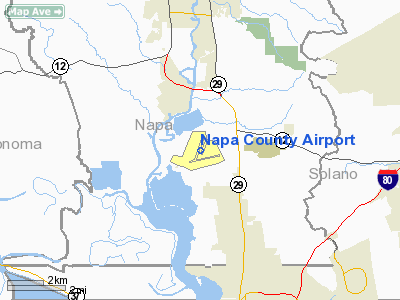
| Location |
Napa County, near Napa, California |
| Elevation AMSL |
35 ft / 11 m |
| Coordinates |
38°12′47.50″N 122°16′50.50″W / 38.213194°N 122.280694°W / 38.213194; -122.280694Coordinates: 38°12′47.50″N 122°16′50.50″W / 38.213194°N 122.280694°W / 38.213194; -122.280694 |
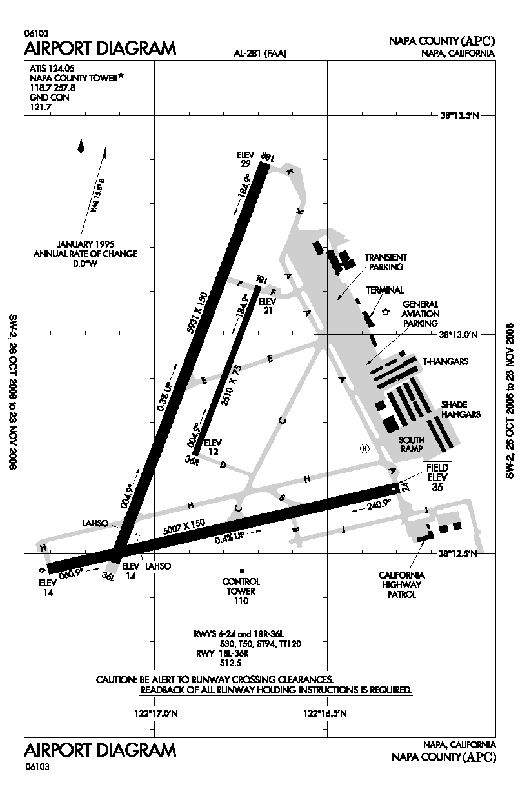
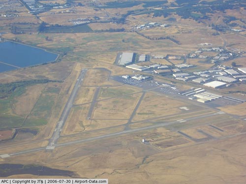
| Runways |
| Direction |
Length |
Surface |
| ft |
m |
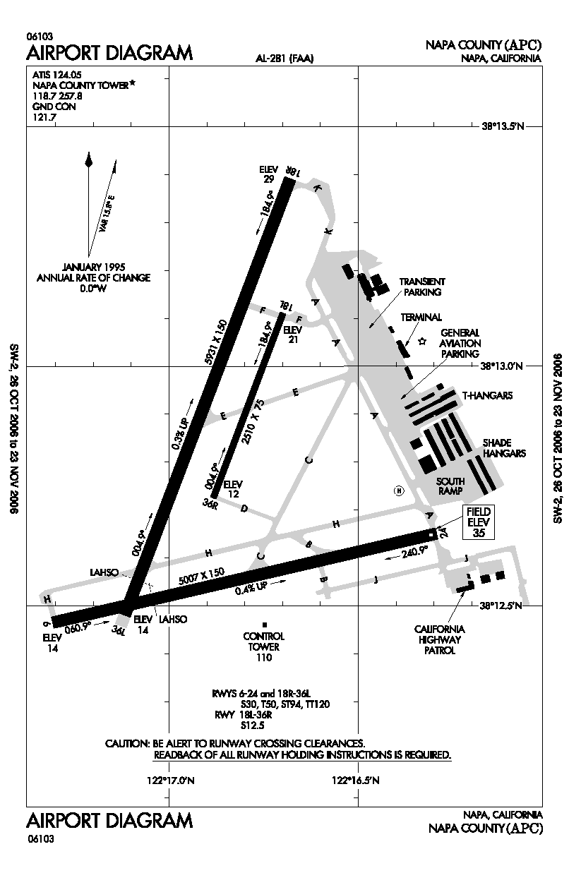
| 6/24 |
5,007 |
1,526 |
Concrete |
| 18R/36L |
5,931 |
1,808 |
Concrete |
| 18L/36R |
2,510 |
765 |
Asphalt |
Napa County Airport (IATA: APC, ICAO: KAPC, FAA LID: APC), also known as Napa Valley Airport, is a public airport located five miles (8 km) south of Napa, in Napa County, California, USA. It has three runways.
During 2008, the airport's 1960-era control tower received extensive radio, plumbing and electrical upgrades and renovations funded by the federal government. At the time of these renovations, airport officials claimed that the airport had about 122,000 flights take off or land at the facility annually. History
The airport was built by the United States Army Air Force about 1942, and was known as Napa Flight Strip. It was an emergency landing airfield for military aircraft on training flights. It was expanded later in the war and was re designated as Napa Army Airfield, becoming an auxiliary airfield of the Fourth Air Force Hamilton Army Airfield. 4th Air Force used the base as a training base for replacement fighter pilots, primarily flying P-38 Lightnings before being deployed to combat units in overseas areas.
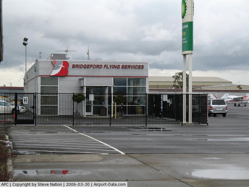
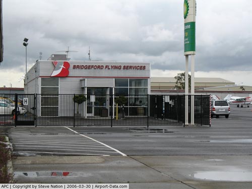
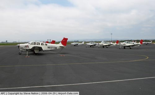
Following World War II, the airfield property was deeded to Napa County by the War Assets Administration for civilian use. The airport soon became a business hub for what was once a rural, sparsely populated portion in the southern end of the county. Jonesy's Restaurant opened for business in 1946 at the airport and was a longtime favorite of locals and visitors. The restaurant remained in business for 63 years before closing in 2010. By 1947 half a dozen small businesses had opened at the facility but only Bridgeford Flying Service remained open past the first year and still remains in business today. In 1971 International Air Services Company and Japan Airlines opened a flight training school at the airport. In June 2010 Japan Airlines announced that it would be closing its training facility as part of a bankruptcy reorganization plan.
The above content comes from Wikipedia and is published under free licenses – click here to read more.
|
 |
(Click on the photo to enlarge) |
|
 |
(Click on the photo to enlarge) |
|
 |
(Click on the photo to enlarge) |
|
 |
(Click on the photo to enlarge) |
|
 |
(Click on the photo to enlarge) |
Location
& QuickFacts
|
FAA
Information Effective: |
2006-09-28 |
|
Airport
Identifier: |
APC |
|
Longitude/Latitude: |
122-16-50.5000W/38-12-47.5000N
-122.280694/38.213194 (Estimated) |
|
Elevation: |
35 ft / 10.67 m (Surveyed) |
|
Land: |
804 acres |
|
From
nearest city: |
5 nautical miles S of Napa, CA |
|
Location: |
Napa County, CA |
|
Magnetic Variation: |
15E (2005) |
Owner
& Manager
|
Ownership: |
Publicly owned |
|
Owner: |
Napa County |
|
Address: |
2030 Airport Rd.
Napa, CA 94558 |
|
Phone number: |
707-253-4300 |
|
Manager: |
Wanda Kennedy |
|
Address: |
2030 Airport Rd.
Napa, CA 94558 |
|
Phone number: |
707-253-4300 |
Airport
Operations and Facilities
|
Airport
Use: |
Open to public |
|
Wind
indicator: |
Yes |
|
Segmented
Circle: |
Yes |
|
Control
Tower: |
Yes |
|
Attendance
Schedule: |
ALL/ALL/0800-2100 |
|
Lighting
Schedule: |
DUSK-DAWN
WHEN ATCT CLSD ACTVT MIRL RYS 18R/36L & RY 06/24, REIL
RY 06, PAPI RY 18R & MALS RY 36L - CTAF. |
|
Beacon
Color: |
Clear-Green (lighted land airport) |
|
Landing
fee charge: |
No |
|
Sectional
chart: |
San Francisco |
|
Region: |
AWP - Western-Pacific |
|
Traffic
Pattern Alt: |
1000 ft |
|
Boundary
ARTCC: |
ZOA - Oakland |
|
Tie-in
FSS: |
OAK - Oakland |
|
FSS
on Airport: |
No |
|
FSS
Phone: |
510-273-6111 |
|
FSS
Toll Free: |
1-800-WX-BRIEF |
|
NOTAMs
Facility: |
APC (NOTAM-d service avaliable) |
|
Federal Agreements: |
NGY |
Airport
Communications
|
CTAF: |
118.700 |
|
Unicom: |
122.950 |
Airport
Services
|
Fuel
available: |
100LLA
FOR FUEL SVC 2100-0800 CALL 707-253-4451. |
|
Airframe
Repair: |
MAJOR |
|
Power
Plant Repair: |
MAJOR |
|
Bottled
Oxygen: |
HIGH/LOW |
|
Bulk
Oxygen: |
NONE |
|
Runway Information
Runway 06/24
|
Dimension: |
5007 x 150 ft / 1526.1 x 45.7 m |
|
Surface: |
CONC, Fair Condition |
|
Weight
Limit: |
Single wheel: 30000 lbs.
Dual wheel: 50000 lbs.
Dual
tandem wheel: 120000 lbs. |
|
Edge
Lights: |
Medium |
|
|
Runway 06 |
Runway 24 |
|
Longitude: |
122-17-18.5417W |
122-16-17.4784W |
|
Latitude: |
38-12-27.7472N |
38-12-39.0976N |
|
Elevation: |
14.00
ft |
35.00 ft |
|
Alignment: |
77 |
127 |
|
Traffic
Pattern: |
Left |
Left |
|
Markings: |
Non-precision instrument, Fair Condition |
Non-precision instrument, Fair Condition |
|
Runway
End Identifier: |
Yes |
No |
|
Centerline
Lights: |
No |
No |
|
Touchdown
Lights: |
No |
No |
|
Obstruction: |
, 50:1 slope to clear |
100 ft tree, 2410.0 ft from runway, 100 ft
left of centerline, 22:1 slope to clear
SHALLOW DITCH 115 FT FM APCH END RY 24. |
|
Runway 18L/36R
|
Dimension: |
2510 x 75 ft / 765.0 x 22.9 m |
|
Surface: |
ASPH, Fair Condition |
|
Weight
Limit: |
Single wheel: 12500 lbs. |
|
|
Runway 18L |
Runway 36R |
|
Longitude: |
122-16-41.8854W |
122-16-53.0230W |
|
Latitude: |
38-13-06.6791N |
38-12-43.4722N |
|
Elevation: |
21.00
ft |
12.00
ft |
|
Alignment: |
127 |
21 |
|
Traffic
Pattern: |
Left |
Right |
|
Markings: |
Basic, Fair Condition |
Basic, Fair Condition |
|
Runway
End Identifier: |
No |
No |
|
Touchdown
Lights: |
No |
No |
|
Runway 18R/36L
|
Dimension: |
5931 x 150 ft / 1807.8 x 45.7 m |
|
Surface: |
CONC, Fair Condition |
|
Weight
Limit: |
Single wheel: 30000 lbs.
Dual wheel: 50000 lbs.
Dual
tandem wheel: 120000 lbs. |
|
Edge
Lights: |
Medium |
|
|
Runway 18R |
Runway 36L |
|
Longitude: |
122-16-40.6556W |
122-17-06.9741W |
|
Latitude: |
38-13-23.5382N |
38-12-28.7104N |
|
Elevation: |
29.00 ft |
14.00
ft |
|
Alignment: |
127 |
21 |
|
ILS
Type: |
|
LOCALIZER |
|
Traffic
Pattern: |
Right |
Left |
|
Markings: |
Non-precision instrument, Fair Condition |
Non-precision instrument, Fair Condition |
|
Crossing
Height: |
52.00 ft |
0.00
ft |
|
VASI: |
4-light PAPI on left side |
|
|
Visual
Glide Angle: |
3.25� |
0.00� |
|
Approach
lights: |
|
MALS |
|
Runway
End Identifier: |
No |
No |
|
Centerline
Lights: |
No |
No |
|
Touchdown
Lights: |
No |
No |
|
Obstruction: |
, 50:1 slope to clear |
76 ft tree, 3100.0 ft from runway, 200 ft right
of centerline, 38:1 slope to clear |
|
Radio Navigation
Aids
|
ID |
Type |
Name |
Ch |
Freq |
Var |
Dist |
|
LV |
NDB |
Reiga |
|
374.00 |
16E |
42.2 nm |
|
SUU |
TACAN |
Travis |
113X |
|
17E |
16.0 nm |
|
NUQ |
TACAN |
Moffett |
123X |
|
17E |
48.1 nm |
|
TZZ |
VOR |
Travis |
|
116.40 |
17E |
23.5 nm |
|
CCR |
VOR/DME |
Concord |
117X |
117.00 |
17E |
15.0 nm |
|
STS |
VOR/DME |
Santa Rosa |
077X |
113.00 |
16E |
30.6 nm |
|
SFO |
VOR/DME |
San Francisco |
105X |
115.80 |
17E |
36.0 nm |
|
MCC |
VOR/DME |
Mc Clellan |
029X |
109.20 |
17E |
49.5 nm |
|
SGD |
VORTAC |
Scaggs Island |
058X |
112.10 |
17E |
4.8 nm |
|
SAU |
VORTAC |
Sausalito |
109X |
116.20 |
17E |
24.4 nm |
|
PYE |
VORTAC |
Point Reyes |
084X |
113.70 |
17E |
28.9 nm |
|
OAK |
VORTAC |
Oakland |
115X |
116.80 |
17E |
29.4 nm |
|
SAC |
VORTAC |
Sacramento |
099X |
115.20 |
17E |
37.1 nm |
|
OSI |
VORTAC |
Woodside |
086X |
113.90 |
17E |
49.3 nm |
|
SFO |
VOT |
San Francisco Intl |
|
111.00 |
|
36.0 nm |
|
SAC |
VOT |
Sacramento Executive |
|
111.40 |
|
41.1 nm |
|
SMF |
VOT |
Sacramento Metropolitan |
|
111.40 |
|
43.3 nm |
Remarks
- ASPH
TWYS STRENGTH 30,000 GWT SINGLE WHEEL.
- ASPH
APRONS STRENGTH 12500-30000 LBS GWT SINGLE WHEEL.
- FLOCKS
OF GULLS AND NUMEROUS BIRDS ON RWYS AND IN VICINITY OF ARPT DURING THE
MONTHS OF OCT THRU APR AND DURING RAINY WEATHER.
- RWY
18R/36L - 150' ASPH STOPWAY SOUTH END.
- RY
18R/36L & 06/24 LIMITED BY ARPT OPER TO 50000 LBS.
DUAL WHEEL GEAR.
- HOLD
SHORT OF RY 18L APCH AREA (18L-APCH) ON TWY ALPHA.
Based Aircraft
|
Aircraft
based on field: |
227 |
|
Single
Engine Airplanes: |
183 |
|
Multi
Engine Airplanes: |
32 |
|
Jet Engine
Airplanes: |
7 |
|
Helicopters: |
3 |
|
Gliders: |
2 |
Operational Statistics
|
Aircraft
Operations: |
347/Day |
|
Air Taxi: |
0.1% |
|
General
Aviation Local: |
51.4% |
|
General
Aviation Itinerant: |
48.2% |
|
Military: |
0.3% |
Napa County Airport
Address:
Napa County, CA
Tel:
707-253-4300
Images
and information placed above are from
http://www.airport-data.com/airport/APC/
We
thank them for the data!
| General
Info |
| Country |
United
States |
| State |
CALIFORNIA
|
| FAA ID |
APC
|
| Latitude |
38-12-47.500N
|
| Longitude |
122-16-50.500W
|
| Elevation |
33 feet
|
| Near City |
NAPA
|
We don't guarantee the information is fresh and accurate. The data may
be wrong or outdated.
For more up-to-date information please refer to other sources.
|
|