 |
|
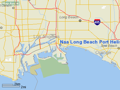
Naa Long Beach Port Helistop Heliport |
|
|
Location
& QuickFacts
|
FAA
Information Effective: |
2006-09-28 |
|
Airport
Identifier: |
42L |
|
Longitude/Latitude: |
118-11-58.2460W/33-45-53.0640N
-118.199513/33.764740 (Estimated) |
|
Elevation: |
15 ft / 4.57 m (Estimated) |
|
Land: |
0 acres |
|
From
nearest city: |
1 nautical miles SW of Long Beach, CA |
|
Location: |
Los Angeles County, CA |
|
Magnetic Variation: |
14E (1985) |
Owner
& Manager
|
Ownership: |
Publicly owned |
|
Owner: |
City Of Long Beach |
|
Address: |
2609 E. Spring Street
Long Beach, CA 90806 |
|
Phone
number: |
213-426-0162 |
|
Manager: |
Dan W. Ramos |
|
Address: |
2609 E. Spring Street
Long Beach, CA 90806 |
|
Phone number: |
213-426-0162 |
Airport
Operations and Facilities
|
Airport Use: |
Private |
|
Wind indicator: |
Yes |
|
Segmented Circle: |
Yes |
|
Control Tower: |
No |
|
Attendance Schedule: |
ALL/MON-FRI/0700-1530 |
|
Landing fee charge: |
No |
|
Sectional chart: |
Los Angeles |
|
Region: |
AWP - Western-Pacific |
|
Boundary ARTCC: |
ZLA - Los Angeles |
|
Tie-in FSS: |
HHR - Hawthorne |
|
FSS on Airport: |
No |
|
FSS Phone: |
310-970-0102 |
|
FSS Toll Free: |
1-800-WX-BRIEF |
Airport
Services
|
Airframe
Repair: |
NONE |
|
Power
Plant Repair: |
NONE |
|
Runway Information
Helipad H1
|
Dimension: |
105 x 75 ft / 32.0 x 22.9 m |
|
Surface: |
ASPH, |
|
|
Runway H1 |
Runway |
|
Elevation: |
15.00
ft |
0.00
ft |
|
Traffic
Pattern: |
Left |
Left |
|
Radio Navigation
Aids
|
ID |
Type |
Name |
Ch |
Freq |
Var |
Dist |
|
CPM |
NDB |
Compton |
|
378.00 |
15E |
7.8 nm |
|
EMT |
NDB |
El Monte |
|
359.00 |
15E |
21.2 nm |
|
PAI |
NDB |
Pacoima |
|
370.00 |
15E |
31.6 nm |
|
SB |
NDB |
Petis |
|
397.00 |
14E |
45.1 nm |
|
NUC |
NDB |
San Clemente |
|
350.00 |
15E |
48.1 nm |
|
RIV |
TACAN |
March |
077X |
|
14E |
47.0 nm |
|
NUC |
TACAN |
San Clemente |
123X |
|
15E |
48.3 nm |
|
RAL |
VOR |
Riverside |
|
112.40 |
15E |
39.1 nm |
|
SMO |
VOR/DME |
Santa Monica |
045X |
110.80 |
15E |
19.6 nm |
|
ELB |
VOR/DME |
El Toro |
119X |
117.20 |
14E |
24.0 nm |
|
VNY |
VOR/DME |
Van Nuys |
078X |
113.10 |
15E |
31.2 nm |
|
VTU |
VOR/DME |
Ventura |
019X |
108.20 |
15E |
47.3 nm |
|
SLI |
VORTAC |
Seal Beach |
104X |
115.70 |
15E |
7.3 nm |
|
LAX |
VORTAC |
Los Angeles |
083X |
113.60 |
15E |
15.4 nm |
|
SXC |
VORTAC |
Santa Catalina |
051X |
111.40 |
15E |
25.9 nm |
|
POM |
VORTAC |
Pomona |
041X |
110.40 |
15E |
27.9 nm |
|
PDZ |
VORTAC |
Paradise |
059X |
112.20 |
15E |
34.7 nm |
|
FIM |
VORTAC |
Fillmore |
072X |
112.50 |
15E |
49.2 nm |
|
LAX |
VOT |
San Pedro Hill |
|
113.90 |
|
6.9 nm |
|
SNA |
VOT |
Santa Ana |
|
110.00 |
|
17.3 nm |
Remarks
- PVT
USE-DAYLGT OPERNS ONLY.
Based Aircraft
|
Aircraft
based on field: |
4 |
|
Single
Engine Airplanes: |
2 |
|
Helicopters: |
2 |
Naa Long Beach Port Helistop Heliport
Address:
Los Angeles County, CA
Tel:
213-426-0162
Images
and information placed above are from
http://www.airport-data.com/airport/42L/
We
thank them for the data!
| General
Info |
| Country |
United
States |
| State |
CALIFORNIA
|
| FAA ID |
42L
|
| Latitude |
33-45-53.064N
|
| Longitude |
118-11-58.246W
|
| Elevation |
15 feet
|
| Near City |
LONG BEACH
|
We don't guarantee the information is fresh and accurate. The data may
be wrong or outdated.
For more up-to-date information please refer to other sources.
|
|


