 |
|
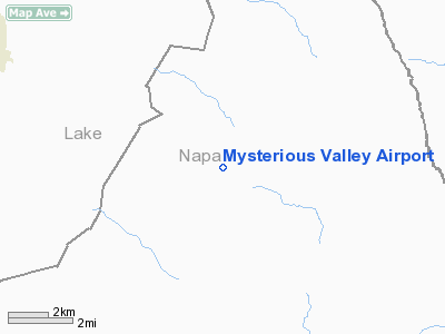
Mysterious Valley Airport |
Location
& QuickFacts
|
FAA
Information Effective: |
2006-09-28 |
|
Airport
Identifier: |
20CL |
|
Longitude/Latitude: |
122-22-02.9220W/38-44-57.6490N
-122.367478/38.749347 (Estimated) |
|
Elevation: |
1410 ft / 429.77 m (Estimated) |
|
Land: |
10 acres |
|
From
nearest city: |
9 nautical miles N of Pope Valley, CA |
|
Location: |
Napa County, CA |
|
Magnetic Variation: |
16E (1985) |
Owner
& Manager
|
Ownership: |
Privately owned |
|
Owner: |
N. C. Pease |
|
Address: |
48 Donald Dr
Orinda, CA 94563 |
|
Phone number: |
925-254-2413 |
|
Address: |
|
Airport
Operations and Facilities
|
Airport Use: |
Private |
|
Wind indicator: |
Yes |
|
Segmented Circle: |
No |
|
Control Tower: |
No |
|
Attendance Schedule: |
IREG |
|
Landing fee charge: |
No |
|
Sectional chart: |
San Francisco |
|
Region: |
AWP - Western-Pacific |
|
Boundary ARTCC: |
ZOA - Oakland |
|
Tie-in FSS: |
OAK - Oakland |
|
FSS on Airport: |
No |
|
FSS Phone: |
510-273-6111 |
|
FSS Toll Free: |
1-800-WX-BRIEF |
Airport
Services
|
Airframe
Repair: |
NONE |
|
Power
Plant Repair: |
NONE |
|
Runway Information
Runway 14/32
|
Dimension: |
3500 x 30 ft / 1066.8 x 9.1 m |
|
Surface: |
GRVL, |
|
|
Runway 14 |
Runway 32 |
|
Traffic
Pattern: |
Left |
Left |
|
Radio Navigation
Aids
|
ID |
Type |
Name |
Ch |
Freq |
Var |
Dist |
|
LOP |
NDB |
Lampson |
|
217.00 |
16E |
28.3 nm |
|
MY |
NDB |
Halow |
|
222.00 |
16E |
43.5 nm |
|
SUU |
TACAN |
Travis |
113X |
|
17E |
36.2 nm |
|
BAB |
TACAN |
Beale |
023X |
|
16E |
49.1 nm |
|
TZZ |
VOR |
Travis |
|
116.40 |
17E |
35.8 nm |
|
STS |
VOR/DME |
Santa Rosa |
077X |
113.00 |
16E |
25.4 nm |
|
MYV |
VOR/DME |
Marysville |
045X |
110.80 |
16E |
42.7 nm |
|
CCR |
VOR/DME |
Concord |
117X |
117.00 |
17E |
45.0 nm |
|
MCC |
VOR/DME |
Mc Clellan |
029X |
109.20 |
17E |
45.5 nm |
|
ILA |
VORTAC |
Williams |
091X |
114.40 |
18E |
25.0 nm |
|
SGD |
VORTAC |
Scaggs Island |
058X |
112.10 |
17E |
34.3 nm |
|
MXW |
VORTAC |
Maxwell |
037X |
110.00 |
18E |
34.8 nm |
|
SAC |
VORTAC |
Sacramento |
099X |
115.20 |
17E |
42.5 nm |
|
ENI |
VORTAC |
Mendocino |
070X |
112.30 |
16E |
46.2 nm |
|
PYE |
VORTAC |
Point Reyes |
084X |
113.70 |
17E |
46.6 nm |
|
SMF |
VOT |
Sacramento Metropolitan |
|
111.40 |
|
36.6 nm |
|
SAC |
VOT |
Sacramento Executive |
|
111.40 |
|
43.2 nm |
Remarks
- HAZARDOUS
STRIP-SURROUNDED BY HILLS, 95 FT FENCE TO FENCE.
- FORM
7480-1 SUBMITTED FOR RECORDS.
Based Aircraft
|
Aircraft
based on field: |
2 |
|
Single
Engine Airplanes: |
2 |
Mysterious Valley Airport
Address:
Napa County, CA
Tel:
925-254-2413
Images
and information placed above are from
http://www.airport-data.com/airport/20CL/
We
thank them for the data!
| General
Info |
| Country |
United
States |
| State |
CALIFORNIA
|
| FAA ID |
20CL
|
| Latitude |
38-44-57.649N
|
| Longitude |
122-22-02.922W
|
| Elevation |
1410 feet
|
| Near City |
POPE VALLEY
|
We don't guarantee the information is fresh and accurate. The data may
be wrong or outdated.
For more up-to-date information please refer to other sources.
|
|


