 |
|
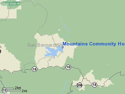
Mountains Community Hospital Heliport |
|
|
Location
& QuickFacts
|
FAA
Information Effective: |
2006-09-28 |
|
Airport
Identifier: |
47CA |
|
Longitude/Latitude: |
117-10-04.0000W/34-15-55.0000N
-117.167778/34.265278 (Estimated) |
|
Elevation: |
5318 ft / 1620.93 m (Estimated) |
|
Land: |
0 acres |
|
From
nearest city: |
2 nautical miles NE of Lake Arrowhead, CA |
|
Location: |
San Bernardino County, CA |
|
Magnetic Variation: |
14E (1985) |
Owner
& Manager
|
Ownership: |
Publicly owned |
|
Owner: |
Mountains Community Hosp. |
|
Address: |
Po Box 70
Lake Arrowhead, CA 92352 |
|
Phone
number: |
714-336-3651 |
|
Manager: |
Tom Madrigal |
|
Address: |
Po Box 70
Lake Arrowhead, CA 92352 |
|
Phone number: |
909-336-3651 |
Airport
Operations and Facilities
|
Airport
Use: |
Private
MEDICAL. |
|
Wind
indicator: |
Yes |
|
Segmented
Circle: |
No |
|
Control
Tower: |
No |
|
Attendance
Schedule: |
UNATNDD |
|
Lighting
Schedule: |
PHONE REQ
FOR ROTG BCN CALL 909-336-3651. |
|
Beacon
Color: |
Clear (unlighted land airport) |
|
Landing
fee charge: |
No |
|
Sectional
chart: |
Los Angeles |
|
Region: |
AWP - Western-Pacific |
|
Boundary
ARTCC: |
ZLA - Los Angeles |
|
Tie-in
FSS: |
RAL - Riverside |
|
FSS
on Airport: |
No |
|
FSS
Phone: |
951-351-3020 |
|
FSS
Toll Free: |
1-800-WX-BRIEF |
|
Runway Information
Helipad H1
|
Dimension: |
50 x 50 ft / 15.2 x 15.2 m |
|
Surface: |
CONC, |
|
|
Runway H1 |
Runway |
|
Traffic
Pattern: |
Left |
Left |
|
Radio Navigation
Aids
|
ID |
Type |
Name |
Ch |
Freq |
Var |
Dist |
|
SB |
NDB |
Petis |
|
397.00 |
14E |
16.0 nm |
|
SJY |
NDB |
San Jacinto |
|
227.00 |
14E |
29.5 nm |
|
EMT |
NDB |
El Monte |
|
359.00 |
15E |
44.2 nm |
|
RIV |
TACAN |
March |
077X |
|
14E |
22.2 nm |
|
RAL |
VOR |
Riverside |
|
112.40 |
15E |
23.5 nm |
|
HDF |
VOR |
Homeland |
|
113.40 |
14E |
29.4 nm |
|
VCV |
VOR/DME |
Victorville |
031X |
109.40 |
14E |
22.6 nm |
|
ELB |
VOR/DME |
El Toro |
119X |
117.20 |
14E |
45.2 nm |
|
PDZ |
VORTAC |
Paradise |
059X |
112.20 |
15E |
27.6 nm |
|
POM |
VORTAC |
Pomona |
041X |
110.40 |
15E |
32.8 nm |
|
PSP |
VORTAC |
Palm Springs |
102X |
115.50 |
13E |
43.8 nm |
|
HEC |
VORTAC |
Hector |
074X |
112.70 |
15E |
47.3 nm |
|
PMD |
VORTAC |
Palmdale |
092X |
114.50 |
15E |
49.6 nm |
|
SNA |
VOT |
Santa Ana |
|
110.00 |
|
49.8 nm |
Remarks
Mountains Community Hospital Heliport
Address:
San Bernardino County, CA
Tel:
714-336-3651,
909-336-3651
Images
and information placed above are from
http://www.airport-data.com/airport/47CA/
We
thank them for the data!
| General
Info |
| Country |
United
States |
| State |
CALIFORNIA
|
| FAA ID |
47CA
|
| Latitude |
34-15-55.000N
|
| Longitude |
117-10-04.000W
|
| Elevation |
5318 feet
|
| Near City |
LAKE ARROWHEAD
|
We don't guarantee the information is fresh and accurate. The data may
be wrong or outdated.
For more up-to-date information please refer to other sources.
|
|


