 |
|
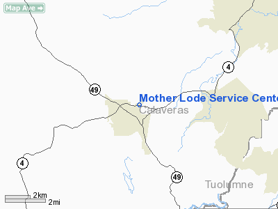
Mother Lode Service Center Heliport |
|
|
Location
& QuickFacts
|
FAA
Information Effective: |
2006-09-28 |
|
Airport
Identifier: |
16CL |
|
Longitude/Latitude: |
120-32-28.7260W/38-04-59.7170N
-120.541313/38.083255 (Estimated) |
|
Elevation: |
1560 ft / 475.49 m (Estimated) |
|
Land: |
0 acres |
|
From
nearest city: |
1 nautical miles E of Angels Camp, CA |
|
Location: |
Calaveras County, CA |
|
Magnetic Variation: |
16E (1985) |
Owner
& Manager
|
Ownership: |
Privately owned |
|
Owner: |
Pacific Gas & Electric |
|
Address: |
Po Box 930
Stockton, CA 95201 |
|
Phone
number: |
209-466-2261 |
|
Manager: |
S.v. Koop
DIVISION LAND SUPERVISOR. |
|
Address: |
Pacific Gas & Electric, Po Box 930
Stockton, CA 95201 |
|
Phone number: |
209-942-1443 |
Airport
Operations and Facilities
|
Airport
Use: |
Private |
|
Wind
indicator: |
Yes |
|
Segmented
Circle: |
No |
|
Control
Tower: |
No |
|
Attendance
Schedule: |
IREG |
|
Landing
fee charge: |
No |
|
Sectional
chart: |
San Francisco |
|
Region: |
AWP - Western-Pacific |
|
Boundary
ARTCC: |
ZOA - Oakland |
|
Tie-in
FSS: |
RIU - Rancho Murieta |
|
FSS
on Airport: |
No |
|
FSS
Phone: |
916-354-0161 |
|
FSS
Toll Free: |
1-800-WX-BRIEF |
|
Runway Information
Helipad H1
|
Dimension: |
40 x 40 ft / 12.2 x 12.2 m |
|
Surface: |
CONC, |
|
|
Runway H1 |
Runway |
|
Traffic
Pattern: |
Left |
Left |
|
Radio Navigation
Aids
|
ID |
Type |
Name |
Ch |
Freq |
Var |
Dist |
|
TCY |
NDB |
Tracy |
|
203.00 |
15E |
48.9 nm |
|
MOD |
VOR/DME |
Modesto |
093X |
114.60 |
17E |
33.8 nm |
|
HNW |
VOR/DME |
Hangtown |
102X |
115.50 |
17E |
39.8 nm |
|
LIN |
VORTAC |
Linden |
095X |
114.80 |
17E |
21.9 nm |
|
ECA |
VORTAC |
Manteca |
107X |
116.00 |
17E |
33.4 nm |
Based Aircraft
|
Aircraft
based on field: |
1 |
|
Helicopters: |
1 |
Mother Lode Service Center Heliport
Address:
Calaveras County, CA
Tel:
209-466-2261,
209-942-1443
Images
and information placed above are from
http://www.airport-data.com/airport/16CL/
We
thank them for the data!
| General
Info |
| Country |
United
States |
| State |
CALIFORNIA
|
| FAA ID |
16CL
|
| Latitude |
38-04-59.717N
|
| Longitude |
120-32-28.726W
|
| Elevation |
1560 feet
|
| Near City |
ANGELS
CAMP |
We don't guarantee the information is fresh and accurate. The data may
be wrong or outdated.
For more up-to-date information please refer to other sources.
|
|


