 |
|
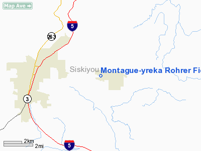
Montague-yreka Rohrer Field Airport |
| Montague Airport-Yreka Rohrer Field |
| IATA: RKC – ICAO: none – FAA LID: 1O5 |
| Summary |
| Airport type |
Public |
| Owner |
City of Montague, California |
| Location |
Montague, California |
| Elevation AMSL |
2527 ft / 770 m |
| Coordinates |
41°43′50″N 122°32′44″W / 41.7304203°N 122.5455783°W / 41.7304203; -122.5455783 |
| Runways |
| Direction |
Length |
Surface |
| ft |
m |
| 14/32 |
3360 |
1024 |
Asphalt |
| 05/23 |
2080 |
634 |
Turf |
The Montague Airport or Yreka Rohrer Field (IATA: RKC, FAA LID: 1O5) is located on the west side of Montague, California. It is owned by the City of Montague.
The above content comes from Wikipedia and is published under free licenses – click here to read more.
Location
& QuickFacts
|
FAA
Information Effective: |
2006-09-28 |
|
Airport
Identifier: |
1O5 |
|
Longitude/Latitude: |
122-32-44.0820W/41-43-49.5130N
-122.545578/41.730420 (Estimated) |
|
Elevation: |
2527 ft / 770.23 m (Estimated) |
|
Land: |
90 acres |
|
From
nearest city: |
1 nautical miles W of Montague, CA |
|
Location: |
Siskiyou County, CA |
|
Magnetic Variation: |
18E (1985) |
Owner
& Manager
|
Ownership: |
Publicly owned |
|
Owner: |
City Of Montague |
|
Address: |
Po Box 428
Montague, CA 96064 |
|
Phone
number: |
530-459-3030 |
|
Manager: |
David Weld |
|
Address: |
900a West Old Montegue Rd
Montague, CA 96064 |
|
Phone number: |
530-459-3456 |
Airport
Operations and Facilities
|
Airport
Use: |
Open to public |
|
Wind
indicator: |
Yes |
|
Segmented
Circle: |
Yes |
|
Control
Tower: |
No |
|
Attendance
Schedule: |
ALL/ALL/0800-1700
AFTER HOURS CALL (530) 842-0217. |
|
Lighting
Schedule: |
DUSK-DAWN
MIRL RY 14/32 PRESET LOW INTST; TO INCR INTST ACTVT - CTAF. |
|
Landing fee charge: |
No |
|
Sectional chart: |
Klamath Falls |
|
Region: |
AWP - Western-Pacific |
|
Traffic Pattern Alt: |
800 ft |
|
Boundary ARTCC: |
ZSE - Seattle |
|
Tie-in FSS: |
RIU - Rancho Murieta |
|
FSS on Airport: |
No |
|
FSS Phone: |
916-354-0161 |
|
FSS Toll Free: |
1-800-WX-BRIEF |
|
NOTAMs Facility: |
105 (NOTAM-d service avaliable) |
Airport
Communications
|
CTAF: |
122.800 |
|
Unicom: |
122.800 |
Airport
Services
|
Fuel
available: |
100LLA
FUEL AVBL AFT HRS CALL (530) 842-0217. |
|
Airframe
Repair: |
MINOR |
|
Power
Plant Repair: |
MINOR |
|
Runway Information
Runway 05/23
|
Dimension: |
2080 x 100 ft / 634.0 x 30.5 m |
|
Surface: |
TURF, Good Condition |
|
|
Runway 05 |
Runway 23 |
|
Traffic
Pattern: |
Left |
Right |
|
Markings: |
None,
/23 EDGES MARKED WITH WHITE TIRES. |
None, |
|
Runway
End Identifier: |
No |
No |
|
Centerline
Lights: |
No |
No |
|
Touchdown
Lights: |
No |
No |
|
Runway 14/32
|
Dimension: |
3360 x 50 ft / 1024.1 x 15.2 m |
|
Surface: |
ASPH, Good Condition |
|
Weight
Limit: |
Single wheel: 12000 lbs. |
|
Edge
Lights: |
Medium |
|
|
Runway 14 |
Runway 32 |
|
Traffic
Pattern: |
Right |
Left |
|
Markings: |
Basic, Good Condition |
Basic, Good Condition |
|
Crossing
Height: |
0.00
ft |
25.00 ft |
|
VASI: |
|
2-box on left side |
|
Visual
Glide Angle: |
0.00� |
3.00� |
|
Runway
End Identifier: |
No |
No |
|
Centerline
Lights: |
No |
No |
|
Touchdown
Lights: |
No |
No |
|
Obstruction: |
, 50:1 slope to clear |
15 ft road, 350.0 ft from runway, 140 ft left
of centerline, 10:1 slope to clear |
|
Radio Navigation
Aids
|
ID |
Type |
Name |
Ch |
Freq |
Var |
Dist |
|
MOG |
NDB |
Montague |
|
404.00 |
19E |
2.9 nm |
|
MEF |
NDB |
Medford |
|
356.00 |
19E |
42.4 nm |
|
LFA |
NDB |
Merrill |
|
347.00 |
17E |
43.2 nm |
|
FJS |
VOR/DME |
Fort Jones |
033X |
109.60 |
19E |
20.6 nm |
|
LMT |
VORTAC |
Klamath Falls |
106X |
115.90 |
17E |
44.5 nm |
|
OED |
VORTAC |
Rogue Valley |
083X |
113.60 |
19E |
47.9 nm |
|
MFR |
VOT |
Medford-jackson County |
|
117.20 |
|
40.4 nm |
Remarks
- DEER
ON & INVOF ARPT.
- BE
ALERT: HILL NORTH OF AIRPORT
- OCCASIONAL
BALOON LAUNCHES.
- USE
OF RUNWAY TRAFFIC PATTERNS STRONGLY RECOMMENDED. AVOID OVERFLIGHT OF
TOWN + MILE EAST OF AIRPORT.
Based Aircraft
|
Aircraft
based on field: |
27 |
|
Single
Engine Airplanes: |
26 |
|
Gliders: |
1 |
Operational Statistics
|
Aircraft
Operations: |
134/Week |
|
Air Taxi: |
21.6% |
|
General
Aviation Local: |
43.2% |
|
General
Aviation Itinerant: |
35.3% |
Montague-yreka Rohrer Field Airport
Address:
Siskiyou County, CA
Tel:
530-459-3030,
530-459-3456
Images
and information placed above are from
http://www.airport-data.com/airport/1O5/
We
thank them for the data!
| General
Info |
| Country |
United
States |
| State |
CALIFORNIA
|
| FAA ID |
1O5
|
| Latitude |
41-43-49.513N
|
| Longitude |
122-32-44.082W
|
| Elevation |
2527 feet
|
| Near City |
MONTAGUE
|
We don't guarantee the information is fresh and accurate. The data may
be wrong or outdated.
For more up-to-date information please refer to other sources.
|
|


