 |
|
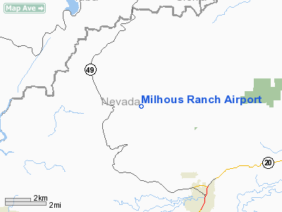
Location
& QuickFacts
|
FAA
Information Effective: |
2006-09-28 |
|
Airport
Identifier: |
79CL |
|
Longitude/Latitude: |
121-04-33.8280W/39-19-29.6140N
-121.076063/39.324893 (Estimated) |
|
Elevation: |
2625 ft / 800.10 m (Estimated) |
|
Land: |
0 acres |
|
From
nearest city: |
3 nautical miles S of North San Juan, CA |
|
Location: |
Nevada County, CA |
|
Magnetic Variation: |
16E (1985) |
Owner
& Manager
|
Ownership: |
Privately owned |
|
Owner: |
Richard Milhous |
|
Address: |
10777 Milhous Dr
Nevada City, CA 95959 |
|
Phone number: |
916-265-9057 |
|
Address: |
|
Airport
Operations and Facilities
|
Airport
Use: |
Private |
|
Wind
indicator: |
Yes |
|
Segmented
Circle: |
No |
|
Control
Tower: |
No |
|
Attendance
Schedule: |
UNATNDD |
|
Landing
fee charge: |
No |
|
Sectional
chart: |
San Francisco |
|
Region: |
AWP - Western-Pacific |
|
Boundary
ARTCC: |
ZOA - Oakland |
|
Tie-in
FSS: |
RIU - Rancho Murieta |
|
FSS
on Airport: |
No |
|
FSS
Phone: |
916-354-0161 |
|
FSS
Toll Free: |
1-800-WX-BRIEF |
|
Runway Information
Runway 03/21
|
Dimension: |
2100 x 75 ft / 640.1 x 22.9 m |
|
Surface: |
DIRT, |
|
|
Runway 03 |
Runway 21 |
|
Traffic
Pattern: |
Left |
Left |
|
Radio Navigation
Aids
|
ID |
Type |
Name |
Ch |
Freq |
Var |
Dist |
|
MY |
NDB |
Halow |
|
222.00 |
16E |
26.5 nm |
|
OVE |
NDB |
Oroville |
|
212.00 |
16E |
27.3 nm |
|
BAB |
TACAN |
Beale |
023X |
|
16E |
20.5 nm |
|
MYV |
VOR/DME |
Marysville |
045X |
110.80 |
16E |
26.8 nm |
|
SWR |
VOR/DME |
Squaw Valley |
079X |
113.20 |
16E |
38.5 nm |
|
HNW |
VOR/DME |
Hangtown |
102X |
115.50 |
17E |
39.2 nm |
|
MCC |
VOR/DME |
Mc Clellan |
029X |
109.20 |
17E |
42.4 nm |
|
CIC |
VOR/DME |
Chico |
035X |
109.80 |
16E |
45.4 nm |
|
ILA |
VORTAC |
Williams |
091X |
114.40 |
18E |
46.9 nm |
|
SMF |
VOT |
Sacramento Metropolitan |
|
111.40 |
|
45.1 nm |
Remarks
- PVT
USE, VFR ONLY. NO OBSTNS WI THE RWY APCH SFCE EXCEEDING 20:1 SLOPE.
Based Aircraft
|
Aircraft
based on field: |
1 |
|
Single
Engine Airplanes: |
1 |
Milhous Ranch Airport
Address:
Nevada County, CA
Tel:
916-265-9057
Images
and information placed above are from
http://www.airport-data.com/airport/79CL/
We
thank them for the data!
| General
Info |
| Country |
United
States |
| State |
CALIFORNIA
|
| FAA ID |
79CL
|
| Latitude |
39-19-29.614N
|
| Longitude |
121-04-33.828W
|
| Elevation |
2625 feet
|
| Near City |
NORTH
SAN JUAN |
We don't guarantee the information is fresh and accurate. The data may
be wrong or outdated.
For more up-to-date information please refer to other sources.
|
|


