 |
|
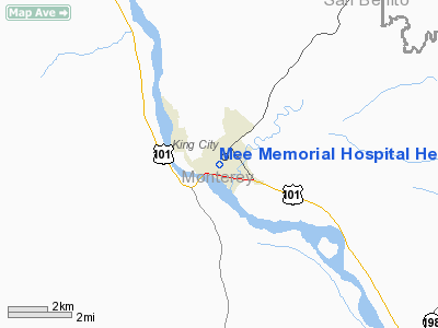
Mee Memorial Hospital Heliport |
Location
& QuickFacts
|
FAA
Information Effective: |
2006-09-28 |
|
Airport
Identifier: |
09CA |
|
Longitude/Latitude: |
121-07-53.7060W/36-12-29.8770N
-121.131585/36.208299 (Estimated) |
|
Elevation: |
320 ft / 97.54 m (Estimated) |
|
Land: |
0 acres |
|
From
nearest city: |
0 nautical miles N of King City, CA |
|
Location: |
Monterey County, CA |
|
Magnetic Variation: |
15E (1985) |
Owner
& Manager
|
Ownership: |
Privately owned |
|
Owner: |
Mee Memorial Hospital |
|
Address: |
300 Canal St
King City, CA 93930 |
|
Phone
number: |
831-385-6000 |
|
Manager: |
David Head |
|
Address: |
300 Canal St
King City, CA 93930 |
|
Phone number: |
831-385-6000 |
Airport
Operations and Facilities
|
Airport
Use: |
Private
MEDICAL. |
|
Wind
indicator: |
Yes |
|
Segmented
Circle: |
No |
|
Control
Tower: |
No |
|
Attendance
Schedule: |
UNATNDD |
|
Lighting
Schedule: |
SS-SR |
|
Landing
fee charge: |
No |
|
Sectional
chart: |
San Francisco |
|
Region: |
AWP - Western-Pacific |
|
Boundary
ARTCC: |
ZOA - Oakland |
|
Tie-in
FSS: |
OAK - Oakland |
|
FSS
on Airport: |
No |
|
FSS
Phone: |
510-273-6111 |
|
FSS
Toll Free: |
1-800-WX-BRIEF |
|
Runway Information
Helipad H1
|
Dimension: |
65
x 65 ft / 19.8 x 19.8 m
65' X 65' TOUCHDOWN AREA WITHIN 65' X 65' LANDING/TAKEOFF AREA. |
|
Surface: |
ASPH, |
|
Edge
Lights: |
Low |
|
|
Runway H1 |
Runway |
|
Traffic
Pattern: |
Left |
Left |
|
Radio Navigation
Aids
|
ID |
Type |
Name |
Ch |
Freq |
Var |
Dist |
|
HGT |
NDB |
Hunter Liggett |
|
209.00 |
15E |
15.1 nm |
|
UAD |
NDB |
Chualar |
|
263.00 |
16E |
23.8 nm |
|
ROM |
VOR |
Priest |
|
110.00 |
16E |
23.0 nm |
|
BSR |
VORTAC |
Big Sur |
087X |
114.00 |
16E |
24.8 nm |
|
PXN |
VORTAC |
Panoche |
073X |
112.60 |
16E |
34.9 nm |
|
SNS |
VORTAC |
Salinas |
120X |
117.30 |
17E |
35.6 nm |
|
PRB |
VORTAC |
Paso Robles |
090X |
114.30 |
16E |
40.5 nm |
Mee Memorial Hospital Heliport
Address:
Monterey County, CA
Tel:
831-385-6000
Images
and information placed above are from
http://www.airport-data.com/airport/09CA/
We
thank them for the data!
| General
Info |
| Country |
United
States |
| State |
CALIFORNIA
|
| FAA ID |
09CA
|
| Latitude |
36-12-29.877N
|
| Longitude |
121-07-53.706W
|
| Elevation |
320 feet
|
| Near City |
KING CITY
|
We don't guarantee the information is fresh and accurate. The data may
be wrong or outdated.
For more up-to-date information please refer to other sources.
|
|


