|
 |
|
||||
|
Meadows Field (IATA: BFL, ICAO: KBFL, FAA LID: BFL) is the primary airport of Bakersfield, California and is owned by Kern County. Meadows Field is also called Kern County Airport #1. The airport covers 1,357 acres (549 ha) and has two runways. HistoryThe first airport in 1925 Kern County Airport No. 1 was developed under auspices of the Kern County Chamber of Commerce near Highway 99, about a mile west of the present site of Meadows Field. During World War II the airport was used by the United States Army Air Forces as a night fighter training airfield. The Air University Army Air Forces School of Applied Tactics (AAFSAT) moved its 481st Night Fighter Operational Training Group from Orlando Army Airbase, Florida to California and assigned its 423d Night Fighter Squadron to the airport in January 1944. Flying P-70s and A-20 Havoc training fighters, the squadron trained over the Central Valley before being deployed to England in March. The 481st the began training replacement pilots at the airport until the end of the war in September 1945. By Board Minute Order of August 6, 1957 the name of Kern County Airport No. 1 was changed to Meadows Field in memory of Cecil Meadows, a World War II pilot who visioned the airport. In 1957, The "Kern County Air Terminal" building was opened. On February 27, 2006, the terminal was replaced by the "William M. Thomas Terminal", which contains jet bridges, an indoor luggage carousel and a Blimpie restaurant. The former terminal was renovated into an international terminal with a newly constructed customs facility adjacent to it. Meadows Field's air service operations have experienced frequent change over the past decades. The last mainline service was on American Airlines which operated MD-80 flights to Dallas/Fort Worth International Airport until 1999. Continental Express had direct service to Houston that was suspended in 2007 due to fleet shortage. In 2008, Delta Connection and ExpressJet Airlines discontinued operations at the airport as well as Mexicana ending its international flights to Guadalajara. On September 28, 2010, Allegiant Air anounced service to Las Vegas. The flight will occur three times a week in the evening, utilizing a MD-80 for operations. TerminalsWilliam M. Thomas Terminal (Domestic)William M. Thomas Terminal has 3 gates: 4, 7, 9 and houses United Express and US Airways Express. It serves all domestic flights at the airport. It was constructed in 2006. Features of the terminal include a rotunda with compass point floor design and a scaled model of Spaceship One (which flew out of Mojave about 50 miles east of Bakersfield). It is also constructed on a hill, which allows for all passenger services to be on the second level, while airport services are on the first. Kern County Air Terminal (International)Kern County Air Terminal has 3 open air gates: 1, 2, 3 and contains no airlines. It serves all international flights at the airport. It was constructed in 1957 and originally served all domestic flights. It was remodeled into the international terminal in 2006, after the construction of the new domestic terminal. The terminal currently does not house any international carriers after Mexicana discontinued service in 2008. Airlines and destinations
FutureKern County has several improvements to the airport that are planned over the next 20 years. All of which are based on future demand. PassangerThe domestic terminal was constructed in anticipation of future expansion. Currently it has 3 sky bridges to connect passengers to airplanes. Without any new construction, two additional sky bridges can be added. The existing gate area can then be extended towards the runway for an additional 7 gates. After that, a new concourse can be constructed on the west side of the terminal for 12 more gates. That makes the ultimate capacity for the terminal at 24 gates. Other facility are planned to expand, with these future changes to the terminal. The existing parking lot will grow both east and west. The rental car parking lots will be consolidated and relocated east of the terminal. Wings Way, the road that connects to the airport, will be extend to Airport Drive, and connect to Day Avenue. CargoCurrently, all cargo operations are conducted out of a small facility, east of the international terminal. A new, expanded cargo facility is planned west of Merle Haggard Drive, north of the runway. Ultimate build out will contain 12 sortation buildings, 30,000 square feet each. A road will connect then to trucking/warehouse/distribution facilities west of the airport. That road will terminate at Porterville Highway (SR 65) and Merle Haggard Drive (at Wings Way). Other aviation related structures are planned in the area. In addition, there is a long term plan to construct a third parallel runway. Designated 13-31, it will be located north of the cargo facilities, as well as Merle Haggard Drive. The runway is planned to be 8,000 feet long and 150 feet wide. It will be widely spaced, which will allow for simultaneous Instrument Flight Rule (IFR). The above content comes from Wikipedia and is published under free licenses – click here to read more.
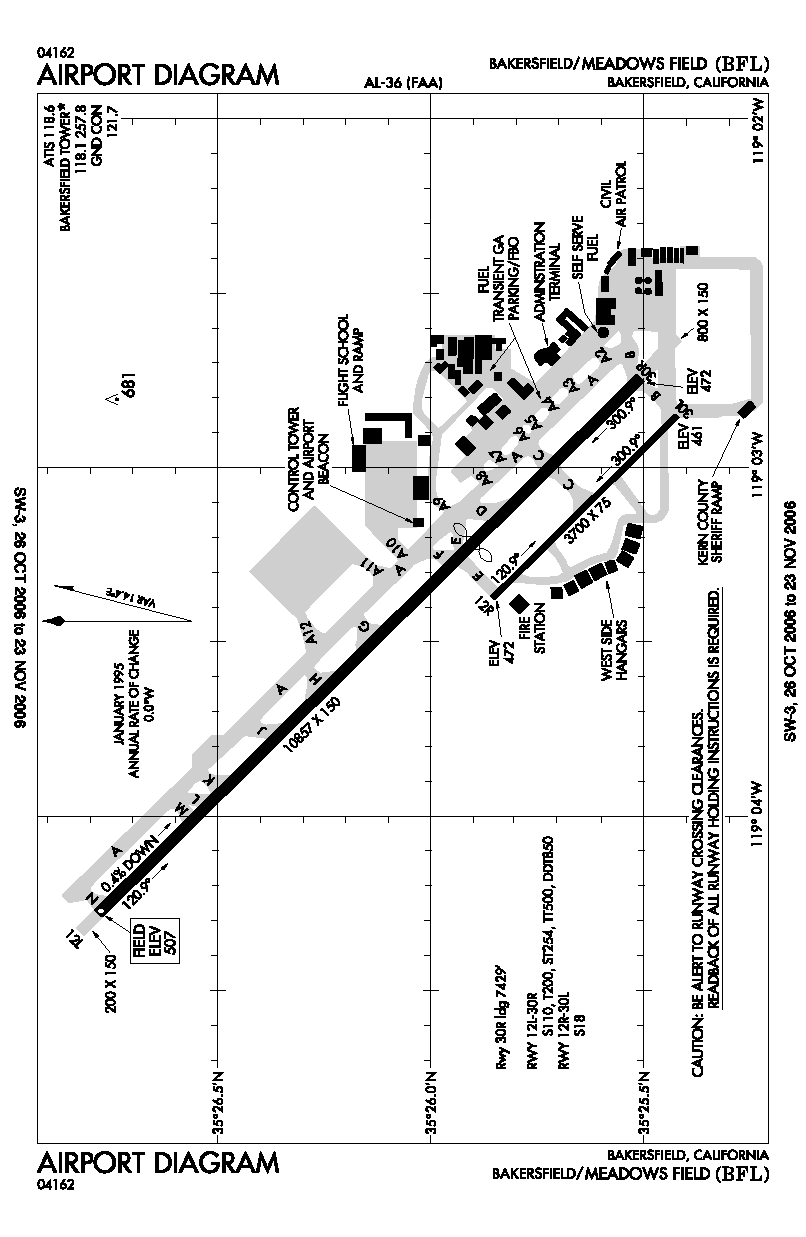
Runway InformationRunway 12L/30R
Runway 12R/30L
Radio Navigation Aids
Remarks
Based Aircraft
Major Carriers Serving This Airport
Most Popular Destinations
Most Popular Aircraft
Operational Statistics
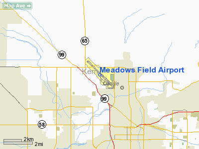
Meadows Field Airport Address: Kern County, CA Tel: 661-391-1800 Images
and information placed above are from We thank them for the data!
We don't guarantee the information is fresh and accurate. The data may
be wrong or outdated. |
||||||||||||||||||||||||||||||||||||||||||||||||||||||||||||||||||||||||||||||||||||||||||||||||||||||||||||||||||||||||||||||||||||||||||||||||||||||||||||||||||||||||||||||||||||||||||||||||||||||||||||||||||||||||||||||||||||||||||||||||||||||||||||||||||||||||||||||||||||||||||||||||||||||||||||||||||||||||||||||||||||||||||||||||||||||||||||||||||||||||||||||||||||||||||||||||||||||||||||||||||||

 |
|
Copyright 2004-2026 © by Airports-Worldwide.com, Vyshenskoho st. 36, Lviv 79010, Ukraine Legal Disclaimer |