 |
|
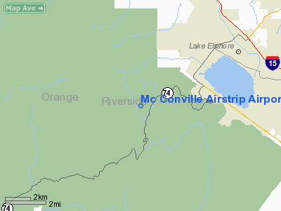
Mc Conville Airstrip Airport |
Location
& QuickFacts
|
FAA
Information Effective: |
2006-09-28 |
|
Airport
Identifier: |
CA42 |
|
Longitude/Latitude: |
117-25-45.0000W/33-38-37.0000N
-117.429167/33.643611 (Estimated) |
|
Elevation: |
2600 ft / 792.48 m (Estimated) |
|
Land: |
0 acres |
|
From
nearest city: |
7 nautical miles W of Lake Elsinore, CA |
|
Location: |
Orange County, CA |
|
Magnetic Variation: |
14E (1995) |
Owner
& Manager
|
Ownership: |
Privately owned |
|
Owner: |
Wallace F. Nilson |
|
Address: |
Hcr 2 - Box 394
Winnemucca, NV 89445 |
|
Phone
number: |
909-678-4494 |
|
Manager: |
James W. Billings |
|
Address: |
P.o. Box 23387
San Diego, CA 92193-3387 |
|
Phone number: |
619-576-2504 |
Airport
Operations and Facilities
|
Airport
Use: |
Private |
|
Wind
indicator: |
Yes |
|
Segmented
Circle: |
No |
|
Control
Tower: |
No |
|
Attendance
Schedule: |
UNATNDD |
|
Sectional
chart: |
Los Angeles |
|
Region: |
AWP - Western-Pacific |
|
Boundary
ARTCC: |
ZLA - Los Angeles |
|
Tie-in
FSS: |
RAL - Riverside |
|
FSS
Phone: |
951-351-3020 |
|
FSS
Toll Free: |
1-800-WX-BRIEF |
|
Runway Information
Runway 18/36
|
Dimension: |
1800 x 50 ft / 548.6 x 15.2 m |
|
Surface: |
GRVL, |
|
|
Runway 18 |
Runway 36 |
|
Traffic
Pattern: |
Left |
Left |
|
Radio Navigation
Aids
|
ID |
Type |
Name |
Ch |
Freq |
Var |
Dist |
|
SJY |
NDB |
San Jacinto |
|
227.00 |
14E |
23.3 nm |
|
SB |
NDB |
Petis |
|
397.00 |
14E |
25.0 nm |
|
EMT |
NDB |
El Monte |
|
359.00 |
15E |
40.2 nm |
|
CPM |
NDB |
Compton |
|
378.00 |
15E |
43.5 nm |
|
RIV |
TACAN |
March |
077X |
|
14E |
17.6 nm |
|
NFG |
TACAN |
Camp Pendleton |
055X |
|
13E |
22.3 nm |
|
NKX |
TACAN |
Miramar |
033X |
|
15E |
48.5 nm |
|
NKX |
UHF/NDB |
Miramar |
|
352.00 |
15E |
48.4 nm |
|
HDF |
VOR |
Homeland |
|
113.40 |
14E |
14.6 nm |
|
RAL |
VOR |
Riverside |
|
112.40 |
15E |
18.6 nm |
|
ELB |
VOR/DME |
El Toro |
119X |
117.20 |
14E |
15.2 nm |
|
PDZ |
VORTAC |
Paradise |
059X |
112.20 |
15E |
17.3 nm |
|
OCN |
VORTAC |
Oceanside |
100X |
115.30 |
15E |
24.2 nm |
|
POM |
VORTAC |
Pomona |
041X |
110.40 |
15E |
31.7 nm |
|
SLI |
VORTAC |
Seal Beach |
104X |
115.70 |
15E |
32.4 nm |
|
SNA |
VOT |
Santa Ana |
|
110.00 |
|
22.1 nm |
|
LAX |
VOT |
San Pedro Hill |
|
113.90 |
|
45.8 nm |
|
SAN |
VOT |
Mount Soledad |
|
109.00 |
|
49.1 nm |
Remarks
- "R"
ON RY TO DENOTE PRIVATE.
- SEND
ALL CORRESPONDENCE TO ARPT MGR.
Mc Conville Airstrip Airport
Address:
Orange County, CA
Tel:
909-678-4494,
619-576-2504
Images
and information placed above are from
http://www.airport-data.com/airport/CA42/
We
thank them for the data!
| General
Info |
| Country |
United
States |
| State |
CALIFORNIA
|
| FAA ID |
CA42
|
| Latitude |
33-38-37.000N
|
| Longitude |
117-25-45.000W
|
| Elevation |
2600 feet
|
| Near City |
LAKE ELSINORE
|
We don't guarantee the information is fresh and accurate. The data may
be wrong or outdated.
For more up-to-date information please refer to other sources.
|
|


