 |
|
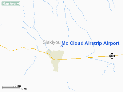
Mc Cloud Airstrip Airport |
|
|
Location
& QuickFacts
|
FAA
Information Effective: |
2006-09-28 |
|
Airport
Identifier: |
CA11 |
|
Longitude/Latitude: |
122-07-20.0140W/41-16-23.5630N
-122.122226/41.273212 (Estimated) |
|
Elevation: |
3540 ft / 1078.99 m (Estimated) |
|
Land: |
0 acres |
|
From
nearest city: |
1 nautical miles NE of Mc Cloud, CA |
|
Location: |
Siskiyou County, CA |
|
Magnetic Variation: |
17E (1985) |
Owner
& Manager
|
Ownership: |
Privately owned |
|
Owner: |
John Hancock Mut. Life Ins. |
|
Address: |
Po Box 1540
Mc Cloud, CA 96057 |
|
Phone
number: |
916-964-2121 |
|
Manager: |
D. Marshall |
|
Address: |
John Hancock Mut. Life Ins.
Mc Cloud, CA 96057 |
|
Phone number: |
916-964-2121 |
Airport
Operations and Facilities
|
Airport Use: |
Private |
|
Wind indicator: |
Yes |
|
Segmented Circle: |
No |
|
Control Tower: |
No |
|
Attendance Schedule: |
UNATNDD |
|
Landing fee charge: |
No |
|
Sectional chart: |
Klamath Falls |
|
Region: |
AWP - Western-Pacific |
|
Boundary ARTCC: |
ZSE - Seattle |
|
Tie-in FSS: |
RIU - Rancho Murieta |
|
FSS on Airport: |
No |
|
FSS Phone: |
916-354-0161 |
|
FSS Toll Free: |
1-800-WX-BRIEF |
Airport
Services
|
Airframe
Repair: |
NONE |
|
Power
Plant Repair: |
NONE |
|
Runway Information
Runway 17/35
|
Dimension: |
2800 x 75 ft / 853.4 x 22.9 m |
|
Surface: |
DIRT, |
|
|
Runway 17 |
Runway 35 |
|
Traffic
Pattern: |
Left |
Left |
|
Radio Navigation
Aids
|
ID |
Type |
Name |
Ch |
Freq |
Var |
Dist |
|
MOG |
NDB |
Montague |
|
404.00 |
19E |
31.7 nm |
|
LFA |
NDB |
Merrill |
|
347.00 |
17E |
47.9 nm |
|
FJS |
VOR/DME |
Fort Jones |
033X |
109.60 |
19E |
32.6 nm |
|
RDD |
VOR/DME |
Redding |
021X |
108.40 |
18E |
46.8 nm |
Remarks
- USE
RESTRICTED TO PERMIT GRANTED BY JOHN HANCOCK MUT. LIFE
INS. CO.
- LNDG
RWY 35 ONLY; RWY SLOPES DOWNHILL 3.5 DEG FROM N TO S.
- FIRST
REPORTED 6/4/63-6 MI E OF DUNSMUIR MUNI-MOTT ARPT.
Based Aircraft
|
Aircraft
based on field: |
1 |
|
Single
Engine Airplanes: |
1 |
Mc Cloud Airstrip Airport
Address:
Siskiyou County, CA
Tel:
916-964-2121
Images
and information placed above are from
http://www.airport-data.com/airport/CA11/
We
thank them for the data!
| General
Info |
| Country |
United
States |
| State |
CALIFORNIA
|
| FAA ID |
CA11
|
| Latitude |
41-16-23.563N
|
| Longitude |
122-07-20.014W
|
| Elevation |
3540 feet
|
| Near City |
MC CLOUD
|
We don't guarantee the information is fresh and accurate. The data may
be wrong or outdated.
For more up-to-date information please refer to other sources.
|
|


