 |
|
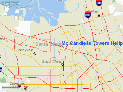
Mc Candless Towers Heliport |
|
|
Location
& QuickFacts
|
FAA
Information Effective: |
2006-09-28 |
|
Airport
Identifier: |
CL86 |
|
Longitude/Latitude: |
121-58-20.8520W/37-23-07.7860N
-121.972459/37.385496 (Estimated) |
|
Elevation: |
201 ft / 61.26 m (Estimated) |
|
Land: |
0 acres |
|
From
nearest city: |
0 nautical miles N of Santa Clara, CA |
|
Location: |
Santa Clara County, CA |
|
Magnetic Variation: |
16E (1985) |
Owner
& Manager
|
Ownership: |
Privately owned |
|
Owner: |
Mc Candless Towers Phase I |
|
Address: |
3945 Freedom Circle, Ste 1000
Santa Clara, CA 95054 |
|
Phone
number: |
408-980-6500 |
|
Manager: |
Mc Candless Management Corp. |
|
Address: |
3945 Freedom Circle Ste.200
Santa Clara, CA 95054 |
|
Phone number: |
408-727-2007 |
Airport
Operations and Facilities
|
Airport
Use: |
Private |
|
Wind
indicator: |
Yes |
|
Segmented
Circle: |
No |
|
Control
Tower: |
No |
|
Attendance
Schedule: |
ALL/MON-FRI/0600-2200 |
|
Lighting
Schedule: |
RDO REQ
PERIMETER LGTS ACTVTD BY RADIO FREQ.123.075. |
|
Sectional
chart: |
San Francisco |
|
Region: |
AWP - Western-Pacific |
|
Boundary
ARTCC: |
ZOA - Oakland |
|
Tie-in
FSS: |
OAK - Oakland |
|
FSS
Phone: |
510-273-6111 |
|
FSS
Toll Free: |
1-800-WX-BRIEF |
|
Runway Information
Helipad H1
|
Dimension: |
40 x 40 ft / 12.2 x 12.2 m |
|
Surface: |
CONC,
ROOFTOP. |
|
|
Runway H1 |
Runway |
|
Traffic
Pattern: |
Left |
Left |
|
Radio Navigation
Aids
|
ID |
Type |
Name |
Ch |
Freq |
Var |
Dist |
|
LV |
NDB |
Reiga |
|
374.00 |
16E |
23.0 nm |
|
PDG |
NDB |
Pajar |
|
327.00 |
17E |
29.4 nm |
|
TCY |
NDB |
Tracy |
|
203.00 |
15E |
31.2 nm |
|
NUQ |
TACAN |
Moffett |
123X |
|
17E |
4.9 nm |
|
SJC |
VOR/DME |
San Jose |
088X |
114.10 |
16E |
1.5 nm |
|
SFO |
VOR/DME |
San Francisco |
105X |
115.80 |
17E |
23.8 nm |
|
CCR |
VOR/DME |
Concord |
117X |
117.00 |
17E |
39.8 nm |
|
OSI |
VORTAC |
Woodside |
086X |
113.90 |
17E |
14.8 nm |
|
OAK |
VORTAC |
Oakland |
115X |
116.80 |
17E |
23.7 nm |
|
SAU |
VORTAC |
Sausalito |
109X |
116.20 |
17E |
38.5 nm |
|
ECA |
VORTAC |
Manteca |
107X |
116.00 |
17E |
46.7 nm |
|
SNS |
VORTAC |
Salinas |
120X |
117.30 |
17E |
46.9 nm |
|
SFO |
VOT |
San Francisco Intl |
|
111.00 |
|
23.8 nm |
Remarks
- VFR,
PRIVATE USE ONLY, LTR OF AGREEMENT WITH SAN JOSE & NAS MOFFETT ATCT.
Mc Candless Towers Heliport
Address:
Santa Clara County, CA
Tel:
408-980-6500,
408-727-2007
Images
and information placed above are from
http://www.airport-data.com/airport/CL86/
We
thank them for the data!
| General
Info |
| Country |
United
States |
| State |
CALIFORNIA
|
| FAA ID |
CL86
|
| Latitude |
37-23-07.786N
|
| Longitude |
121-58-20.852W
|
| Elevation |
201 feet
|
| Near City |
SANTA
CLARA |
We don't guarantee the information is fresh and accurate. The data may
be wrong or outdated.
For more up-to-date information please refer to other sources.
|
|


