 |
|
Location
& QuickFacts
|
FAA
Information Effective: |
2006-09-28 |
|
Airport
Identifier: |
43CN |
|
Longitude/Latitude: |
122-36-07.9410W/38-11-06.7050N
-122.602206/38.185196 (Estimated) |
|
Elevation: |
20 ft / 6.10 m (Estimated) |
|
Land: |
0 acres |
|
From
nearest city: |
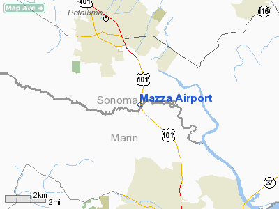
3 nautical miles SE of Petaluma, CA |
|
Location: |
Sonoma County, CA |
|
Magnetic Variation: |
16E (1985) |
Owner
& Manager
|
Ownership: |
Privately owned |
|
Owner: |
Joseph Tognalda |
|
Address: |
460 San Antonio Rd
Petaluma, CA 94952 |
|
Phone number: |
415-762-2033 |
|
Address: |
|
Airport
Operations and Facilities
|
Airport Use: |
Private |
|
Wind indicator: |
Yes |
|
Segmented Circle: |
No |
|
Control Tower: |
No |
|
Attendance Schedule: |
UNATNDD |
|
Landing fee charge: |
No |
|
Sectional chart: |
San Francisco |
|
Region: |
AWP - Western-Pacific |
|
Boundary ARTCC: |
ZOA - Oakland |
|
Tie-in FSS: |
OAK - Oakland |
|
FSS on Airport: |
No |
|
FSS Phone: |
510-273-6111 |
|
FSS Toll Free: |
1-800-WX-BRIEF |
Airport
Services
|
Airframe
Repair: |
NONE |
|
Power
Plant Repair: |
NONE |
|
Runway Information
Runway 18/36
|
Dimension: |
1100 x 10 ft / 335.3 x 3.0 m |
|
Surface: |
DIRT, |
|
|
Runway 18 |
Runway 36 |
|
Traffic
Pattern: |
Left |
Left |
|
Radio Navigation
Aids
|
ID |
Type |
Name |
Ch |
Freq |
Var |
Dist |
|
SUU |
TACAN |
Travis |
113X |
|
17E |
31.2 nm |
|
TZZ |
VOR |
Travis |
|
116.40 |
17E |
38.6 nm |
|
STS |
VOR/DME |
Santa Rosa |
077X |
113.00 |
16E |
21.8 nm |
|
CCR |
VOR/DME |
Concord |
117X |
117.00 |
17E |
27.7 nm |
|
SFO |
VOR/DME |
San Francisco |
105X |
115.80 |
17E |
35.7 nm |
|
SGD |
VORTAC |
Scaggs Island |
058X |
112.10 |
17E |
10.8 nm |
|
PYE |
VORTAC |
Point Reyes |
084X |
113.70 |
17E |
14.1 nm |
|
SAU |
VORTAC |
Sausalito |
109X |
116.20 |
17E |
20.2 nm |
|
OAK |
VORTAC |
Oakland |
115X |
116.80 |
17E |
32.9 nm |
|
SFO |
VOT |
San Francisco Intl |
|
111.00 |
|
35.7 nm |
Remarks
- ESTABD
PRIOR TO 15 MAY 1959.
Based Aircraft
|
Aircraft
based on field: |
4 |
|
Single
Engine Airplanes: |
4 |
Mazza Airport
Address:
Sonoma County, CA
Tel:
415-762-2033
Images
and information placed above are from
http://www.airport-data.com/airport/43CN/
We
thank them for the data!
| General
Info |
| Country |
United
States |
| State |
CALIFORNIA
|
| FAA ID |
43CN
|
| Latitude |
38-11-06.705N
|
| Longitude |
122-36-07.941W
|
| Elevation |
20 feet
|
| Near City |
PETALUMA
|
We don't guarantee the information is fresh and accurate. The data may
be wrong or outdated.
For more up-to-date information please refer to other sources.
|
|


