 |
|
Marine Corp Mtn War Training Center Heliport |
|
|
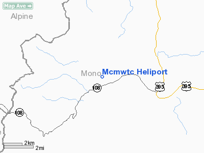
Location
& QuickFacts
|
FAA
Information Effective: |
2006-09-28 |
|
Airport
Identifier: |
7CL4 |
|
Longitude/Latitude: |
119-31-12.0000W/38-21-49.0000N
-119.520000/38.363611 (Estimated) |
|
Elevation: |
6762 ft / 2061.06 m (Estimated) |
|
Land: |
0 acres |
|
From
nearest city: |
15 nautical miles N of Bridgeport, CA |
|
Location: |
Mono County, CA |
|
Magnetic Variation: |
15E (1995) |
Owner
& Manager
|
Ownership: |
Navy owned |
|
Owner: |
Us Marine Corp |
|
Address: |
Marine Corp Mtn War Trng Ctr
Bridgeport, CA 93517-5001 |
|
Phone
number: |
619-932-7761 |
|
Manager: |
Capt. J.g. Koffel |
|
Address: |
Marine Corp Mtn War Trng Ctr
Bridgeport, CA 93517-5001 |
|
Phone number: |
619-932-7761
EXTENSION 219. |
Airport
Operations and Facilities
|
Airport Use: |
Private |
|
Segmented Circle: |
No |
|
Control Tower: |
No |
|
Attendance Schedule: |
UNATNDD |
|
Sectional chart: |
San Francisco |
|
Region: |
AWP - Western-Pacific |
|
Boundary ARTCC: |
ZOA - Oakland |
|
Tie-in FSS: |
RAL - Riverside |
|
FSS on Airport: |
No |
|
FSS Phone: |
951-351-3020 |
|
FSS Toll Free: |
1-800-WX-BRIEF |
Airport
Communications
|
Runway Information
Helipad H1
|
Dimension: |
1000 x 78 ft / 304.8 x 23.8 m |
|
Surface: |
MATS, |
|
|
Runway H1 |
Runway |
|
Traffic
Pattern: |
Left |
Left |
|
Radio Navigation
Aids
|
ID |
Type |
Name |
Ch |
Freq |
Var |
Dist |
Mcmwtc Heliport
Address:
Mono County, CA
Tel:
619-932-7761
Images
and information placed above are from
http://www.airport-data.com/airport/7CL4/
We
thank them for the data!
| General
Info |
| Country |
United
States |
| State |
CALIFORNIA
|
| FAA ID |
7CL4
|
| Latitude |
38-21-49.000N
|
| Longitude |
119-31-12.000W
|
| Elevation |
6762 feet
|
| Near City |
BRIDGEPORT
|
We don't guarantee the information is fresh and accurate. The data may
be wrong or outdated.
For more up-to-date information please refer to other sources.
|
|


