 |
|
|
|
|
|
Location
& QuickFacts
|
FAA
Information Effective: |
2006-09-28 |
|
Airport
Identifier: |
4CL1 |
|
Longitude/Latitude: |
117-35-28.1730W/33-36-48.0810N
-117.591159/33.613356 (Estimated) |
|
Elevation: |
898 ft / 273.71 m (Estimated) |
|
Land: |
0 acres |
|
From
nearest city: |
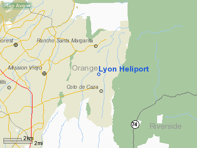
2 nautical miles SE of Rancho Santa Margarita,
CA |
|
Location: |
Orange County, CA |
|
Magnetic Variation: |
14E (1990) |
Owner
& Manager
|
Ownership: |
Privately owned |
|
Owner: |
William Lyon |
|
Address: |
24331 Coto De Caza Drive
Trabuco Canyon, CA 92679 |
|
Phone
number: |
714-497-7130 |
|
Manager: |
Jeffrey W. Wright |
|
Address: |
1278 Glenneyre Street No 13
Laguna Beach, CA 92651 |
|
Phone number: |
714-497-7130 |
Airport
Operations and Facilities
|
Airport
Use: |
Private |
|
Segmented
Circle: |
No |
|
Control
Tower: |
No |
|
Attendance
Schedule: |
UNATNDD |
|
Lighting
Schedule: |
PHONE REQ
FOR PERIMETER LGTS CALL (714) 497-7130. |
|
Sectional
chart: |
Los Angeles |
|
Region: |
AWP - Western-Pacific |
|
Boundary
ARTCC: |
ZLA - Los Angeles |
|
Tie-in
FSS: |
SAN - San Diego |
|
FSS
on Airport: |
No |
|
FSS
Phone: |
858-277-7043 |
|
FSS
Toll Free: |
1-800-WX-BRIEF |
|
Runway Information
Helipad H1
|
Dimension: |
74 x 40 ft / 22.6 x 12.2 m |
|
Surface: |
TURF, |
|
|
Runway H1 |
Runway |
|
Traffic
Pattern: |
Left |
Left |
|
Radio Navigation
Aids
|
ID |
Type |
Name |
Ch |
Freq |
Var |
Dist |
|
SB |
NDB |
Petis |
|
397.00 |
14E |
28.9 nm |
|
SJY |
NDB |
San Jacinto |
|
227.00 |
14E |
31.5 nm |
|
EMT |
NDB |
El Monte |
|
359.00 |
15E |
36.0 nm |
|
CPM |
NDB |
Compton |
|
378.00 |
15E |
36.7 nm |
|
NFG |
TACAN |
Camp Pendleton |
055X |
|
13E |
22.8 nm |
|
RIV |
TACAN |
March |
077X |
|
14E |
23.7 nm |
|
NKX |
TACAN |
Miramar |
033X |
|
15E |
49.8 nm |
|
NKX |
UHF/NDB |
Miramar |
|
352.00 |
15E |
49.8 nm |
|
RAL |
VOR |
Riverside |
|
112.40 |
15E |
21.6 nm |
|
HDF |
VOR |
Homeland |
|
113.40 |
14E |
22.5 nm |
|
ELB |
VOR/DME |
El Toro |
119X |
117.20 |
14E |
8.0 nm |
|
SMO |
VOR/DME |
Santa Monica |
045X |
110.80 |
15E |
49.4 nm |
|
PDZ |
VORTAC |
Paradise |
059X |
112.20 |
15E |
18.6 nm |
|
OCN |
VORTAC |
Oceanside |
100X |
115.30 |
15E |
24.0 nm |
|
SLI |
VORTAC |
Seal Beach |
104X |
115.70 |
15E |
25.3 nm |
|
POM |
VORTAC |
Pomona |
041X |
110.40 |
15E |
29.6 nm |
|
SXC |
VORTAC |
Santa Catalina |
051X |
111.40 |
15E |
43.9 nm |
|
LAX |
VORTAC |
Los Angeles |
083X |
113.60 |
15E |
46.2 nm |
|
SNA |
VOT |
Santa Ana |
|
110.00 |
|
14.5 nm |
|
LAX |
VOT |
San Pedro Hill |
|
113.90 |
|
38.1 nm |
|
SAN |
VOT |
Mount Soledad |
|
109.00 |
|
49.5 nm |
Remarks
- PROVIDED
PVT USE VFR; HELICOPTERS SHALL NOT OVERFLY CONTO DE CAZA DRIVE ON TKF
OR LDG; & INSTALL LIGHTING FOR NIGHT OPNS IN ACCORDANCE WITH FAA
GUIDANCE.
Lyon Heliport
Address:
Orange County, CA
Tel:
714-497-7130
Images
and information placed above are from
http://www.airport-data.com/airport/4CL1/
We
thank them for the data!
| General
Info |
| Country |
United
States |
| State |
CALIFORNIA
|
| FAA ID |
4CL1
|
| Latitude |
33-36-48.081N
|
| Longitude |
117-35-28.173W
|
| Elevation |
898 feet
|
| Near City |
RANCHO
SANTA MARGARITA |
We don't guarantee the information is fresh and accurate. The data may
be wrong or outdated.
For more up-to-date information please refer to other sources.
|
|


