 |
|
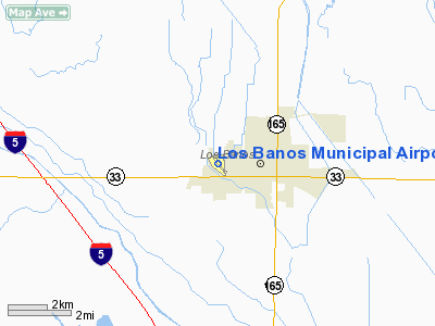
Los Banos Municipal Airport |
Coordinates: 37°03′50″N 120°52′12″W / 37.06389°N 120.87°W / 37.06389; -120.87
| Los Banos Municipal Airport |
| IATA: LSN – ICAO: KLSN – FAA LID: LSN |
| Summary |
| Airport type |
Public |
| Owner |
City of Los Banos |
| Location |
Los Banos, California |
| Elevation AMSL |
121 ft / 37 m |
| Runways |
| Direction |
Length |
Surface |
| ft |
m |
| 14/32 |
3,801 |
1,159 |
Asphalt |
| Statistics (2008) |
| Aircraft operations |
16,000 |
| Based aircraft |
13 |
| Source: Federal Aviation Administration |
Los Banos Municipal Airport (IATA: LSN, ICAO: KLSN, FAA LID: LSN) is a city-owned public-use airport located one mile (1.6 km) west of the central business district of Los Banos, a city in Merced County, California, United States. Facilities and aircraft
Los Banos Municipal Airport covers an area of 101 acres (41 ha) which contains one asphalt paved runway (14/32) measuring 3,801 x 75 ft (1,159 x 23 m).
For the 12-month period ending August 5, 2008, the airport had 16,000 general aviation aircraft operations, an average of 44 per day. At that time there were 13 aircraft based at this airport: 12 single engine, and one jet aircraft.
Hazardous materials issues
Historically a release of hazardous materials to the environment has occurred at the airport. Groundwater in the site vicinity is perched in a high water table, with depth to groundwater being only seven to ten feet below the surface. Therefore, any release of contaminants to the soil poses a risk to aquifer contamination. The chief hazardous substances of concern at the airport are derived from prior pesticides and herbicides used by crop dusting aircraft; these operations ceased in 1989. At the present time, no such flights are authorized from the airport; in fact, the only hazardous materials presently used and stored at the airport are those associated with the underground gasoline fuel storage tanks. Surface runoff and groundwater flow is generally to the northeast toward the San Joaquin River.
Rinse water from maintenance operations flows into a storm drainage system and pesticide chemicals, which have previously contaminated soil and groundwater on the site, may have been introduced to the environment via this route. Contaminants include S,S,S-tributyl phosphorotrithioate (DEF), dicapthon, and bromophosethyl. These contaminants have been found in wells owned by the Los Banos Community Water District within three miles (5 km) of the airport.
The above content comes from Wikipedia and is published under free licenses – click here to read more.
Location
& QuickFacts
|
FAA
Information Effective: |
2006-09-28 |
|
Airport
Identifier: |
LSN |
|
Longitude/Latitude: |
120-52-09.3040W/37-03-46.4600N
-120.869251/37.062906 (Estimated) |
|
Elevation: |
119 ft / 36.27 m (Estimated) |
|
Land: |
101 acres |
|
From
nearest city: |
1 nautical miles W of Los Banos, CA |
|
Location: |
Merced County, CA |
|
Magnetic Variation: |
15E (2000) |
Owner
& Manager
|
Ownership: |
Publicly owned |
|
Owner: |
City Of Los Banos |
|
Address: |
Po Box 31
Los Banos, CA 93635 |
|
Phone
number: |
209-827-7034 |
|
Manager: |
Joe Sousa
PUBLIC SERVICES DIRECTOR. |
|
Address: |
Po Box 31
Los Banos, CA 93635 |
|
Phone number: |
209-827-7034 |
Airport
Operations and Facilities
|
Airport
Use: |
Open to public |
|
Wind
indicator: |
Yes |
|
Segmented
Circle: |
Yes |
|
Control
Tower: |
No |
|
Attendance
Schedule: |
UNATNDD |
|
Lighting
Schedule: |
DUSK-DAWN
MIRL RY 14/32 PRESET LOW INTST UNTIL 2400. TO INCR INTST
AND ACTVT MIRL & VASI RY 14/32 - CTAF. |
|
Beacon
Color: |
Clear-Green (lighted land airport) |
|
Landing
fee charge: |
No |
|
Sectional
chart: |
San Francisco |
|
Region: |
AWP - Western-Pacific |
|
Traffic
Pattern Alt: |
800 ft |
|
Boundary
ARTCC: |
ZOA - Oakland |
|
Tie-in
FSS: |
RIU - Rancho Murieta |
|
FSS
on Airport: |
No |
|
FSS
Phone: |
916-354-0161 |
|
FSS
Toll Free: |
1-800-WX-BRIEF |
|
NOTAMs
Facility: |
RIU (NOTAM-d service avaliable) |
|
Federal Agreements: |
NGY |
Airport
Communications
|
CTAF: |
122.800 |
|
Unicom: |
122.800 |
Airport
Services
|
Fuel
available: |
100LLA
FOR CASH FUEL AFT HRS CALL 209-827-7070. 24 HR AUTOMATED
FUEL AVBL WITH MAJOR CREDIT CARD. |
|
Airframe
Repair: |
MINOR |
|
Power
Plant Repair: |
MAJOR |
|
Bottled
Oxygen: |
NONE |
|
Bulk
Oxygen: |
NONE |
|
Runway Information
Runway 14/32
|
Dimension: |
3005 x 75 ft / 915.9 x 22.9 m |
|
Surface: |
ASPH, Fair Condition |
|
Weight
Limit: |
Single wheel: 23000 lbs. |
|
Edge
Lights: |
Medium |
|
|
Runway 14 |
Runway 32 |
|
Longitude: |
120-52-17.6430W |
120-52-00.9660W |
|
Latitude: |
37-03-59.7260N |
37-03-33.1940N |
|
Elevation: |
117.00 ft |
119.00 ft |
|
Alignment: |
127 |
127 |
|
Traffic
Pattern: |
Right |
Left |
|
Markings: |
Basic, Fair Condition |
Basic, Fair Condition |
|
Crossing
Height: |
30.00 ft |
38.00 ft |
|
VASI: |
2-light PAPI on left side |
2-light PAPI on left side |
|
Visual
Glide Angle: |
3.00� |
3.00� |
|
Runway
End Identifier: |
No |
No |
|
Centerline
Lights: |
No |
No |
|
Touchdown
Lights: |
No |
No |
|
Obstruction: |
, 50:1 slope to clear |
55 ft tree, 985.0 ft from runway, 209 ft right
of centerline, 14:1 slope to clear |
|
Radio Navigation
Aids
|
ID |
Type |
Name |
Ch |
Freq |
Var |
Dist |
|
UAD |
NDB |
Chualar |
|
263.00 |
16E |
45.1 nm |
|
PDG |
NDB |
Pajar |
|
327.00 |
17E |
46.0 nm |
|
TCY |
NDB |
Tracy |
|
203.00 |
15E |
46.8 nm |
|
HYP |
VOR/DME |
El Nido |
089X |
114.20 |
15E |
24.4 nm |
|
MOD |
VOR/DME |
Modesto |
093X |
114.60 |
17E |
34.2 nm |
|
PXN |
VORTAC |
Panoche |
073X |
112.60 |
16E |
21.3 nm |
|
SNS |
VORTAC |
Salinas |
120X |
117.30 |
17E |
42.7 nm |
|
ECA |
VORTAC |
Manteca |
107X |
116.00 |
17E |
48.5 nm |
Remarks
- AVOID
OVERFLIGHT OF HOUSES SOUTH OF ARPT.
- NO
DEPS OVER HOUSING AREAS TO EAST OF ARPT.
Based Aircraft
|
Aircraft
based on field: |
34 |
|
Single
Engine Airplanes: |
26 |
|
Multi
Engine Airplanes: |
2 |
|
Helicopters: |
6 |
Operational Statistics
|
Aircraft
Operations: |
44/Day |
|
General
Aviation Local: |
60.0% |
|
General
Aviation Itinerant: |
40.0% |
Los Banos Municipal Airport
Address:
Merced County, CA
Tel:
209-827-7034
Images
and information placed above are from
http://www.airport-data.com/airport/LSN/
We
thank them for the data!
| General
Info |
| Country |
United
States |
| State |
CALIFORNIA
|
| FAA ID |
LSN
|
| Latitude |
37-03-46.460N
|
| Longitude |
120-52-09.304W
|
| Elevation |
119 feet
|
| Near City |
LOS BANOS
|
We don't guarantee the information is fresh and accurate. The data may
be wrong or outdated.
For more up-to-date information please refer to other sources.
|
|


