 |
|
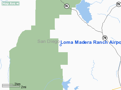
Loma Madera Ranch Airport |
Location
& QuickFacts
|
FAA
Information Effective: |
2006-09-28 |
|
Airport
Identifier: |
25CA |
|
Longitude/Latitude: |
116-47-33.0850W/33-10-45.1450N
-116.792524/33.179207 (Estimated) |
|
Elevation: |
3375 ft / 1028.70 m (Estimated) |
|
Land: |
0 acres |
|
From
nearest city: |
7 nautical miles NW of Santa Ysabel, CA |
|
Location: |
San Diego County, CA |
|
Magnetic Variation: |
13E (1985) |
Owner
& Manager
|
Ownership: |
Privately owned |
|
Owner: |
D.j. Wilkinson |
|
Address: |
700 Front St, Unit 805
San Diego, CA 92101 |
|
Phone
number: |
619-239-6311 |
|
Manager: |
D.j. Wilkinson |
|
Address: |
25390 Black Canyon Rd
Santa Ysabel, CA 92070 |
|
Phone number: |
619-782-3443 |
Airport
Operations and Facilities
|
Airport
Use: |
Private |
|
Wind
indicator: |
No |
|
Segmented
Circle: |
No |
|
Control
Tower: |
No |
|
Attendance
Schedule: |
UNATNDD |
|
Landing
fee charge: |
No |
|
Sectional
chart: |
Los Angeles |
|
Region: |
AWP - Western-Pacific |
|
Boundary
ARTCC: |
ZLA - Los Angeles |
|
Tie-in
FSS: |
SAN - San Diego |
|
FSS
on Airport: |
No |
|
FSS
Phone: |
858-277-7043 |
|
FSS
Toll Free: |
1-800-WX-BRIEF |
|
Runway Information
Runway 06/24
|
Dimension: |
2300 x 40 ft / 701.0 x 12.2 m |
|
Surface: |
ASPH, |
|
|
Runway 06 |
Runway 24 |
|
Traffic
Pattern: |
Left |
Left |
|
Obstruction: |
175 ft hill, 2800.0 ft from runway |
600 ft peak, 10000.0 ft from runway |
|
Radio Navigation
Aids
|
ID |
Type |
Name |
Ch |
Freq |
Var |
Dist |
|
SAN |
FAN MARKER |
Encat |
|
|
15E |
32.0 nm |
|
SJY |
NDB |
San Jacinto |
|
227.00 |
14E |
38.4 nm |
|
UN |
NDB |
Tijuana |
|
381.00 |
14E |
40.7 nm |
|
NKX |
TACAN |
Miramar |
033X |
|
15E |
26.1 nm |
|
NFG |
TACAN |
Camp Pendleton |
055X |
|
13E |
30.4 nm |
|
NZY |
TACAN |
North Island |
117X |
|
14E |
35.7 nm |
|
NRS |
TACAN |
Imperial Beach |
029X |
|
14E |
40.3 nm |
|
RIV |
TACAN |
March |
077X |
|
14E |
49.9 nm |
|
NKX |
UHF/NDB |
Miramar |
|
352.00 |
15E |
25.3 nm |
|
HDF |
VOR |
Homeland |
|
113.40 |
14E |
40.9 nm |
|
TIJ |
VOR/DME |
Tijuana |
112X |
116.50 |
14E |
39.3 nm |
|
JLI |
VORTAC |
Julian |
087X |
114.00 |
15E |
10.7 nm |
|
OCN |
VORTAC |
Oceanside |
100X |
115.30 |
15E |
31.7 nm |
|
MZB |
VORTAC |
Mission Bay |
125X |
117.80 |
15E |
32.3 nm |
|
PGY |
VORTAC |
Poggi |
035X |
109.80 |
14E |
35.5 nm |
|
TRM |
VORTAC |
Thermal |
109X |
116.20 |
13E |
41.7 nm |
|
PSP |
VORTAC |
Palm Springs |
102X |
115.50 |
13E |
45.3 nm |
|
SEE |
VOT |
Gillespie Field |
|
110.00 |
|
23.2 nm |
|
SAN |
VOT |
Mount Soledad |
|
109.00 |
|
30.9 nm |
Remarks
Based Aircraft
|
Aircraft
based on field: |
1 |
|
Multi
Engine Airplanes: |
1 |
Loma Madera Ranch Airport
Address:
San Diego County, CA
Tel:
619-239-6311,
619-782-3443
Images
and information placed above are from
http://www.airport-data.com/airport/25CA/
We
thank them for the data!
| General
Info |
| Country |
United
States |
| State |
CALIFORNIA
|
| FAA ID |
25CA
|
| Latitude |
33-10-45.145N
|
| Longitude |
116-47-33.085W
|
| Elevation |
3375 feet
|
| Near City |
SANTA
YSABEL |
We don't guarantee the information is fresh and accurate. The data may
be wrong or outdated.
For more up-to-date information please refer to other sources.
|
|


