 |
|
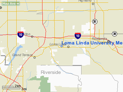
Loma Linda University Medical Center Heliport |
|
|
Location
& QuickFacts
|
FAA
Information Effective: |
2006-09-28 |
|
Airport
Identifier: |
94CL |
|
Longitude/Latitude: |
117-15-52.1490W/34-03-00.0500N
-117.264486/34.050014 (Estimated) |
|
Elevation: |
1223 ft / 372.77 m (Estimated) |
|
Land: |
0 acres |
|
From
nearest city: |
0 nautical miles N of Loma Linda, CA |
|
Location: |
San Bernardino County, CA |
|
Magnetic Variation: |
14E (1985) |
Owner
& Manager
|
Ownership: |
Privately owned |
|
Owner: |
Loma Linda University Med Ctr |
|
Address: |
11234 Anderson
Loma Linda, CA 92354 |
|
Phone number: |
714-824-4303 |
|
Manager: |
Thomas J. Zirkle |
|
Address: |
11234 Anderson
Loma Linda, CA 92354 |
|
Phone number: |
714-824-4716 |
Airport
Operations and Facilities
|
Airport
Use: |
Private
MEDICAL. |
|
Wind
indicator: |
Yes |
|
Segmented
Circle: |
No |
|
Control
Tower: |
No |
|
Attendance
Schedule: |
UNATNDD |
|
Lighting
Schedule: |
SS-SR |
|
Beacon
Color: |
Clear-Green-Yellow (heliport)
ROTG BCN IS NON STD. |
|
Landing fee charge: |
No |
|
Sectional chart: |
Los Angeles |
|
Region: |
AWP - Western-Pacific |
|
Boundary ARTCC: |
ZLA - Los Angeles |
|
Tie-in FSS: |
RAL - Riverside |
|
FSS on Airport: |
No |
|
FSS Phone: |
951-351-3020 |
|
FSS Toll Free: |
1-800-WX-BRIEF |
Airport
Communications
Airport
Services
|
Airframe
Repair: |
NONE |
|
Power
Plant Repair: |
NONE |
|
Runway Information
Helipad H1
|
Dimension: |
54 x 54 ft / 16.5 x 16.5 m |
|
Surface: |
MATS, |
|
|
Runway H1 |
Runway |
|
Elevation: |
1223.00 ft |
0.00
ft |
|
Traffic
Pattern: |
Left |
Left |
|
Radio Navigation
Aids
|
ID |
Type |
Name |
Ch |
Freq |
Var |
Dist |
|
SB |
NDB |
Petis |
|
397.00 |
14E |
5.1 nm |
|
SJY |
NDB |
San Jacinto |
|
227.00 |
14E |
20.2 nm |
|
EMT |
NDB |
El Monte |
|
359.00 |
15E |
38.2 nm |
|
CPM |
NDB |
Compton |
|
378.00 |
15E |
49.9 nm |
|
RIV |
TACAN |
March |
077X |
|
14E |
8.6 nm |
|
NFG |
TACAN |
Camp Pendleton |
055X |
|
13E |
47.0 nm |
|
RAL |
VOR |
Riverside |
|
112.40 |
15E |
10.9 nm |
|
HDF |
VOR |
Homeland |
|
113.40 |
14E |
16.9 nm |
|
ELB |
VOR/DME |
El Toro |
119X |
117.20 |
14E |
32.4 nm |
|
VCV |
VOR/DME |
Victorville |
031X |
109.40 |
14E |
33.3 nm |
|
PDZ |
VORTAC |
Paradise |
059X |
112.20 |
15E |
15.4 nm |
|
POM |
VORTAC |
Pomona |
041X |
110.40 |
15E |
26.1 nm |
|
SLI |
VORTAC |
Seal Beach |
104X |
115.70 |
15E |
42.6 nm |
|
PSP |
VORTAC |
Palm Springs |
102X |
115.50 |
13E |
43.0 nm |
|
OCN |
VORTAC |
Oceanside |
100X |
115.30 |
15E |
49.3 nm |
|
SNA |
VOT |
Santa Ana |
|
110.00 |
|
37.6 nm |
Remarks
Loma Linda University Medical Center Heliport
Address:
San Bernardino County, CA
Tel:
714-824-4303, 714-824-4716
Images
and information placed above are from
http://www.airport-data.com/airport/94CL/
We
thank them for the data!
| General
Info |
| Country |
United
States |
| State |
CALIFORNIA
|
| FAA ID |
94CL
|
| Latitude |
34-03-00.050N
|
| Longitude |
117-15-52.149W
|
| Elevation |
1223 feet
|
| Near City |
LOMA LINDA
|
We don't guarantee the information is fresh and accurate. The data may
be wrong or outdated.
For more up-to-date information please refer to other sources.
|
|


