 |
|
|
|
|
|
Location
& QuickFacts
|
FAA
Information Effective: |
2006-09-28 |
|
Airport
Identifier: |
53CL |
|
Longitude/Latitude: |
123-35-26.0430W/38-51-34.6710N
-123.590568/38.859631 (Estimated) |
|
Elevation: |
1317 ft / 401.42 m (Estimated) |
|
Land: |
0 acres |
|
From
nearest city: |
3 nautical miles N of Anchor Bay, CA |
|
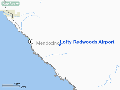
Location: |
Mendocino County, CA |
|
Magnetic Variation: |
17E (1985) |
Owner
& Manager
|
Ownership: |
Privately owned |
|
Owner: |
Richard Henrikson |
|
Address: |
29460 Ten Mile Cutoff Road, Po Box 1058
Point Arena, CA 95468 |
|
Phone
number: |
707-884-9069 |
|
Manager: |
Richard Henrikson |
|
Address: |
29460 Ten Mile Cutoff Road, Po Box 1058
Point Arena, CA 95468 |
|
Phone number: |
707-884-9069 |
Airport
Operations and Facilities
|
Airport Use: |
Private |
|
Wind indicator: |
Yes |
|
Segmented Circle: |
No |
|
Control Tower: |
No |
|
Attendance Schedule: |
UNATNDD |
|
Landing fee charge: |
No |
|
Sectional chart: |
San Francisco |
|
Region: |
AWP - Western-Pacific |
|
Boundary ARTCC: |
ZOA - Oakland |
|
Tie-in FSS: |
OAK - Oakland |
|
FSS on Airport: |
No |
|
FSS Phone: |
510-273-6111 |
|
FSS Toll Free: |
1-800-WX-BRIEF |
Airport
Services
|
Airframe
Repair: |
NONE |
|
Power
Plant Repair: |
NONE |
|
Runway Information
Runway 13/31
|
Dimension: |
3200 x 60 ft / 975.4 x 18.3 m |
|
Surface: |
GRVL-TRTD,
SEAL COATED. |
|
|
Runway 13 |
Runway 31 |
|
Traffic
Pattern: |
Left |
Right |
|
Radio Navigation
Aids
|
ID |
Type |
Name |
Ch |
Freq |
Var |
Dist |
|
LOP |
NDB |
Lampson |
|
217.00 |
16E |
34.0 nm |
|
STS |
VOR/DME |
Santa Rosa |
077X |
113.00 |
16E |
42.3 nm |
|
ENI |
VORTAC |
Mendocino |
070X |
112.30 |
16E |
18.8 nm |
Remarks
- 5
DEG DOGLEG AT MIDPOINT ON RWY 13/31.
- HIGH
TREES AT W SIDE OF RWY.
Based Aircraft
|
Aircraft
based on field: |
1 |
|
Single
Engine Airplanes: |
1 |
Lofty Redwoods Airport
Address:
Mendocino County, CA
Tel:
707-884-9069
Images
and information placed above are from
http://www.airport-data.com/airport/53CL/
We
thank them for the data!
| General
Info |
| Country |
United
States |
| State |
CALIFORNIA
|
| FAA ID |
53CL
|
| Latitude |
38-51-34.671N
|
| Longitude |
123-35-26.043W
|
| Elevation |
1317 feet
|
| Near City |
ANCHOR
BAY |
We don't guarantee the information is fresh and accurate. The data may
be wrong or outdated.
For more up-to-date information please refer to other sources.
|
|


