 |
|
|
|
|
|
Location
& QuickFacts
|
FAA
Information Effective: |
2006-09-28 |
|
Airport
Identifier: |
33CA |
|
Longitude/Latitude: |
118-18-06.2810W/34-54-19.9120N
-118.301745/34.905531 (Estimated) |
|
Elevation: |
2690 ft / 819.91 m (Surveyed) |
|
Land: |
236 acres |
|
From
nearest city: |
7 nautical miles NW of Rosamond, CA |
|
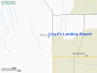
Location: |
Kern County, CA |
|
Magnetic Variation: |
14E (1985) |
Owner
& Manager
|
Ownership: |
Privately owned |
|
Owner: |
Richard H. Miner |
|
Address: |
9678 Dawn Road
Rosamond, CA 93560 |
|
Phone number: |
661-256-4381 |
|
Manager: |
Richard H. Miner |
|
Address: |
9678 Dawn Road
Rosamond, CA 93560 |
|
Phone number: |
661-256-4381 |
Airport
Operations and Facilities
|
Airport
Use: |
Private |
|
Wind
indicator: |
Yes |
|
Segmented
Circle: |
Yes |
|
Control
Tower: |
No |
|
Attendance
Schedule: |
ALL/ALL/ALL |
|
Lighting
Schedule: |
PHONE REQ
FOR LIRL RWY 06/24 CALL 661-256-4381. |
|
Landing fee charge: |
No |
|
Sectional chart: |
Los Angeles |
|
Region: |
AWP - Western-Pacific |
|
Boundary ARTCC: |
ZLA - Los Angeles |
|
Tie-in FSS: |
RAL - Riverside |
|
FSS on Airport: |
No |
|
FSS Phone: |
951-351-3020 |
|
FSS Toll Free: |
1-800-WX-BRIEF |
Airport
Communications
|
Unicom: |
123.000
FOR UNICOM PHONE 661-256-4381. |
|
Runway Information
Runway 06/24
|
Dimension: |
2300 x 90 ft / 701.0 x 27.4 m |
|
Surface: |
DIRT, |
|
Edge
Lights: |
Low |
|
|
Runway 06 |
Runway 24 |
|
Traffic
Pattern: |
Left |
Left |
|
Obstruction: |
40 ft trees, 2000.0 ft from runway |
16 ft bldg, 4000.0 ft from runway |
|
Runway 11/29
|
Dimension: |
1370 x 60 ft / 417.6 x 18.3 m |
|
Surface: |
DIRT, |
|
|
Runway 11 |
Runway 29 |
|
Traffic
Pattern: |
Left |
Left |
|
Displaced
threshold: |
100.00 ft |
0.00
ft |
|
Obstruction: |
4 ft fence, 100.0 ft from runway |
12 ft bushes, 30.0 ft from runway |
|
Radio Navigation
Aids
|
ID |
Type |
Name |
Ch |
Freq |
Var |
Dist |
|
GWF |
NDB |
Gen William J Fox |
|
282.00 |
15E |
10.9 nm |
|
PAI |
NDB |
Pacoima |
|
370.00 |
15E |
39.2 nm |
|
VNY |
VOR/DME |
Van Nuys |
078X |
113.10 |
15E |
42.1 nm |
|
VCV |
VOR/DME |
Victorville |
031X |
109.40 |
14E |
48.8 nm |
|
LHS |
VORTAC |
Lake Hughes |
021X |
108.40 |
15E |
19.1 nm |
|
PMD |
VORTAC |
Palmdale |
092X |
114.50 |
15E |
20.2 nm |
|
GMN |
VORTAC |
Gorman |
108X |
116.10 |
16E |
28.3 nm |
|
EDW |
VORTAC |
Edwards |
111X |
116.40 |
15E |
28.4 nm |
|
FIM |
VORTAC |
Fillmore |
072X |
112.50 |
15E |
43.7 nm |
|
BFL |
VOT |
Bakersfield |
|
111.20 |
|
48.1 nm |
Remarks
Based Aircraft
|
Aircraft
based on field: |
1 |
|
Single
Engine Airplanes: |
1 |
Lloyd's Landing Airport
Address:
Kern County, CA
Tel:
661-256-4381
Images
and information placed above are from
http://www.airport-data.com/airport/33CA/
We
thank them for the data!
| General
Info |
| Country |
United
States |
| State |
CALIFORNIA
|
| FAA ID |
33CA
|
| Latitude |
34-54-19.912N
|
| Longitude |
118-18-06.281W
|
| Elevation |
2690 feet
|
| Near City |
ROSAMOND
|
We don't guarantee the information is fresh and accurate. The data may
be wrong or outdated.
For more up-to-date information please refer to other sources.
|
|


