|
|
|
 |
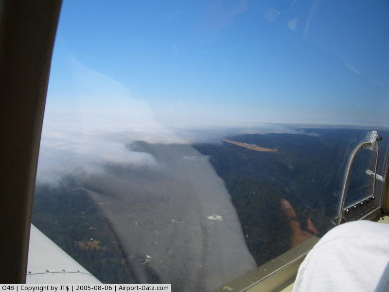
(Click on the photo to enlarge) |
|
 |
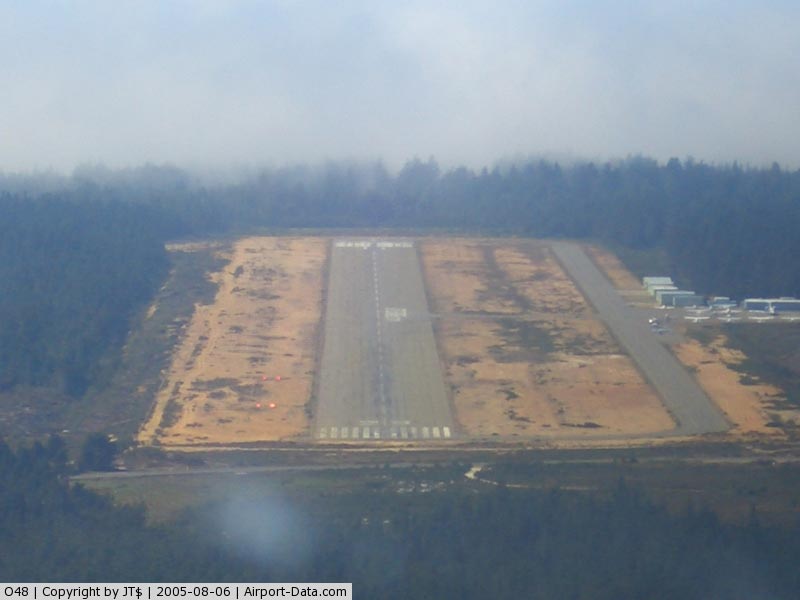
(Click on the photo to enlarge) |
Location
& QuickFacts
|
FAA
Information Effective: |
2006-09-28 |
|
Airport
Identifier: |
O48 |
|
Longitude/Latitude: |
123-45-13.4450W/39-15-43.3360N
-123.753735/39.262038 (Estimated) |
|
Elevation: |
572 ft / 174.35 m (Surveyed) |
|
Land: |
548 acres |
|
From
nearest city: |
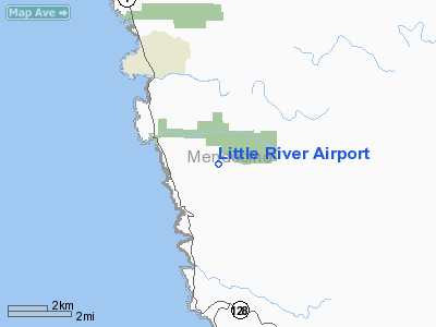
3 nautical miles SE of Little River, CA |
|
Location: |
Mendocino County, CA |
|
Magnetic Variation: |
17E (1985) |
Owner
& Manager
|
Ownership: |
Publicly owned |
|
Owner: |
Mendocino County |
|
Address: |
County Courthouse
Ukiah, CA 95482 |
|
Phone
number: |
707-463-4363 |
|
Manager: |
Charles A. Boyer
DEPUTY DIRECTOR/ADMIN & BUS. SVCS. |
|
Address: |
340 Lake Mendocino Drive
Ukiah, CA 95482 |
|
Phone number: |
707-463-4363 |
Airport
Operations and Facilities
|
Airport
Use: |
Open to public |
|
Wind
indicator: |
Yes |
|
Segmented
Circle: |
No |
|
Control
Tower: |
No |
|
Attendance
Schedule: |
ALL/THU-MON/0800-1700 |
|
Lighting
Schedule: |
DUSK-DAWN
ACTVT MIRL RY 11/29 AND VASI RY 29 - CTAF. |
|
Beacon
Color: |
Clear-Green (lighted land airport) |
|
Landing
fee charge: |
No |
|
Sectional
chart: |
San Francisco |
|
Region: |
AWP - Western-Pacific |
|
Boundary
ARTCC: |
ZOA - Oakland |
|
Tie-in
FSS: |
OAK - Oakland |
|
FSS
on Airport: |
No |
|
FSS
Phone: |
510-273-6111 |
|
FSS
Toll Free: |
1-800-WX-BRIEF |
|
NOTAMs
Facility: |
OAK (NOTAM-d service avaliable) |
|
Federal Agreements: |
NR1 |
Airport
Communications
|
CTAF: |
122.700 |
|
Unicom: |
122.700 |
Airport
Services
|
Fuel
available: |
100LL |
|
Airframe
Repair: |
NONE |
|
Power
Plant Repair: |
NONE |
|
Bottled
Oxygen: |
NONE |
|
Bulk
Oxygen: |
NONE |
|
Runway Information
Runway 11/29
|
Dimension: |
5249 x 150 ft / 1599.9 x 45.7 m |
|
Surface: |
ASPH, Fair Condition |
|
Weight
Limit: |
Single wheel: 60000 lbs.
Dual wheel: 200000 lbs.
Dual
tandem wheel: 400000 lbs. |
|
Edge
Lights: |
Medium |
|
|
Runway 11 |
Runway 29 |
|
Longitude: |
123-45-39.8300W |
123-44-47.1420W |
|
Latitude: |
39-15-59.2400N |
39-15-27.4060N |
|
Elevation: |
545.00 ft |
572.00 ft |
|
Alignment: |
127 |
127 |
|
Traffic
Pattern: |
Left |
Left |
|
Markings: |
Basic, Good Condition |
Basic, Good Condition |
|
Crossing
Height: |
0.00
ft |
52.00 ft |
|
Displaced
threshold: |
193.00 ft |
0.00
ft |
|
VASI: |
|
4-box on left side |
|
Visual
Glide Angle: |
0.00� |
4.00� |
|
Runway
End Identifier: |
No |
No |
|
Centerline
Lights: |
No |
No |
|
Touchdown
Lights: |
No |
No |
|
Obstruction: |
6 ft brush, 200.0 ft from runway
RWY 11 APCH RATIO 31:1 TO DSPLCD THR OVER +35' TREES @ 1200',
312' RIGHT FM EOR.
+6'
BRUSH IN THE RUNWAY SAFETY AREA TO RWY 11. |
45 ft trees, 1500.0 ft from runway, 28:1 slope
to clear
RWY 29 +4 FT BRUSH 140 FT FM RY END. |
|
Radio Navigation
Aids
|
ID |
Type |
Name |
Ch |
Freq |
Var |
Dist |
|
LOP |
NDB |
Lampson |
|
217.00 |
16E |
43.6 nm |
|
ENI |
VORTAC |
Mendocino |
070X |
112.30 |
16E |
25.6 nm |
Remarks
Based Aircraft
|
Aircraft
based on field: |
35 |
|
Single
Engine Airplanes: |
32 |
|
Multi
Engine Airplanes: |
1 |
|
Ultralights: |
2 |
Operational Statistics
|
Aircraft
Operations: |
122/Week |
|
Air Taxi: |
1.6% |
|
General
Aviation Local: |
28.6% |
|
General
Aviation Itinerant: |
69.8% |
Little River Airport
Address:
Mendocino County, CA
Tel:
707-463-436
Images
and information placed above are from
http://www.airport-data.com/airport/O48/
We
thank them for the data!
| General
Info |
| Country |
United
States |
| State |
CALIFORNIA
|
| FAA ID |
O48
|
| Latitude |
39-15-43.336N
|
| Longitude |
123-45-13.445W
|
| Elevation |
572 feet
|
| Near City |
LITTLE
RIVER |
We don't guarantee the information is fresh and accurate. The data may
be wrong or outdated.
For more up-to-date information please refer to other sources.
|
|