 |
|
Lincoln Regional - Karl Harder Field Airport |
Lincoln Regional Airport
Karl Harder Field |
| IATA: none – ICAO: KLHM – FAA LID: LHM |
| Summary |
| Airport type |
Public |
| Owner |
City of Lincoln |
| Location |
Lincoln, California |
| Elevation AMSL |
121 ft / 37 m |
| Coordinates |
38°54′33″N 121°21′05″W / 38.90917°N 121.35139°W / 38.90917; -121.35139 |
| Runways |
| Direction |
Length |
Surface |
| ft |
m |
| 15/33 |
6,001 |
1,829 |
Asphalt |
| Statistics (1993) |
| Aircraft operations |
71,000 |
| Based aircraft |
207 |
| Source: Federal Aviation Administration |
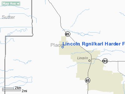
Lincoln Regional Airport (ICAO: KLHM, FAA LID: LHM, formerly O51), also known as Karl Harder Field, is a public airport located three miles (5 km) west of the central business district of Lincoln, a city in Placer County, California, United States. It is owned by the City of Lincoln.
Although most U.S. airports use the same three-letter location identifier for the Federal Aviation Administration and International Air Transport Association, Lincoln Regional Airport is assigned LHM by the FAA but has no designation from the IATA.
Facilities and aircraft
Lincoln Regional Airport covers an area of 725 acres (293 ha) which contains one asphalt paved runway (15/33) measuring 6,001 x 100 ft (1,829 x 30 m).
For the 12-month period ending June 10, 1993, the airport had 71,000 aircraft operations, an average of 194 per day: 96% general aviation and 4% air taxi. There are 207 aircraft based at this airport: 92% single engine, 7% multi-engine, 1% jet aircraft and <1% helicopters.
The above content comes from Wikipedia and is published under free licenses – click here to read more.
Location
& QuickFacts
|
FAA
Information Effective: |
2006-09-28 |
|
Airport
Identifier: |
LHM |
|
Longitude/Latitude: |
121-21-04.8000W/38-54-33.0000N
-121.351333/38.909167 (Estimated) |
|
Elevation: |
121 ft / 36.88 m (Surveyed) |
|
Land: |
725 acres |
|
From
nearest city: |
3 nautical miles W of Lincoln, CA |
|
Location: |
Placer County, CA |
|
Magnetic Variation: |
16E (1985) |
Owner
& Manager
|
Ownership: |
Publicly owned |
|
Owner: |
City Of Lincoln |
|
Address: |
1530-3rd St, Suite 111
Lincoln, CA 95648 |
|
Phone number: |
916-645-3314 |
|
Manager: |
James A.mcleod |
|
Address: |
1480 Flightline Dr.
Lincoln, CA 95648 |
|
Phone number: |
916-645-8576 |
Airport
Operations and Facilities
|
Airport
Use: |
Open to public |
|
Wind
indicator: |
Yes |
|
Segmented
Circle: |
Yes |
|
Control
Tower: |
No |
|
Attendance
Schedule: |
ALL/MON-FRI/0730-1830,ALL/SAT-SUN/0830-1559 |
|
Lighting
Schedule: |
DUSK-DAWN
ACTVT MIRL RY 15/33, MALSR RY 15 - CTAF. |
|
Beacon
Color: |
Clear-Green (lighted land airport) |
|
Landing
fee charge: |
No |
|
Sectional
chart: |
San Francisco |
|
Region: |
AWP - Western-Pacific |
|
Traffic
Pattern Alt: |
1000 ft |
|
Boundary
ARTCC: |
ZOA - Oakland |
|
Tie-in
FSS: |
RIU - Rancho Murieta |
|
FSS
on Airport: |
No |
|
FSS
Phone: |
916-354-0161 |
|
FSS
Toll Free: |
1-800-WX-BRIEF |
|
NOTAMs
Facility: |
RIU (NOTAM-d service avaliable) |
|
Federal Agreements: |
NGRY |
Airport
Communications
|
CTAF: |
123.000 |
|
Unicom: |
123.000 |
Airport
Services
|
Fuel
available: |
100LLA
FUEL SVC AVBL DURG ARPT OPER HRS; SELF SVC FUEL AVBL 24
HRS WITH MAJOR CREDIT CARD. |
|
Airframe
Repair: |
MAJOR |
|
Power
Plant Repair: |
MAJOR |
|
Bottled
Oxygen: |
NONE |
|
Bulk
Oxygen: |
NONE |
|
Runway Information
Runway 15/33
|
Dimension: |
6001 x 100 ft / 1829.1 x 30.5 m |
|
Surface: |
ASPH, Good Condition |
|
Weight
Limit: |
Single wheel: 30000 lbs.
Dual wheel: 60000 lbs. |
|
Edge
Lights: |
Medium |
|
|
Runway 15 |
Runway 33 |
|
Longitude: |
121-21-14.4429W |
121-20-55.1873W |
|
Latitude: |
38-55-01.6673N |
38-54-04.2960N |
|
Elevation: |
120.00 ft |
120.00 ft |
|
Alignment: |
127 |
127 |
|
ILS
Type: |
ILS/DME |
|
|
Traffic
Pattern: |
Left |
Left |
|
Markings: |
Non-precision instrument, Good Condition |
Non-precision instrument, Good Condition |
|
Crossing
Height: |
31.00 ft |
31.00 ft |
|
VASI: |
2-box on left side |
2-box on left side |
|
Visual
Glide Angle: |
3.00� |
3.00� |
|
Approach
lights: |
MALSR |
|
|
Runway
End Identifier: |
No |
No |
|
Centerline
Lights: |
No |
No |
|
Touchdown
Lights: |
No |
No |
|
Obstruction: |
25 ft tree, 1000.0 ft from runway, 32:1 slope
to clear |
40 ft trees, 1600.0 ft from runway, 35:1 slope
to clear |
|
Radio Navigation
Aids
|
ID |
Type |
Name |
Ch |
Freq |
Var |
Dist |
|
MY |
NDB |
Halow |
|
222.00 |
16E |
19.8 nm |
|
OVE |
NDB |
Oroville |
|
212.00 |
16E |
37.4 nm |
|
BAB |
TACAN |
Beale |
023X |
|
16E |
14.2 nm |
|
SUU |
TACAN |
Travis |
113X |
|
17E |
48.7 nm |
|
TZZ |
VOR |
Travis |
|
116.40 |
17E |
40.2 nm |
|
MCC |
VOR/DME |
Mc Clellan |
029X |
109.20 |
17E |
14.7 nm |
|
MYV |
VOR/DME |
Marysville |
045X |
110.80 |
16E |
15.4 nm |
|
HNW |
VOR/DME |
Hangtown |
102X |
115.50 |
17E |
30.3 nm |
|
SAC |
VORTAC |
Sacramento |
099X |
115.20 |
17E |
29.5 nm |
|
ILA |
VORTAC |
Williams |
091X |
114.40 |
18E |
33.0 nm |
|
MXW |
VORTAC |
Maxwell |
037X |
110.00 |
18E |
47.4 nm |
|
SMF |
VOT |
Sacramento Metropolitan |
|
111.40 |
|
17.3 nm |
|
SAC |
VOT |
Sacramento Executive |
|
111.40 |
|
24.7 nm |
Based Aircraft
|
Aircraft
based on field: |
207 |
|
Single
Engine Airplanes: |
190 |
|
Multi
Engine Airplanes: |
14 |
|
Jet Engine
Airplanes: |
2 |
|
Helicopters: |
1 |
Operational Statistics
|
Aircraft
Operations: |
195/Day |
|
Air Taxi: |
4.2% |
|
General
Aviation Local: |
49.3% |
|
General
Aviation Itinerant: |
46.5% |
Lincoln Rgnl/karl Harder Field Airport
Address:
Placer County, CA
Tel:
916-645-3314, 916-645-8576
Images
and information placed above are from
http://www.airport-data.com/airport/LHM/
We
thank them for the data!
| General
Info |
| Country |
United
States |
| State |
CALIFORNIA
|
| FAA ID |
LHM
|
| Latitude |
38-54-33.000N
|
| Longitude |
121-21-04.800W
|
| Elevation |
121 feet
|
| Near City |
LINCOLN
|
We don't guarantee the information is fresh and accurate. The data may
be wrong or outdated.
For more up-to-date information please refer to other sources.
|
|


