 |
|
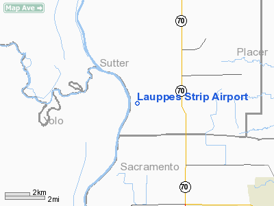
Location
& QuickFacts
|
FAA
Information Effective: |
2006-09-28 |
|
Airport
Identifier: |
CA22 |
|
Longitude/Latitude: |
121-35-06.8520W/38-45-33.6460N
-121.585237/38.759346 (Estimated) |
|
Elevation: |
23 ft / 7.01 m (Estimated) |
|
Land: |
0 acres |
|
From
nearest city: |
10 nautical miles NW of Sacramento, CA |
|
Location: |
Sutter County, CA |
|
Magnetic Variation: |
16E (1985) |
Owner
& Manager
|
Ownership: |
Privately owned |
|
Owner: |
Burton H. Lauppe |
|
Address: |
11000 Garden Hwy
Sacramento, CA 95837 |
|
Phone number: |
916-925-6954 |
|
Address: |
|
Airport
Operations and Facilities
|
Airport
Use: |
Private |
|
Wind
indicator: |
Yes |
|
Segmented
Circle: |
No |
|
Control
Tower: |
No |
|
Attendance
Schedule: |
UNATNDD |
|
Landing
fee charge: |
No |
|
Sectional
chart: |
San Francisco |
|
Region: |
AWP - Western-Pacific |
|
Boundary
ARTCC: |
ZOA - Oakland |
|
Tie-in
FSS: |
RIU - Rancho Murieta |
|
FSS
on Airport: |
No |
|
FSS
Phone: |
916-354-0161 |
|
FSS
Toll Free: |
1-800-WX-BRIEF |
|
Runway Information
Runway 15/33
|
Dimension: |
2000 x 30 ft / 609.6 x 9.1 m |
|
Surface: |
DIRT, |
|
|
Runway 15 |
Runway 33 |
|
Traffic
Pattern: |
Left |
Left |
|
Radio Navigation
Aids
|
ID |
Type |
Name |
Ch |
Freq |
Var |
Dist |
|
MY |
NDB |
Halow |
|
222.00 |
16E |
24.7 nm |
|
OVE |
NDB |
Oroville |
|
212.00 |
16E |
44.2 nm |
|
BAB |
TACAN |
Beale |
023X |
|
16E |
23.6 nm |
|
SUU |
TACAN |
Travis |
113X |
|
17E |
35.2 nm |
|
TZZ |
VOR |
Travis |
|
116.40 |
17E |
27.1 nm |
|
MCC |
VOR/DME |
Mc Clellan |
029X |
109.20 |
17E |
10.1 nm |
|
MYV |
VOR/DME |
Marysville |
045X |
110.80 |
16E |
20.4 nm |
|
HNW |
VOR/DME |
Hangtown |
102X |
115.50 |
17E |
39.2 nm |
|
CCR |
VOR/DME |
Concord |
117X |
117.00 |
17E |
48.1 nm |
|
SAC |
VORTAC |
Sacramento |
099X |
115.20 |
17E |
19.0 nm |
|
ILA |
VORTAC |
Williams |
091X |
114.40 |
18E |
27.9 nm |
|
MXW |
VORTAC |
Maxwell |
037X |
110.00 |
18E |
44.8 nm |
|
LIN |
VORTAC |
Linden |
095X |
114.80 |
17E |
49.4 nm |
|
SMF |
VOT |
Sacramento Metropolitan |
|
111.40 |
|
4.1 nm |
|
SAC |
VOT |
Sacramento Executive |
|
111.40 |
|
15.3 nm |
Remarks
- (E111-2)
ESTAB & MAINT RDO COMM WITH SACRAMENTO ATCT WITHIN THE SACRAMENTO
METRO CTL ZONE.
- VFR
OPNS ONLY. TKOF N - MAINT RWY HEADING FOR 1 MI THEN 45 DEG R TURN MAINT
APRX 500'AGL UNTIL OUT OF CTL ZONE. TKOF S - EXECUTE A 180 DEG R TURN
APRX 500'AGL REMAIN E OF THE SACRAMENTO RIVER UNTIL OUT OF CONTROL ZONE.
Based Aircraft
|
Aircraft
based on field: |
2 |
|
Single
Engine Airplanes: |
2 |
Lauppes Strip Airport
Address:
Sutter County, CA
Tel:
916-925-6954
Images
and information placed above are from
http://www.airport-data.com/airport/CA22/
We
thank them for the data!
| General
Info |
| Country |
United
States |
| State |
CALIFORNIA
|
| FAA ID |
CA22
|
| Latitude |
38-45-33.646N
|
| Longitude |
121-35-06.852W
|
| Elevation |
23 feet
|
| Near City |
SACRAMENTO
|
We don't guarantee the information is fresh and accurate. The data may
be wrong or outdated.
For more up-to-date information please refer to other sources.
|
|


