 |
|
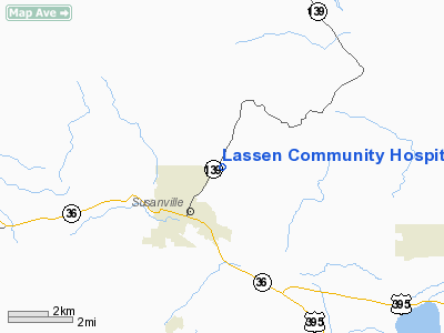
Lassen Community Hospital Heliport |
Location
& QuickFacts
|
FAA
Information Effective: |
2006-09-28 |
|
Airport
Identifier: |
99CN |
|
Longitude/Latitude: |
120-37-40.0000W/40-26-16.0000N
-120.627778/40.437778 (Estimated) |
|
Elevation: |
4419 ft / 1346.91 m (Surveyed) |
|
Land: |
0 acres |
|
From
nearest city: |
5 nautical miles NE of Susanville, CA |
|
Location: |
Lassen County, CA |
|
Magnetic Variation: |
() |
Owner
& Manager
|
Ownership: |
Privately owned |
|
Owner: |
Banner Lassen Medical Center |
|
Address: |
1800 Spring Ridge Dr.
Susanville, CA 96130 |
|
Phone number: |
530-252-2000 |
|
Address: |
|
Airport
Operations and Facilities
|
Airport
Use: |
Private |
|
Wind
indicator: |
Yes |
|
Segmented
Circle: |
No |
|
Control
Tower: |
No |
|
Attendance
Schedule: |
UNATNDD |
|
Sectional
chart: |
San Francisco |
|
Region: |
AWP - Western-Pacific |
|
Boundary
ARTCC: |
ZOA - Oakland |
|
Responsible
ARTCC: |
ZOA - Oakland |
|
Tie-in
FSS: |
RNO - Reno |
|
FSS
Phone: |
775-858-1300 |
|
FSS
Toll Free: |
1-800-WX-BRIEF |
|
Runway Information
Helipad H1
|
Dimension: |
86 x 50 ft / 26.2 x 15.2 m |
|
Surface: |
CONC, |
|
|
Runway H1 |
Runway |
|
Traffic
Pattern: |
Left |
Left |
|
Radio Navigation
Aids
|
ID |
Type |
Name |
Ch |
Freq |
Var |
Dist |
|
AHC |
VOR/DME |
Amedee |
027X |
109.00 |
17E |
24.1 nm |
Remarks
- PROVIDED
PVT, VFR OPERATIONS SHALL BE CONDUCTED IN ACCORDANCE WITH THE REQUIREMENT
OF THE OVERLYING CLASS OF AIRSPACE.
Lassen Community Hospital Heliport
Address:
Lassen County, CA
Tel:
530-252-2000
Images
and information placed above are from
http://www.airport-data.com/airport/99CN/
We
thank them for the data!
We don't guarantee the information is fresh and accurate. The data may
be wrong or outdated.
For more up-to-date information please refer to other sources.
|
|


