 |
|
| LAPD Hooper Heliport |
| IATA: none – ICAO: none – FAA LID: 4CA0 |
| Summary |
| Airport type |
Private |
| Owner |
City of Los Angeles |
| Location |
Los Angeles, California |
| Elevation AMSL |
302 ft / 92 m |
| Coordinates |
34°03′15″N 118°13′48″W / 34.054295°N 118.229885°W / 34.054295; -118.229885 |
| Helipads |
| Number |
Length |
Surface |
| ft |
m |
| H1 |
205 |
62 |
Concrete |
| Statistics |
| Based aircraft |
1 |
| Source: Federal Aviation Administration |
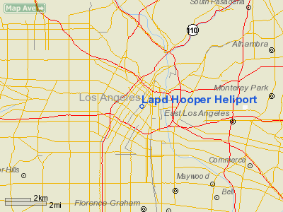
LAPD Hooper Heliport (FAA LID: 4CA0) is a city-owned private-use heliport located one nautical mile (2 km) southwest of the central business district of Los Angeles, in Los Angeles County, California, United States.
Hooper Heliport is located on the roof of the C. Erwin Piper Technical Center, the world's largest rooftop airport. It is centrally located between Los Angeles Union Station, Chinatown, and Downtown. It is home to the Los Angeles Police Department's Air Support Division which is the largest police aviation unit in America with well over 20 helicopters.
The Piper Technical Center is also used as a parking lot for some of the LAPD's motor pool including marked and un-marked units, vans, buses, motorcycles, and even the V-100 SWAT armored cars.
Hooper Heliport served as home base for the fictional police helicopter Blue Thunder in the 1983 motion picture of the same name, while construction of the heliport was still being completed.
The above content comes from Wikipedia and is published under free licenses – click here to read more.
Location
& QuickFacts
|
FAA
Information Effective: |
2006-09-28 |
|
Airport
Identifier: |
4CA0 |
|
Longitude/Latitude: |
118-14-49.2650W/34-02-36.0440N
-118.247018/34.043346 (Estimated) |
|
Elevation: |
302 ft / 92.05 m (Estimated) |
|
Land: |
0 acres |
|
From
nearest city: |
1 nautical miles SW of Los Angeles, CA |
|
Location: |
Los Angeles County, CA |
|
Magnetic Variation: |
14E (1985) |
Owner
& Manager
|
Ownership: |
Publicly owned |
|
Owner: |
City Of Los Angeles |
|
Address: |
555 Ramirez St, Space 475
Los Angeles, CA 90012 |
|
Phone
number: |
213-485-2011 |
|
Manager: |
C.o.-air Support Div-lapd |
|
Address: |
150 N. Los Angeles Street
Los Angeles, CA 90012 |
|
Phone number: |
213-485-2600 |
Airport
Operations and Facilities
|
Airport
Use: |
Private |
|
Wind
indicator: |
Yes |
|
Segmented
Circle: |
No |
|
Control
Tower: |
No |
|
Attendance
Schedule: |
ALL/ALL/ALL |
|
Landing
fee charge: |
No |
|
Sectional
chart: |
Los Angeles |
|
Region: |
AWP - Western-Pacific |
|
Boundary
ARTCC: |
ZLA - Los Angeles |
|
Tie-in FSS: |
HHR - Hawthorne |
|
FSS on Airport: |
No |
|
FSS Phone: |
310-970-0102 |
|
FSS Toll Free: |
1-800-WX-BRIEF |
Airport
Communications
|
Runway Information
Helipad H1
|
Dimension: |
205 x 105 ft / 62.5 x 32.0 m |
|
Surface: |
CONC,
ROOFTOP. |
|
|
Runway H1 |
Runway |
|
Traffic
Pattern: |
Left |
Left |
|
Radio Navigation
Aids
|
ID |
Type |
Name |
Ch |
Freq |
Var |
Dist |
|
CPM |
NDB |
Compton |
|
378.00 |
15E |
9.3 nm |
|
EMT |
NDB |
El Monte |
|
359.00 |
15E |
11.1 nm |
|
PAI |
NDB |
Pacoima |
|
370.00 |
15E |
15.4 nm |
|
GWF |
NDB |
Gen William J Fox |
|
282.00 |
15E |
41.8 nm |
|
SB |
NDB |
Petis |
|
397.00 |
14E |
43.9 nm |
|
NTD |
TACAN |
Point Mugu |
043X |
|
15E |
43.8 nm |
|
RIV |
TACAN |
March |
077X |
|
14E |
49.2 nm |
|
RAL |
VOR |
Riverside |
|
112.40 |
15E |
40.1 nm |
|
SMO |
VOR/DME |
Santa Monica |
045X |
110.80 |
15E |
10.6 nm |
|
VNY |
VOR/DME |
Van Nuys |
078X |
113.10 |
15E |
16.3 nm |
|
ELB |
VOR/DME |
El Toro |
119X |
117.20 |
14E |
33.9 nm |
|
VTU |
VOR/DME |
Ventura |
019X |
108.20 |
15E |
40.2 nm |
|
CMA |
VOR/DME |
Camarillo |
105X |
115.80 |
15E |
43.4 nm |
|
LAX |
VORTAC |
Los Angeles |
083X |
113.60 |
15E |
11.4 nm |
|
SLI |
VORTAC |
Seal Beach |
104X |
115.70 |
15E |
18.3 nm |
|
POM |
VORTAC |
Pomona |
041X |
110.40 |
15E |
23.0 nm |
|
PMD |
VORTAC |
Palmdale |
092X |
114.50 |
15E |
36.5 nm |
|
PDZ |
VORTAC |
Paradise |
059X |
112.20 |
15E |
36.5 nm |
|
FIM |
VORTAC |
Fillmore |
072X |
112.50 |
15E |
36.7 nm |
|
SXC |
VORTAC |
Santa Catalina |
051X |
111.40 |
15E |
41.1 nm |
|
LHS |
VORTAC |
Lake Hughes |
021X |
108.40 |
15E |
41.8 nm |
|
LAX |
VOT |
San Pedro Hill |
|
113.90 |
|
18.4 nm |
|
SNA |
VOT |
Santa Ana |
|
110.00 |
|
29.0 nm |
Remarks
- RSTRD
LNGD--POLICE BUSINESS ONLY. PHONE AIR SUPPORT DIV WATCH COMMANDER (213)
485-2600 PRIOR TO FLIGHT; THEN CTC KMB-7 ON 123.075 PRIOR TO LNDG AT
HELIPORT.
- VFR
ONLY.
Based Aircraft
|
Aircraft
based on field: |
1 |
|
Helicopters: |
1 |
Lapd Hooper Heliport
Address:
Los Angeles County, CA
Tel:
213-485-2011,
213-485-2600
Images
and information placed above are from
http://www.airport-data.com/airport/4CA0/
We
thank them for the data!
| General
Info |
| Country |
United
States |
| State |
CALIFORNIA
|
| FAA ID |
4CA0
|
| Latitude |
34-02-36.044N
|
| Longitude |
118-14-49.265W
|
| Elevation |
302 feet
|
| Near City |
LOS ANGELES
|
We don't guarantee the information is fresh and accurate. The data may
be wrong or outdated.
For more up-to-date information please refer to other sources.
|
|

