 |
|
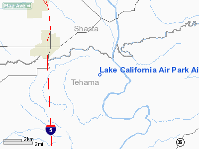
Lake California Air Park Airport |
Location
& QuickFacts
|
FAA
Information Effective: |
2006-09-28 |
|
Airport
Identifier: |
68CA |
|
Longitude/Latitude: |
122-12-57.0000W/40-21-40.0000N
-122.215833/40.361111 (Estimated) |
|
Elevation: |
615 ft / 187.45 m (Estimated) |
|
Land: |
61 acres |
|
From
nearest city: |
4 nautical miles NW of Cottonwood, CA |
|
Location: |
Tehama County, CA |
|
Magnetic Variation: |
17E (1990) |
Owner
& Manager
|
Ownership: |
Privately owned |
|
Owner: |
Lake Ca Property Owner Assoc |
|
Address: |
19999 Lake California Way
Cottonwood, CA 96022 |
|
Phone
number: |
530-347-7900 |
|
Manager: |
Mel Freimuth |
|
Address: |
19999 Lake California Way
Cottonwood, CA 96022 |
|
Phone number: |
530-347-7900 |
Airport
Operations and Facilities
|
Airport
Use: |
Private |
|
Wind
indicator: |
Yes |
|
Segmented
Circle: |
Yes |
|
Control
Tower: |
No |
|
Attendance
Schedule: |
UNATNDD |
|
Sectional
chart: |
Klamath Falls |
|
Region: |
AWP - Western-Pacific |
|
Boundary
ARTCC: |
ZOA - Oakland |
|
Tie-in
FSS: |
RIU - Rancho Murieta |
|
FSS
on Airport: |
No |
|
FSS
Phone: |
916-354-0161 |
|
FSS
Toll Free: |
1-800-WX-BRIEF |
|
Runway Information
Runway 15/33
|
Dimension: |
3000 x 75 ft / 914.4 x 22.9 m |
|
Surface: |
ASPH, Fair Condition |
|
|
Runway 15 |
Runway 33 |
|
Traffic
Pattern: |
Left |
Left |
|
Displaced
threshold: |
0.00
ft |
200.00 ft |
|
Obstruction: |
|
15 ft road
OBSTN CLEARENCE TO DSPLCD THLD 33:1. |
|
Radio Navigation
Aids
|
ID |
Type |
Name |
Ch |
Freq |
Var |
Dist |
|
PBT |
NDB |
Proberta |
|
338.00 |
16E |
14.9 nm |
|
RDD |
VOR/DME |
Redding |
021X |
108.40 |
18E |
9.3 nm |
|
CIC |
VOR/DME |
Chico |
035X |
109.80 |
16E |
38.3 nm |
|
RBL |
VORTAC |
Red Bluff |
104X |
115.70 |
18E |
15.8 nm |
Remarks
- PRVDD
VFR/PRIVATE USE ONLY.
Based Aircraft
|
Aircraft
based on field: |
4 |
|
Single
Engine Airplanes: |
3 |
|
Helicopters: |
1 |
Lake California Air Park Airport
Address:
Tehama County, CA
Tel:
530-347-7900
Images
and information placed above are from
http://www.airport-data.com/airport/68CA/
We
thank them for the data!
| General
Info |
| Country |
United
States |
| State |
CALIFORNIA
|
| FAA ID |
68CA
|
| Latitude |
40-21-40.000N
|
| Longitude |
122-12-57.000W
|
| Elevation |
615 feet
|
| Near City |
COTTONWOOD
|
We don't guarantee the information is fresh and accurate. The data may
be wrong or outdated.
For more up-to-date information please refer to other sources.
|
|


