 |
|
|
|
|
|
Location
& QuickFacts
|
FAA
Information Effective: |
2006-09-28 |
|
Airport
Identifier: |
08CL |
|
Longitude/Latitude: |
120-33-15.7190W/37-51-34.7370N
-120.554366/37.859649 (Estimated) |
|
Elevation: |
1025 ft / 312.42 m (Estimated) |
|
Land: |
0 acres |
|
From
nearest city: |
9 nautical miles SW of Jamestown, CA |
|
Location: |
Tuolumne County, CA |
|
Magnetic Variation: |
16E (1985) |
Owner
& Manager
|
Ownership: |
Privately owned |
|
Owner: |
P. J. Kistler, Md |
|
Address: |
10 Versailles
Menlo Park, CA 94025 |
|
Phone number: |
650-323-9538 |
|
Manager: |
P. J. Kistler, Md |
|
Address: |
10 Versailles
Menlo Park, CA 94025 |
|
Phone number: |
650-323-9538 |
Airport
Operations and Facilities
|
Airport Use: |
Private |
|
Wind indicator: |
Yes |
|
Segmented Circle: |
No |
|
Control Tower: |
No |
|
Attendance Schedule: |
UNATNDD |
|
Landing fee charge: |
No |
|
Sectional chart: |
San Francisco |
|
Region: |
AWP - Western-Pacific |
|
Boundary ARTCC: |
ZOA - Oakland |
|
Tie-in FSS: |
RIU - Rancho Murieta |
|
FSS on Airport: |
No |
|
FSS Phone: |
916-354-0161 |
|
FSS Toll Free: |
1-800-WX-BRIEF |
Airport
Services
|
Airframe
Repair: |
NONE |
|
Power
Plant Repair: |
NONE |
|
Runway
Information
Runway E/W
|
Dimension: |
2000 x 50 ft / 609.6 x 15.2 m |
|
Surface: |
DIRT, |
|
|
Runway E |
Runway W |
|
Traffic
Pattern: |
Right |
Right |
|
Radio Navigation
Aids
|
ID |
Type |
Name |
Ch |
Freq |
Var |
Dist |
|
TCY |
NDB |
Tracy |
|
203.00 |
15E |
43.5 nm |
|
MOD |
VOR/DME |
Modesto |
093X |
114.60 |
17E |
23.7 nm |
|
HYP |
VOR/DME |
El Nido |
089X |
114.20 |
15E |
39.2 nm |
|
LIN |
VORTAC |
Linden |
095X |
114.80 |
17E |
24.9 nm |
|
ECA |
VORTAC |
Manteca |
107X |
116.00 |
17E |
29.3 nm |
Remarks
- AIRSPACE
DETERMINATION PENDING.
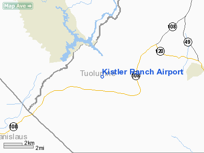
Kistler Ranch Airport
Address:
Tuolumne County, CA
Tel:
650-323-9538
Images
and information placed above are from
http://www.airport-data.com/airport/08CL/
We
thank them for the data!
| General
Info |
| Country |
United
States |
| State |
CALIFORNIA
|
| FAA ID |
08CL
|
| Latitude |
37-51-34.737N
|
| Longitude |
120-33-15.719W
|
| Elevation |
1025 feet
|
| Near City |
JAMESTOWN
|
We don't guarantee the information is fresh and accurate. The data may
be wrong or outdated.
For more up-to-date information please refer to other sources.
|
|


