 |
|
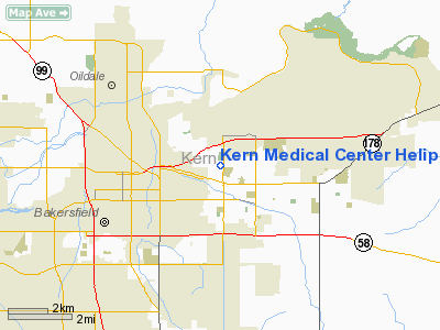
Kern Medical Center Heliport |
Location
& QuickFacts
|
FAA
Information Effective: |
2006-09-28 |
|
Airport
Identifier: |
CL61 |
|
Longitude/Latitude: |
118-58-08.3600W/35-23-02.8500N
-118.968989/35.384125 (Estimated) |
|
Elevation: |
505 ft / 153.92 m (Estimated) |
|
Land: |
0 acres |
|
From
nearest city: |
3 nautical miles NE of Bakersfield, CA |
|
Location: |
Kern County, CA |
|
Magnetic Variation: |
14E (1980) |
Owner
& Manager
|
Ownership: |
Publicly owned |
|
Owner: |
County Of Kern |
|
Address: |
1415 Truxtun Ave.
Bakersfield, CA 93301 |
|
Phone number: |
805-326-2000 |
|
Manager: |
Lester W. Holcomb, Jr. |
|
Address: |
1830 Flower Street
Bakersfield, CA 93305 |
Airport
Operations and Facilities
|
Airport
Use: |
Private
MEDICAL. |
|
Segmented
Circle: |
No |
|
Control
Tower: |
No |
|
Attendance
Schedule: |
UNATNDD |
|
Sectional
chart: |
Los Angeles |
|
Region: |
AWP - Western-Pacific |
|
Boundary
ARTCC: |
ZLA - Los Angeles |
|
Tie-in
FSS: |
RIU - Rancho Murieta |
|
FSS
Phone: |
916-354-0161 |
|
FSS
Toll Free: |
1-800-WX-BRIEF |
|
Runway Information
Helipad H1
|
Dimension: |
66 x 66 ft / 20.1 x 20.1 m |
|
Surface: |
CONC, |
|
|
Runway H1 |
Runway |
|
Traffic
Pattern: |
Left |
Left |
|
Radio Navigation
Aids
|
ID |
Type |
Name |
Ch |
Freq |
Var |
Dist |
|
COR |
NDB |
Salyer Farms |
|
205.00 |
16E |
49.5 nm |
|
TTE |
VOR/DME |
Tule |
029X |
109.20 |
16E |
31.9 nm |
|
EHF |
VORTAC |
Shafter |
101X |
115.40 |
14E |
8.7 nm |
|
GMN |
VORTAC |
Gorman |
108X |
116.10 |
16E |
35.3 nm |
|
LHS |
VORTAC |
Lake Hughes |
021X |
108.40 |
15E |
46.4 nm |
|
FLW |
VORTAC |
Fellows |
122X |
117.50 |
16E |
47.4 nm |
|
BFL |
VOT |
Bakersfield |
|
111.20 |
|
4.5 nm |
Remarks
Kern Medical Center Heliport
Address:
Kern County, CA
Tel:
805-326-2000
Images
and information placed above are from
http://www.airport-data.com/airport/CL61/
We
thank them for the data!
| General
Info |
| Country |
United
States |
| State |
CALIFORNIA
|
| FAA ID |
CL61
|
| Latitude |
35-23-02.850N
|
| Longitude |
118-58-08.360W
|
| Elevation |
505 feet
|
| Near City |
BAKERSFIELD
|
We don't guarantee the information is fresh and accurate. The data may
be wrong or outdated.
For more up-to-date information please refer to other sources.
|
|


