 |
|
|
|
Location
& QuickFacts
|
FAA
Information Effective: |
2006-09-28 |
|
Airport
Identifier: |
CN37 |
|
Longitude/Latitude: |
118-13-51.2770W/35-22-52.8520N
-118.230910/35.381348 (Estimated) |
|
Elevation: |
4071 ft / 1240.84 m (Surveyed) |
|
Land: |
0 acres |
|
From
nearest city: |
20 nautical miles NW of Mojave, CA |
|
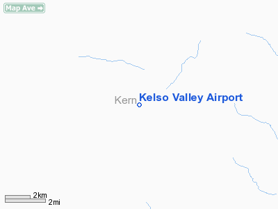
Location: |
Kern County, CA |
|
Magnetic Variation: |
14E (1985) |
Owner
& Manager
|
Ownership: |
Privately owned |
|
Owner: |
R Gossman |
|
Address: |
3661 Meadville Dr
Sherman Oaks, CA 91403 |
|
Manager: |
C. T. Below |
|
Address: |
Kelso Valley, CA 93519 |
|
Phone number: |
818-789-3871 |
Airport
Operations and Facilities
|
Airport Use: |
Private |
|
Wind indicator: |
Yes |
|
Segmented Circle: |
Yes |
|
Control Tower: |
No |
|
Attendance Schedule: |
ALL/ALL/0700-2100 |
|
Landing fee charge: |
Yes |
|
Sectional chart: |
Los Angeles |
|
Region: |
AWP - Western-Pacific |
|
Boundary ARTCC: |
ZLA - Los Angeles |
|
Tie-in FSS: |
RAL - Riverside |
|
FSS on Airport: |
No |
|
FSS Phone: |
951-351-3020 |
|
FSS Toll Free: |
1-800-WX-BRIEF |
Airport
Services
|
Fuel
available: |
100 80 |
|
Airframe
Repair: |
NONE |
|
Power
Plant Repair: |
NONE |
|
Runway Information
Runway 04/22
|
Dimension: |
2600 x 100 ft / 792.5 x 30.5 m |
|
Surface: |
DIRT, |
|
|
Runway 04 |
Runway 22 |
|
Traffic
Pattern: |
Left |
Left |
|
Runway 16/34
|
Dimension: |
3000 x 100 ft / 914.4 x 30.5 m |
|
Surface: |
DIRT, |
|
|
Runway 16 |
Runway 34 |
|
Traffic
Pattern: |
Left |
Left |
|
Radio Navigation
Aids
|
ID |
Type |
Name |
Ch |
Freq |
Var |
Dist |
|
GWF |
NDB |
Gen William J Fox |
|
282.00 |
15E |
38.6 nm |
|
NID |
TACAN |
China Lake |
053X |
|
16E |
32.2 nm |
|
EDW |
VORTAC |
Edwards |
111X |
116.40 |
15E |
34.3 nm |
|
EHF |
VORTAC |
Shafter |
101X |
115.40 |
14E |
42.9 nm |
|
LHS |
VORTAC |
Lake Hughes |
021X |
108.40 |
15E |
45.3 nm |
|
PMD |
VORTAC |
Palmdale |
092X |
114.50 |
15E |
45.8 nm |
|
GMN |
VORTAC |
Gorman |
108X |
116.10 |
16E |
46.5 nm |
|
BFL |
VOT |
Bakersfield |
|
111.20 |
|
40.1 nm |
Remarks
Kelso Valley Airport
Address:
Kern County, CA
Tel:
818-789-3871
Images
and information placed above are from
http://www.airport-data.com/airport/CN37/
We
thank them for the data!
| General
Info |
| Country |
United
States |
| State |
CALIFORNIA
|
| FAA ID |
CN37
|
| Latitude |
35-22-52.852N
|
| Longitude |
118-13-51.277W
|
| Elevation |
4071 feet
|
| Near City |
MOJAVE
|
We don't guarantee the information is fresh and accurate. The data may
be wrong or outdated.
For more up-to-date information please refer to other sources.
|
|


