 |
|
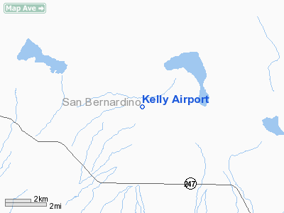
Location
& QuickFacts
|
FAA
Information Effective: |
2006-09-28 |
|
Airport
Identifier: |
51CA |
|
Longitude/Latitude: |
116-37-01.0830W/34-25-24.9980N
-116.616968/34.423611 (Estimated) |
|
Elevation: |
2806 ft / 855.27 m (Surveyed) |
|
Land: |
120 acres |
|
From
nearest city: |
17 nautical miles E of Lucerne Valley, CA |
|
Location: |
San Bernardino County, CA |
|
Magnetic Variation: |
14E (1985) |
Owner
& Manager
|
Ownership: |
Privately owned |
|
Owner: |
Glen Kelly |
|
Address: |
Po Box 831
Lucerne Valley, CA 92356 |
|
Phone
number: |
619-364-3502 |
|
Manager: |
Glen Kelly |
|
Address: |
Po Box 831
Lucerne Valley, CA 92356 |
|
Phone number: |
619-364-3502 |
Airport
Operations and Facilities
|
Airport
Use: |
Private |
|
Wind
indicator: |
Yes |
|
Segmented
Circle: |
Yes |
|
Control
Tower: |
No |
|
Attendance
Schedule: |
UNATNDD |
|
Landing
fee charge: |
No |
|
Sectional
chart: |
Los Angeles |
|
Region: |
AWP - Western-Pacific |
|
Boundary
ARTCC: |
ZLA - Los Angeles |
|
Tie-in
FSS: |
RAL - Riverside |
|
FSS
on Airport: |
No |
|
FSS
Phone: |
951-351-3020 |
|
FSS
Toll Free: |
1-800-WX-BRIEF |
|
Runway Information
Runway 12/30
|
Dimension: |
3010 x 100 ft / 917.4 x 30.5 m |
|
Surface: |
DIRT, |
|
|
Runway 12 |
Runway 30 |
|
Traffic
Pattern: |
Left |
Left |
|
Obstruction: |
|
30 ft pline, 600.0 ft from runway |
|
Radio Navigation
Aids
|
ID |
Type |
Name |
Ch |
Freq |
Var |
Dist |
|
SJY |
NDB |
San Jacinto |
|
227.00 |
14E |
42.3 nm |
|
SB |
NDB |
Petis |
|
397.00 |
14E |
43.3 nm |
|
NXP |
TACAN |
Coyote |
063X |
|
14E |
24.0 nm |
|
RIV |
TACAN |
March |
077X |
|
14E |
45.1 nm |
|
HDF |
VOR |
Homeland |
|
113.40 |
14E |
48.1 nm |
|
VCV |
VOR/DME |
Victorville |
031X |
109.40 |
14E |
39.6 nm |
|
HEC |
VORTAC |
Hector |
074X |
112.70 |
15E |
23.7 nm |
|
DAG |
VORTAC |
Daggett |
079X |
113.20 |
15E |
32.4 nm |
|
PSP |
VORTAC |
Palm Springs |
102X |
115.50 |
13E |
34.6 nm |
|
TNP |
VORTAC |
Twentynine Palms |
089X |
114.20 |
15E |
46.1 nm |
Remarks
- VFR;
PVT USE ONLY; PROVIDED TAKEOFFS ARE CONDUCTED TO THE NW AND LANDINGS
ARE MADE TO THE SE; TRAFFIC PATTERNS SHOULD BE ESTABLISHED SOUTHWESTERLY
OF THE RWY ALIGNMENT.
Based Aircraft
|
Aircraft
based on field: |
3 |
|
Single
Engine Airplanes: |
3 |
Kelly Airport
Address:
San Bernardino County, CA
Tel:
619-364-3502
Images
and information placed above are from
http://www.airport-data.com/airport/51CA/
We
thank them for the data!
| General
Info |
| Country |
United
States |
| State |
CALIFORNIA
|
| FAA ID |
51CA
|
| Latitude |
34-25-24.998N
|
| Longitude |
116-37-01.083W
|
| Elevation |
2806 feet
|
| Near City |
LUCERNE
VALLEY |
We don't guarantee the information is fresh and accurate. The data may
be wrong or outdated.
For more up-to-date information please refer to other sources.
|
|


