 |
|
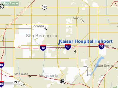
Location
& QuickFacts
|
FAA
Information Effective: |
2006-09-28 |
|
Airport
Identifier: |
94CA |
|
Longitude/Latitude: |
117-25-55.9700W/34-04-21.5420N
-117.432214/34.072651 (Estimated) |
|
Elevation: |
1214 ft / 370.03 m (Estimated) |
|
Land: |
0 acres |
|
From
nearest city: |
2 nautical miles S of Fontana, CA |
|
Location: |
San Bernardino County, CA |
|
Magnetic Variation: |
14E (1985) |
Owner
& Manager
|
Ownership: |
Privately owned |
|
Owner: |
Kaiser Foundation Hospitals |
|
Address: |
9961 Sierra Ave.
Fontana, CA 92335 |
|
Phone number: |
909-427-7300 |
|
Manager: |
Skip Skivington |
|
Address: |
9961 Sierra Ave.
Fontana, CA 92335 |
|
Phone number: |
909-427-7300 |
Airport
Operations and Facilities
|
Airport
Use: |
Private
MEDICAL. |
|
Wind
indicator: |
Yes |
|
Segmented
Circle: |
No |
|
Control
Tower: |
No |
|
Attendance
Schedule: |
ALL/ALL/ALL |
|
Landing
fee charge: |
No |
|
Sectional
chart: |
Los Angeles |
|
Region: |
AWP - Western-Pacific |
|
Boundary
ARTCC: |
ZLA - Los Angeles |
|
Tie-in
FSS: |
RAL - Riverside |
|
FSS
on Airport: |
No |
|
FSS
Phone: |
951-351-3020 |
|
FSS
Toll Free: |
1-800-WX-BRIEF |
|
Runway Information
Helipad H1
|
Dimension: |
65 x 65 ft / 19.8 x 19.8 m |
|
Surface: |
ASPH, |
|
|
Runway H1 |
Runway |
|
Traffic
Pattern: |
Left |
Left |
|
Radio Navigation
Aids
|
ID |
Type |
Name |
Ch |
Freq |
Var |
Dist |
|
SB |
NDB |
Petis |
|
397.00 |
14E |
3.4 nm |
|
SJY |
NDB |
San Jacinto |
|
227.00 |
14E |
27.3 nm |
|
EMT |
NDB |
El Monte |
|
359.00 |
15E |
29.8 nm |
|
CPM |
NDB |
Compton |
|
378.00 |
15E |
42.1 nm |
|
RIV |
TACAN |
March |
077X |
|
14E |
12.7 nm |
|
NFG |
TACAN |
Camp Pendleton |
055X |
|
13E |
48.0 nm |
|
RAL |
VOR |
Riverside |
|
112.40 |
15E |
7.3 nm |
|
HDF |
VOR |
Homeland |
|
113.40 |
14E |
21.7 nm |
|
ELB |
VOR/DME |
El Toro |
119X |
117.20 |
14E |
28.1 nm |
|
VCV |
VOR/DME |
Victorville |
031X |
109.40 |
14E |
31.4 nm |
|
PDZ |
VORTAC |
Paradise |
059X |
112.20 |
15E |
10.5 nm |
|
POM |
VORTAC |
Pomona |
041X |
110.40 |
15E |
17.7 nm |
|
SLI |
VORTAC |
Seal Beach |
104X |
115.70 |
15E |
35.6 nm |
|
PMD |
VORTAC |
Palmdale |
092X |
114.50 |
15E |
45.9 nm |
|
SNA |
VOT |
Santa Ana |
|
110.00 |
|
32.3 nm |
|
LAX |
VOT |
San Pedro Hill |
|
113.90 |
|
49.2 nm |
Remarks
- APPROACH
FROM WEST ONLY.
- CONDL:
VFR USE ONLY.
Kaiser Hospital Heliport
Address:
San Bernardino County, CA
Tel:
909-427-7300
Images
and information placed above are from
http://www.airport-data.com/airport/94CA/
We
thank them for the data!
| General
Info |
| Country |
United
States |
| State |
CALIFORNIA
|
| FAA ID |
94CA
|
| Latitude |
34-04-21.542N
|
| Longitude |
117-25-55.970W
|
| Elevation |
1214 feet
|
| Near City |
FONTANA
|
We don't guarantee the information is fresh and accurate. The data may
be wrong or outdated.
For more up-to-date information please refer to other sources.
|
|


