 |
|
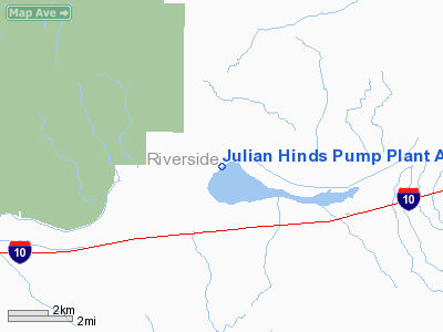
Julian Hinds Pump Plant Airstrip Airport |
Location
& QuickFacts
|
FAA
Information Effective: |
2006-09-28 |
|
Airport
Identifier: |
73CL |
|
Longitude/Latitude: |
115-38-12.9580W/33-41-56.0670N
-115.636933/33.698907 (Estimated) |
|
Elevation: |
1335 ft / 406.91 m (Surveyed) |
|
Land: |
0 acres |
|
From
nearest city: |
12 nautical miles W of Desert Center, CA |
|
Location: |
Riverside County, CA |
|
Magnetic Variation: |
13E (1985) |
Owner
& Manager
|
Ownership: |
Privately owned |
|
Owner: |
The Metro Water Dist Of S Ca |
|
Address: |
1111 Sunset Blvd
Los Angeles, CA 90012 |
|
Manager: |
D.l. Mc Bride |
|
Address: |
Parker Dam, CA 92267 |
|
Phone number: |
619-663-4911 |
Airport
Operations and Facilities
|
Airport
Use: |
Private |
|
Wind
indicator: |
Yes |
|
Segmented
Circle: |
No |
|
Control
Tower: |
No |
|
Attendance
Schedule: |
UNATNDD |
|
Landing
fee charge: |
No |
|
Sectional
chart: |
Los Angeles |
|
Region: |
AWP - Western-Pacific |
|
Boundary
ARTCC: |
ZLA - Los Angeles |
|
Tie-in
FSS: |
RAL - Riverside |
|
FSS
on Airport: |
No |
|
FSS
Phone: |
951-351-3020 |
|
FSS
Toll Free: |
1-800-WX-BRIEF |
|
Runway Information
Runway 04/22
|
Dimension: |
2000 x 30 ft / 609.6 x 9.1 m |
|
Surface: |
ASPH, |
|
|
Runway 04 |
Runway 22 |
|
Traffic
Pattern: |
Left |
Left |
|
Radio Navigation
Aids
|
ID |
Type |
Name |
Ch |
Freq |
Var |
Dist |
|
NXP |
TACAN |
Coyote |
063X |
|
14E |
44.3 nm |
|
TNP |
VORTAC |
Twentynine Palms |
089X |
114.20 |
15E |
25.7 nm |
|
TRM |
VORTAC |
Thermal |
109X |
116.20 |
13E |
26.5 nm |
|
PSP |
VORTAC |
Palm Springs |
102X |
115.50 |
13E |
40.9 nm |
|
BLH |
VORTAC |
Blythe |
121X |
117.40 |
14E |
44.3 nm
|
Remarks
- PVT
USE DURING VFR CONDITIONS ONLY.
Julian Hinds Pump Plant Airstrip Airport
Address:
Riverside County, CA
Tel:
619-663-4911
Images
and information placed above are from
http://www.airport-data.com/airport/73CL/
We
thank them for the data!
| General
Info |
| Country |
United
States |
| State |
CALIFORNIA
|
| FAA ID |
73CL
|
| Latitude |
33-41-56.067N
|
| Longitude |
115-38-12.958W
|
| Elevation |
1335 feet
|
| Near City |
DESERT
CENTER |
We don't guarantee the information is fresh and accurate. The data may
be wrong or outdated.
For more up-to-date information please refer to other sources.
|
|


