 |
|
|
|
Location
& QuickFacts
|
FAA
Information Effective: |
2006-09-28 |
|
Airport
Identifier: |
CL23 |
|
Longitude/Latitude: |
121-41-45.9050W/39-27-34.5920N
-121.696085/39.459609 (Estimated) |
|
Elevation: |
109 ft / 33.22 m (Surveyed) |
|
Land: |
40 acres |
|
From
nearest city: |
3 nautical miles NE of Biggs, CA |
|
Location: |
Butte County, CA |
|
Magnetic Variation: |
17E (1985) |
Owner
& Manager
|
Ownership: |
Privately owned |
|
Owner: |
Chuck Jones Flying Service |
|
Address: |
Po Box 497
Biggs, CA 95917 |
|
Phone number: |
916-868-5798
OR 916-868-5798 |
|
Manager: |
Dale A Jones |
|
Address: |
Po Box 497
Biggs, CA 95917 |
|
Phone number: |
916-868-5798 |
Airport
Operations and Facilities
|
Airport
Use: |
Private |
|
Wind
indicator: |
Yes |
|
Segmented
Circle: |
No |
|
Control
Tower: |
No |
|
Attendance
Schedule: |
ALL/ALL/ALL |
|
Lighting
Schedule: |
PHONE REQ
FOR LIRL RWY 15/33 CALL 916-868-5798 |
|
Landing
fee charge: |
No |
|
Sectional
chart: |
San Francisco |
|
Region: |
AWP - Western-Pacific |
|
Boundary
ARTCC: |
ZOA - Oakland |
|
Tie-in
FSS: |
RIU - Rancho Murieta |
|
FSS
Phone: |
916-354-0161 |
|
FSS
Toll Free: |
1-800-WX-BRIEF |
|
Runway Information
Runway 15/33
|
Dimension: |
2600 x 30 ft / 792.5 x 9.1 m |
|
Surface: |
ASPH, |
|
Edge
Lights: |
Low |
|
|
Runway 15 |
Runway 33 |
|
Traffic
Pattern: |
Left |
Left |
|
Obstruction: |
|
40 ft plines, 10.0 ft from runway |
|
Radio Navigation
Aids
|
ID |
Type |
Name |
Ch |
Freq |
Var |
Dist |
|
OVE |
NDB |
Oroville |
|
212.00 |
16E |
4.0 nm |
|
MY |
NDB |
Halow |
|
222.00 |
16E |
17.9 nm |
|
PBT |
NDB |
Proberta |
|
338.00 |
16E |
46.6 nm |
|
BAB |
TACAN |
Beale |
023X |
|
16E |
22.9 nm |
|
CIC |
VOR/DME |
Chico |
035X |
109.80 |
16E |
21.0 nm |
|
MYV |
VOR/DME |
Marysville |
045X |
110.80 |
16E |
22.4 nm |
|
MCC |
VOR/DME |
Mc Clellan |
029X |
109.20 |
17E |
49.5 nm |
|
MXW |
VORTAC |
Maxwell |
037X |
110.00 |
18E |
25.9 nm |
|
ILA |
VORTAC |
Williams |
091X |
114.40 |
18E |
28.0 nm |
|
RBL |
VORTAC |
Red Bluff |
104X |
115.70 |
18E |
45.8 nm |
|
SMF |
VOT |
Sacramento Metropolitan |
|
111.40 |
|
46.5 nm |
Remarks
Based Aircraft
|
Aircraft
based on field: |
16 |
|
Single
Engine Airplanes: |
14 |
|
Multi
Engine Airplanes: |
1 |
|
Helicopters: |
1 |
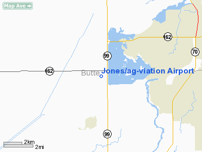
Jones/ag-viation Airport
Address:
Butte County, CA
Tel:
916-868-5798
Images
and information placed above are from
http://www.airport-data.com/airport/CL23/
We
thank them for the data!
| General
Info |
| Country |
United
States |
| State |
CALIFORNIA
|
| FAA ID |
CL23
|
| Latitude |
39-27-34.592N
|
| Longitude |
121-41-45.905W
|
| Elevation |
109 feet
|
| Near City |
BIGGS
|
We don't guarantee the information is fresh and accurate. The data may
be wrong or outdated.
For more up-to-date information please refer to other sources.
|
|


