 |
|
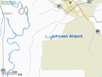
Location
& QuickFacts
|
FAA
Information Effective: |
2006-09-28 |
|
Airport
Identifier: |
4CA7 |
|
Longitude/Latitude: |
121-53-08.9200W/39-40-14.5800N
-121.885811/39.670717 (Estimated) |
|
Elevation: |
190 ft / 57.91 m (Estimated) |
|
Land: |
4 acres |
|
From
nearest city: |
5 nautical miles S of Chico, CA |
|
Location: |
Butte County, CA |
|
Magnetic Variation: |
16E (1990) |
Owner
& Manager
|
Ownership: |
Privately owned |
|
Owner: |
Cliff Johnsen |
|
Address: |
4139 Willow Landing
Chico, CA 95928 |
|
Phone number: |
530-342-1665 |
|
Manager: |
Cliff Johnsen |
|
Address: |
4139 Willow Landing
Chico, CA 95928 |
|
Phone number: |
530-342-1665 |
Airport
Operations and Facilities
|
Airport
Use: |
Private
AGRICULTURAL USE. |
|
Segmented
Circle: |
No |
|
Control
Tower: |
No |
|
Attendance
Schedule: |
UNATNDD |
|
Sectional
chart: |
San Francisco |
|
Region: |
AWP - Western-Pacific |
|
Boundary
ARTCC: |
ZOA - Oakland |
|
Tie-in
FSS: |
RIU - Rancho Murieta |
|
FSS
on Airport: |
No |
|
FSS
Phone: |
916-354-0161 |
|
FSS
Toll Free: |
1-800-WX-BRIEF |
|
Runway Information
Runway 16/34
|
Dimension: |
2700 x 60 ft / 823.0 x 18.3 m |
|
Surface: |
TURF, |
|
|
Runway 16 |
Runway 34 |
|
Traffic
Pattern: |
Left |
Left |
|
Radio Navigation
Aids
|
ID |
Type |
Name |
Ch |
Freq |
Var |
Dist |
|
OVE |
NDB |
Oroville |
|
212.00 |
16E |
16.2 nm |
|
PBT |
NDB |
Proberta |
|
338.00 |
16E |
31.2 nm |
|
MY |
NDB |
Halow |
|
222.00 |
16E |
32.7 nm |
|
BAB |
TACAN |
Beale |
023X |
|
16E |
38.3 nm |
|
CIC |
VOR/DME |
Chico |
035X |
109.80 |
16E |
7.4 nm |
|
MYV |
VOR/DME |
Marysville |
045X |
110.80 |
16E |
37.3 nm |
|
MXW |
VORTAC |
Maxwell |
037X |
110.00 |
18E |
26.3 nm |
|
RBL |
VORTAC |
Red Bluff |
104X |
115.70 |
18E |
30.4 nm |
|
ILA |
VORTAC |
Williams |
091X |
114.40 |
18E |
36.6 nm |
Remarks
Johnsen Airport
Address:
Butte County, CA
Tel:
530-342-1665
Images
and information placed above are from
http://www.airport-data.com/airport/4CA7/
We
thank them for the data!
| General
Info |
| Country |
United
States |
| State |
CALIFORNIA
|
| FAA ID |
4CA7
|
| Latitude |
39-40-14.580N
|
| Longitude |
121-53-08.920W
|
| Elevation |
190 feet
|
| Near City |
CHICO
|
We don't guarantee the information is fresh and accurate. The data may
be wrong or outdated.
For more up-to-date information please refer to other sources.
|
|


