 |
|
|
|
|
|
Location
& QuickFacts
|
FAA
Information Effective: |
2006-09-28 |
|
Airport
Identifier: |
L78 |
|
Longitude/Latitude: |
116-09-53.9400W/32-36-57.5000N
-116.164983/32.615972 (Estimated) |
|
Elevation: |
2844 ft / 866.85 m (Estimated) |
|
Land: |
135 acres |
|
From
nearest city: |
1 nautical miles E of Jacumba, CA |
|
Location: |
San Diego County, CA |
|
Magnetic Variation: |
13E (1985) |
Owner
& Manager
|
Ownership: |
Publicly owned |
|
Owner: |
County Of San Diego |
|
Address: |
1960 Joe Crosson Drive
El Cajon, CA 92020-1236 |
|
Phone
number: |
619-956-4800 |
|
Manager: |
Roger Griffiths |
|
Address: |
1960 Joe Crosson Drive
El Cajon, CA 92020-1236 |
|
Phone number: |
619-956-4805 |
Airport
Operations and Facilities
|
Airport
Use: |
Open to public |
|
Wind
indicator: |
Yes |
|
Segmented
Circle: |
Yes |
|
Control
Tower: |
No |
|
Attendance
Schedule: |
UNATNDD |
|
Landing
fee charge: |
No |
|
Sectional
chart: |
Los Angeles |
|
Region: |
AWP - Western-Pacific |
|
Traffic
Pattern Alt: |
800 ft |
|
Boundary
ARTCC: |
ZLA - Los Angeles |
|
Tie-in
FSS: |
SAN - San Diego |
|
FSS
on Airport: |
No |
|
FSS
Phone: |
858-277-7043 |
|
FSS
Toll Free: |
1-800-WX-BRIEF |
|
NOTAMs
Facility: |
SAN (NOTAM-d service avaliable) |
|
Federal Agreements: |
P |
Airport
Communications
Airport
Services
|
Airframe
Repair: |
NONE |
|
Power
Plant Repair: |
NONE |
|
Bottled
Oxygen: |
NONE |
|
Bulk
Oxygen: |
NONE |
|
Runway Information
Runway 07/25
|
Dimension: |
2508 x 100 ft / 764.4 x 30.5 m |
|
Surface: |
GRVL, Good Condition |
|
Weight
Limit: |
Single wheel: 12000 lbs. |
|
|
Runway 07 |
Runway 25 |
|
Traffic
Pattern: |
Left |
Right |
|
Runway
End Identifier: |
No |
No |
|
Centerline
Lights: |
No |
No |
|
Touchdown
Lights: |
No |
No |
|
Obstruction: |
, 50:1 slope to clear |
480 ft mtn, 5000.0 ft from runway, 10:1 slope
to clear |
|
Radio Navigation
Aids
|
ID |
Type |
Name |
Ch |
Freq |
Var |
Dist |
|
SAN |
FAN MARKER |
Encat |
|
|
15E |
47.2 nm |
|
UN |
NDB |
Tijuana |
|
381.00 |
14E |
44.3 nm |
|
NJK |
TACAN |
El Centro |
047X |
|
13E |
27.7 nm |
|
NRS |
TACAN |
Imperial Beach |
029X |
|
14E |
47.9 nm |
|
TIJ |
VOR/DME |
Tijuana |
112X |
116.50 |
14E |
40.2 nm |
|
MXL |
VOR/DME |
Mexicali |
097X |
115.00 |
14E |
47.7 nm |
|
IPL |
VORTAC |
Imperial |
106X |
115.90 |
14E |
34.2 nm |
|
JLI |
VORTAC |
Julian |
087X |
114.00 |
15E |
38.0 nm |
|
PGY |
VORTAC |
Poggi |
035X |
109.80 |
14E |
41.2 nm |
|
SEE |
VOT |
Gillespie Field |
|
110.00 |
|
42.8 nm |
Remarks
- GLIDER
ACTIVITY ON WEEKENDS.
- WIND
PERMITTING, RECOMMEND LAND RY 07 AND DEPART RY 25 DUE TO 480 FT HILL
1 MILE EAST OF AIRPORT.
Operational Statistics
|
Aircraft
Operations: |
29/Week |
|
General
Aviation Itinerant: |
100.0% |
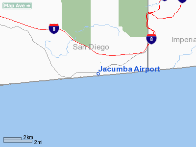
Jacumba Airport
Address:
San Diego County, CA
Tel:
619-956-4800,
619-956-4805
Images
and information placed above are from
http://www.airport-data.com/airport/L78/
We
thank them for the data!
| General
Info |
| Country |
United
States |
| State |
CALIFORNIA
|
| FAA ID |
L78
|
| Latitude |
32-36-57.500N
|
| Longitude |
116-09-53.940W
|
| Elevation |
2844 feet
|
| Near City |
JACUMBA
|
We don't guarantee the information is fresh and accurate. The data may
be wrong or outdated.
For more up-to-date information please refer to other sources.
|
|


