 |
|
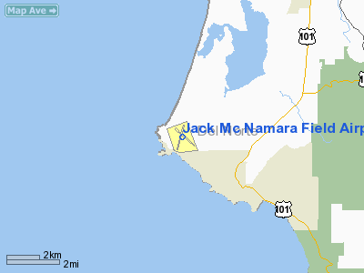
Jack Mc Namara Field Airport |
Del Norte County Airport
Jack McNamara Field |
| IATA: CEC – ICAO: KCEC – FAA LID: CEC |
| Summary |
| Airport type |
Public |
| Owner |
Del Norte County |
| Location |
Crescent City, California |
| Elevation AMSL |
57 ft / 17 m |
| Coordinates |
41°46′49″N 124°14′12″W / 41.78028°N 124.23667°W / 41.78028; -124.23667 |
| Runways |
| Direction |
Length |
Surface |
| ft |
m |
| 11/29 |
5,002 |
1,525 |
Asphalt |
| 17/35 |
5,002 |
1,525 |
Asphalt |
| Statistics (2006) |
| Aircraft operations |
9,820 |
| Based aircraft |
26 |
| Source: Federal Aviation Administration |
Del Norte County Airport (IATA: CEC, ICAO: KCEC, FAA LID: CEC), also known as Jack McNamara Field, is a county-owned public-use airport located three miles (5 km) northwest of the central business district of Crescent City, in Del Norte County, California, United States. It is used primarily for general aviation, but has commercial airline that subsidized by the Essential Air Service program. Facilities and aircraft
Jack McNamara Field covers an area of 500 acres (202 ha) which contains two asphalt paved runways (11/29 and 17/35) each measuring 5,002 x 150 ft. (1,525 x 46 m).
For the 12-month period ending December 31, 2006, the airport had 9,820 aircraft operations, an average of 26 per day: 79% general aviation, 11% scheduled commercial, 9% air taxi and 1% military. There are 26 aircraft based at this airport: 77% single engine and 23% multi-engine.
Airline and destinations
| Airlines |
Destinations |
| United Express operated by SkyWest Airlines |
Arcata/Eureka, San Francisco |
The above content comes from Wikipedia and is published under free licenses – click here to read more.
Location
& QuickFacts
|
FAA
Information Effective: |
2006-09-28 |
|
Airport
Identifier: |
CEC |
|
Longitude/Latitude: |
124-14-11.5200W/41-46-48.5660N
-124.236533/41.780157 (Estimated) |
|
Elevation: |
57 ft / 17.37 m (Surveyed) |
|
Land: |
500 acres |
|
From
nearest city: |
3 nautical miles NW of Crescent City, CA |
|
Location: |
Del Norte County, CA |
|
Magnetic Variation: |
19E (1975) |
Owner
& Manager
|
Ownership: |
Publicly owned |
|
Owner: |
Del Norte County |
|
Address: |
981 H Street, #110
Crescent City, CA 95531 |
|
Phone
number: |
707-464-7229 |
|
Manager: |
Jim Bernard |
|
Address: |
981 H Street, #110
Crescent City, CA 95531 |
|
Phone number: |
707-464-7229 |
Airport
Operations and Facilities
|
Airport
Use: |
Open to public |
|
Wind
indicator: |
Yes |
|
Segmented
Circle: |
Yes |
|
Control
Tower: |
No |
|
Attendance
Schedule: |
ALL/ALL/0800-1800
OTR HRS FBO REQUIRES CALL OUT FEE. |
|
Lighting
Schedule: |
RDO-CTL
ACTVT HIRL 11/29; MIRL RY 17/35; MALSR RY 11 & REIL
RYS 17; 35 & 29 - CTAF. |
|
Beacon
Color: |
Clear-Green (lighted land airport) |
|
Landing
fee charge: |
No |
|
Sectional
chart: |
Klamath Falls |
|
Region: |
AWP - Western-Pacific |
|
Traffic
Pattern Alt: |
1000 ft |
|
Boundary
ARTCC: |
ZSE - Seattle |
|
Tie-in
FSS: |
OAK - Oakland |
|
FSS
on Airport: |
No |
|
FSS
Phone: |
510-273-6111 |
|
FSS
Toll Free: |
1-800-WX-BRIEF |
|
NOTAMs
Facility: |
CEC (NOTAM-d service avaliable) |
|
Certification
type/date: |
I LU 5/1985
PPR FOR UNSKED ACR OPNS WITH MORE THAN 30 PSGR SEATS CALL
AMGR 707-464-7229. |
|
Federal Agreements: |
NGRY |
Airport
Communications
|
CTAF: |
122.800 |
|
Unicom: |
122.800 |
Airport
Services
|
Fuel
available: |
100LLA |
|
Airframe
Repair: |
MINOR |
|
Power
Plant Repair: |
MINOR |
|
Bottled
Oxygen: |
NONE |
|
Bulk
Oxygen: |
NONE |
|
Runway Information
Runway 11/29
|
Dimension: |
5002 x 150 ft / 1524.6 x 45.7 m |
|
Surface: |
ASPH, Good Condition |
|
Surface
Treatment: |
Porous Friction Course |
|
Weight
Limit: |
Single wheel: 30000 lbs.
Dual wheel: 43000 lbs. |
|
Edge
Lights: |
High |
|
|
Runway 11 |
Runway 29 |
|
Longitude: |
124-14-29.5680W |
124-13-41.4190W |
|
Latitude: |
41-47-05.9360N |
41-46-32.1180N |
|
Elevation: |
53.00 ft |
50.00 ft |
|
Alignment: |
127 |
127 |
|
ILS
Type: |
ILS
|
|
|
Traffic
Pattern: |
Left |
Left |
|
Markings: |
Precision instrument, Good Condition |
Precision instrument, Good Condition |
|
Crossing
Height: |
0.00
ft |
52.00 ft |
|
VASI: |
|
4-box on left side |
|
Visual
Glide Angle: |
0.00� |
3.50� |
|
Approach
lights: |
MALSR |
|
|
Runway
End Identifier: |
No |
Yes |
|
Centerline
Lights: |
No |
No |
|
Touchdown
Lights: |
No |
No |
|
Obstruction: |
, 50:1 slope to clear |
86 ft trees, 1520.0 ft from runway, 250 ft
right of centerline, 15:1 slope to clear |
|
Runway 17/35
|
Dimension: |
5002 x 150 ft / 1524.6 x 45.7 m |
|
Surface: |
ASPH, Good Condition |
|
Surface
Treatment: |
Porous Friction Course |
|
Weight
Limit: |
Single wheel: 30000 lbs.
Dual wheel: 43000 lbs. |
|
Edge
Lights: |
Medium |
|
|
Runway 17 |
Runway 35 |
|
Longitude: |
124-14-10.0160W |
124-14-25.0780W |
|
Latitude: |
41-47-12.1620N |
41-46-24.0480N |
|
Elevation: |
57.00 ft |
47.00 ft |
|
Alignment: |
127 |
13 |
|
Traffic
Pattern: |
Left |
Left |
|
Markings: |
Non-precision instrument, Poor Condition |
Non-precision instrument, Poor Condition |
|
Crossing
Height: |
0.00
ft |
48.00 ft |
|
VASI: |
|
4-box on left side |
|
Visual
Glide Angle: |
0.00� |
3.00� |
|
Runway
End Identifier: |
Yes |
Yes |
|
Centerline
Lights: |
No |
No |
|
Touchdown
Lights: |
No |
No |
|
Obstruction: |
55 ft gnd, 1075.0 ft from runway, 250 ft right
of centerline, 15:1 slope to clear |
9 ft road, 350.0 ft from runway, 16:1 slope
to clear |
|
Radio Navigation
Aids
|
ID |
Type |
Name |
Ch |
Freq |
Var |
Dist |
|
ACV |
VOR/DME |
Arcata |
039X |
110.20 |
17E |
48.4 nm |
|
CEC |
VORTAC |
Crescent City |
027X |
109.00 |
19E |
0.2 nm |
Remarks
- A
150' LGTD TWR 3300' WEST CEC VOR.
- BIRDS
AND DEER ON & INVOF ARPT.
- OCCASSIONAL
STANDING WATER ON RWY 17/35 AND RWY 29 RUNUP AREA.
- RIDGE
LINES OF SHIFTING SAND DUNES 30-50 FT AGL AND 1,000 FT OFF APCH END
RY 17.
- TRANSIENT
PARKING RAMP ESTIMATED WGT LIMIT 20,000 LBS, FBO RAMP ESTIMATED WGT
LIMIT 60,000 LBS.
- PRIOR
TO 15 MAY 59
Based Aircraft
|
Aircraft
based on field: |
24 |
|
Single
Engine Airplanes: |
19 |
|
Multi
Engine Airplanes: |
5 |
Major Carriers
Serving This Airport
Most Popular Destinations
| Arcata (ACV) |
62.4% |
| San Francisco Intl (SFO) |
36.8% |
| Sacramento Intl (SMF) |
0.8% |
Most Popular Aircraft
|
N292SW |
13.6% |
| N218SW |
11.2% |
|
N290SW |
8.8% |
| N270YV |
8.0% |
|
N284YV |
7.2% |
| N581SW |
7.2% |
|
N229SW |
6.4% |
| N251YV |
4.8% |
|
N227SW |
4.0% |
| N288SW |
3.2% |
Operational Statistics
|
Aircraft
Operations: |
191/Week |
|
Air Taxi: |
22.8% |
|
General
Aviation Local: |
60.5% |
|
General
Aviation Itinerant: |
15.1% |
|
Military: |
1.6% |
Jack Mc Namara Field Airport
Address:
Del Norte County, CA
Tel:
707-464-7229
Images
and information placed above are from
http://www.airport-data.com/airport/CEC/
We
thank them for the data!
| General
Info |
| Country |
United
States |
| State |
CALIFORNIA
|
| FAA ID |
CEC
|
| Latitude |
41-46-48.566N
|
| Longitude |
124-14-11.520W
|
| Elevation |
57 feet
|
| Near City |
CRESCENT
CITY |
We don't guarantee the information is fresh and accurate. The data may
be wrong or outdated.
For more up-to-date information please refer to other sources.
|
|


