 |
|
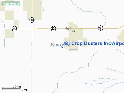
J&j Crop Dusters Inc Airport |
Location
& QuickFacts
|
FAA
Information Effective: |
2006-09-28 |
|
Airport
Identifier: |
6CA7 |
|
Longitude/Latitude: |
118-51-18.3550W/35-10-47.8670N
-118.855099/35.179963 (Estimated) |
|
Elevation: |
388 ft / 118.26 m (Estimated) |
|
Land: |
0 acres |
|
From
nearest city: |
2 nautical miles SW of Arvin, CA |
|
Location: |
Kern County, CA |
|
Magnetic Variation: |
14E (1985) |
Owner
& Manager
|
Ownership: |
Privately owned |
|
Owner: |
Jack Ferdinard |
|
Address: |
1749 Camino Primavera
Bakersfield, CA 93306 |
|
Phone number: |
805-854-2888 |
|
Manager: |
Jack F Ferdinand |
|
Address: |
1749 Camino Primavera
Bakersfield, CA 93306 |
|
Phone number: |
805-871-4624 |
Airport
Operations and Facilities
|
Airport
Use: |
Private |
|
Wind
indicator: |
Yes |
|
Segmented
Circle: |
No |
|
Control
Tower: |
No |
|
Attendance
Schedule: |
ALL/ALL/DAWN-DUSK |
|
Landing
fee charge: |
No |
|
Sectional
chart: |
Los Angeles |
|
Region: |
AWP - Western-Pacific |
|
Boundary
ARTCC: |
ZLA - Los Angeles |
|
Tie-in
FSS: |
RIU - Rancho Murieta |
|
FSS
on Airport: |
No |
|
FSS
Phone: |
916-354-0161 |
|
FSS
Toll Free: |
1-800-WX-BRIEF |
|
Runway Information
Runway 07/25
|
Dimension: |
2500 x 40 ft / 762.0 x 12.2 m |
|
Surface: |
ASPH, |
|
|
Runway 07 |
Runway 25 |
|
Traffic
Pattern: |
Left |
Left |
|
Radio Navigation
Aids
|
ID |
Type |
Name |
Ch |
Freq |
Var |
Dist |
|
GWF |
NDB |
Gen William J Fox |
|
282.00 |
15E |
41.1 nm |
|
TTE |
VOR/DME |
Tule |
029X |
109.20 |
16E |
44.8 nm |
|
EHF |
VORTAC |
Shafter |
101X |
115.40 |
14E |
21.8 nm |
|
GMN |
VORTAC |
Gorman |
108X |
116.10 |
16E |
22.6 nm |
|
LHS |
VORTAC |
Lake Hughes |
021X |
108.40 |
15E |
32.9 nm |
|
FIM |
VORTAC |
Fillmore |
072X |
112.50 |
15E |
49.5 nm |
|
FLW |
VORTAC |
Fellows |
122X |
117.50 |
16E |
49.9 nm |
|
BFL |
VOT |
Bakersfield |
|
111.20 |
|
17.5 nm |
Remarks
Based Aircraft
|
Aircraft
based on field: |
3 |
|
Single
Engine Airplanes: |
3 |
J&j Crop Dusters Inc Airport
Address:
Kern County, CA
Tel:
805-854-2888, 805-871-4624
Images
and information placed above are from
http://www.airport-data.com/airport/6CA7/
We
thank them for the data!
| General
Info |
| Country |
United
States |
| State |
CALIFORNIA
|
| FAA ID |
6CA7
|
| Latitude |
35-10-47.867N
|
| Longitude |
118-51-18.355W
|
| Elevation |
388 feet
|
| Near City |
ARVIN
|
We don't guarantee the information is fresh and accurate. The data may
be wrong or outdated.
For more up-to-date information please refer to other sources.
|
|


