 |
|
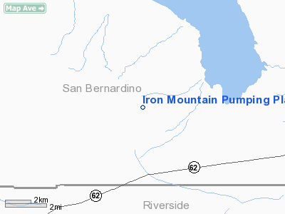
Iron Mountain Pumping Plant Airport |
|
|
Location
& QuickFacts
|
FAA
Information Effective: |
2006-09-28 |
|
Airport
Identifier: |
72CL |
|
Longitude/Latitude: |
115-07-08.9180W/34-08-03.0410N
-115.119144/34.134178 (Estimated) |
|
Elevation: |
890 ft / 271.27 m (Estimated) |
|
Land: |
0 acres |
|
From
nearest city: |
26 nautical miles NE of Desert Center, CA |
|
Location: |
San Bernardino County, CA |
|
Magnetic Variation: |
13E (1985) |
Owner
& Manager
|
Ownership: |
Privately owned |
|
Owner: |
Metro Water Dist Southern Ca |
|
Address: |
1111 Sunset Blvd
Los Angeles, CA 90012 |
|
Manager: |
D.l. Smith |
|
Address: |
Box 256
Earp, CA 92242 |
|
Phone number: |
619-392-4548 |
Airport
Operations and Facilities
|
Airport Use: |
Private |
|
Wind indicator: |
Yes |
|
Segmented Circle: |
No |
|
Control Tower: |
No |
|
Attendance Schedule: |
UNATNDD |
|
Landing fee charge: |
No |
|
Sectional chart: |
Los Angeles |
|
Region: |
AWP - Western-Pacific |
|
Boundary ARTCC: |
ZLA - Los Angeles |
|
Tie-in FSS: |
RAL - Riverside |
|
FSS Phone: |
951-351-3020 |
|
FSS Toll Free: |
1-800-WX-BRIEF |
Airport
Services
|
Airframe
Repair: |
NONE |
|
Power
Plant Repair: |
NONE |
|
Bottled
Oxygen: |
NONE |
|
Bulk
Oxygen: |
NONE |
|
Runway Information
Runway 17/35
|
Dimension: |
3200 x 30 ft / 975.4 x 9.1 m |
|
Surface: |
ASPH, |
|
Edge
Lights: |
Low |
|
|
Runway 17 |
Runway 35 |
|
Traffic
Pattern: |
Left |
Left |
|
Runway
End Identifier: |
No |
No |
|
Centerline
Lights: |
No |
No |
|
Touchdown
Lights: |
No |
No |
|
Radio Navigation
Aids
|
ID |
Type |
Name |
Ch |
Freq |
Var |
Dist |
|
PKE |
VORTAC |
Parker |
126X |
117.90 |
15E |
21.8 nm |
|
TNP |
VORTAC |
Twentynine Palms |
089X |
114.20 |
15E |
32.4 nm |
|
BLH |
VORTAC |
Blythe |
121X |
117.40 |
14E |
37.0 nm |
|
EED |
VORTAC |
Needles |
099X |
115.20 |
15E |
49.6 nm |
Remarks
- PVT
USE ONLY DURING VFR CONDITIONS.
Iron Mountain Pumping Plant Airport
Address:
San Bernardino County, CA
Tel:
619-392-4548
Images
and information placed above are from
http://www.airport-data.com/airport/72CL/
We
thank them for the data!
| General
Info |
| Country |
United
States |
| State |
CALIFORNIA
|
| FAA ID |
72CL
|
| Latitude |
34-08-03.041N
|
| Longitude |
115-07-08.918W
|
| Elevation |
890 feet
|
| Near City |
DESERT
CENTER |
We don't guarantee the information is fresh and accurate. The data may
be wrong or outdated.
For more up-to-date information please refer to other sources.
|
|


