 |
|
Location
& QuickFacts
|
FAA
Information Effective: |
2006-09-28 |
|
Airport
Identifier: |
CA12 |
|
Longitude/Latitude: |
117-26-11.1760W/34-32-52.9750N
-117.436438/34.548049 (Estimated) |
|
Elevation: |
2980 ft / 908.30 m (Estimated) |
|
Land: |
0 acres |
|
From
nearest city: |
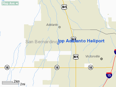
2 nautical miles SW of Adelanto, CA |
|
Location: |
San Bernardino County, CA |
|
Magnetic Variation: |
14E (1985) |
Owner
& Manager
|
Ownership: |
Privately owned |
|
Owner: |
Intermountain Power Agency |
|
Address: |
5250 S 200 W Suite 101
Murray, UT 84107 |
|
Phone
number: |
801-262-8807 |
|
Manager: |
L.a. Dept Of Water & Power
ADELANTO C.S. |
|
Address: |
P.o. Box 111; Room 1259
Los Angeles, CA 90051 |
|
Phone number: |
213-481-6325 |
Airport
Operations and Facilities
|
Airport
Use: |
Private |
|
Wind
indicator: |
Yes |
|
Segmented
Circle: |
No |
|
Control
Tower: |
No |
|
Attendance
Schedule: |
ALL/ALL/ALL |
|
Sectional
chart: |
Los Angeles |
|
Region: |
AWP - Western-Pacific |
|
Boundary
ARTCC: |
ZLA - Los Angeles |
|
Tie-in
FSS: |
RAL - Riverside |
|
FSS
Phone: |
951-351-3020 |
|
FSS
Toll Free: |
1-800-WX-BRIEF |
|
Runway Information
Helipad H1
|
Dimension: |
70 x 70 ft / 21.3 x 21.3 m |
|
Surface: |
CONC, |
|
|
Runway H1 |
Runway |
|
Traffic
Pattern: |
Left |
Left |
|
Radio Navigation
Aids
|
ID |
Type |
Name |
Ch |
Freq |
Var |
Dist |
|
SB |
NDB |
Petis |
|
397.00 |
14E |
29.8 nm |
|
GWF |
NDB |
Gen William J Fox |
|
282.00 |
15E |
40.3 nm |
|
EMT |
NDB |
El Monte |
|
359.00 |
15E |
40.4 nm |
|
RIV |
TACAN |
March |
077X |
|
14E |
39.4 nm |
|
RAL |
VOR |
Riverside |
|
112.40 |
15E |
35.8 nm |
|
HDF |
VOR |
Homeland |
|
113.40 |
14E |
48.0 nm |
|
VCV |
VOR/DME |
Victorville |
031X |
109.40 |
14E |
3.6 nm |
|
EDW |
VORTAC |
Edwards |
111X |
116.40 |
15E |
29.9 nm |
|
PMD |
VORTAC |
Palmdale |
092X |
114.50 |
15E |
31.4 nm |
|
POM |
VORTAC |
Pomona |
041X |
110.40 |
15E |
33.2 nm |
|
PDZ |
VORTAC |
Paradise |
059X |
112.20 |
15E |
38.1 nm |
|
DAG |
VORTAC |
Daggett |
079X |
113.20 |
15E |
49.2 nm |
Remarks
- PROVIDED
PILOTS CTC GEROGE AFB ATCT PRIOR TO ENTERING THE AIRPORT TRAFFIC AREA;
PRIVATE USE ONLY; VFR CONDITIONS ONLY; INSTALL LITHTING IF PAD IS USED
BETWEEN SS AND SR.
Ipp Adelanto Heliport
Address:
San Bernardino County, CA
Tel:
801-262-8807,
213-481-6325
Images
and information placed above are from
http://www.airport-data.com/airport/CA12/
We
thank them for the data!
| General
Info |
| Country |
United
States |
| State |
CALIFORNIA
|
| FAA ID |
CA12
|
| Latitude |
34-32-52.975N
|
| Longitude |
117-26-11.176W
|
| Elevation |
2980 feet
|
| Near City |
ADELANTO
|
We don't guarantee the information is fresh and accurate. The data may
be wrong or outdated.
For more up-to-date information please refer to other sources.
|
|


