 |
|
Coordinates: 35°39′32″N 117°49′46″W / 35.65889°N 117.82944°W / 35.65889; -117.82944
| Inyokern Airport |
 |
| IATA: IYK – ICAO: KIYK – FAA LID: IYK |
| Summary |
| Airport type |
Public |
| Owner |
Indian Wells Valley
Airport District |
| Serves |
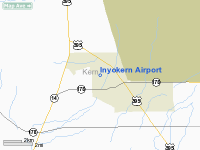
Ridgecrest, California |
| Elevation AMSL |
2,455 ft / 748 m |
| Website |
www.InyokernAirport.com |
| Runways |
| Direction |
Length |
Surface |
| ft |
m |
| 2/20 |
6,275 |
1,913 |
Asphalt |
| 10/28 |
4,150 |
1,265 |
Asphalt |
| 15/33 |
7,100 |
2,164 |
Asphalt |
| Statistics (2007) |
| Aircraft operations |
39,632 |
| Based aircraft |
120 |
| Sources: airport web site and FAA |
Inyokern Airport (IATA: IYK, ICAO: KIYK, FAA LID: IYK) is a public airport located in Inyokern, California, United States, serving the Indian Wells Valley area of Kern County. It is owned by the Indian Wells Valley Airport District. The airport is mostly used for general aviation, but is served by one commercial airline. Drag Racing History
The Inyokern Airport Dragstrip opened in 1954, and was the second oldest continuously operating dragstrip in the United States, behind Thornhill Dragstrip in Kenton, KY which opened in 1953. The drag strip closed during the 2005 season due to new Federal Aviation Administration regulations.
Soaring History
Beginning in the 1950s, regular glider records were set out of Inyokern in various sources of lift. Due to its location on the lee side of the Sierra Nevada mountain range, it is an excellent location for altitude records in wave conditions or distance and speed records in thermal lift. It is a challenging location, as the winds change frequently, but with three long runways pilots generally have a variety of options for launch and landing. Many well known pilots have flown gliders out of Inyokern, including Neal Armstrong, Paul Bikle, and Steve Fossett.
Presently Inyokern Airport is the home to Sierra Soaring Club, which operates a Cessna 182 for towing gliders, a Blanik L-23 for rides and instruction, and a Schweizer 1-35 and Standard Cirrus for wave flights and cross country soaring.
Film history
In the wake of the drag strip's closing, the airport has been actively promoting its use for film shoots, with the Ridgecrest Regional Film Commission marketing it (Runway 28) as "the region's #1 filming location". A notable example of this new use is a television advertisement titled "Gravity", for the Lexus IS. The airdrop "target" featured in the commercial, where the falling automobile hits the ground, was painted on the old drag strip; however, many of the vehicle shots preceding the car drop actually feature the Lexus rolling down runway 20. Other notable automotive television ads shot here include most spots from Saab's "Born from Jets" campaign, as well as commercials for Volkswagen.
Facilities and aircraft
Inyokern Airport covers an area of 1,640 acres (664 ha) which contains three asphalt paved runways: 2/20 measuring 6,275 x 75 ft. (1,913 x 23 m), 10/28 at 4,150 x 75 ft. (1,265 x 23 m), and 15/33 at 7,100 x 75 ft. (2,164 x 23 m).
For the 12-month period ending April 30, 2007, the airport had 39,632 aircraft operations, an average of 108 per day: 86% general aviation, 6% air taxi, 5% scheduled commercial and 3% military. At that time there were 120 aircraft based at this airport: 79% single-engine, 8% multi-engine, 5% jet, 5% glider and 3% ultralight.
Airline and destination
| Airlines |
Destinations |
| United Express operated by SkyWest Airlines |
Los Angeles |
The above content comes from Wikipedia and is published under free licenses – click here to read more.
Location
& QuickFacts
|
FAA
Information Effective: |
2006-09-28 |
|
Airport
Identifier: |
IYK |
|
Longitude/Latitude: |
117-49-46.2440W/35-39-31.8350N
-117.829512/35.658843 (Estimated) |
|
Elevation: |
2455 ft / 748.28 m (Estimated) |
|
Land: |
1640 acres |
|
From
nearest city: |
1 nautical miles NW of Inyokern, CA |
|
Location: |
Kern County, CA |
|
Magnetic Variation: |
14E (1985) |
Owner
& Manager
|
Ownership: |
Publicly owned |
|
Owner: |
Indian Wells Valley Apt Dist |
|
Address: |
P.o. Box 634
Inyokern, CA 93527 |
|
Phone
number: |
760-377-5844 |
|
Manager: |
Scott A. Seymour
AIRPORT DIRECTOR. |
|
Address: |
1669 Airport Road
Inyokern, CA 93527 |
|
Phone number: |
760-377-5844 |
Airport
Operations and Facilities
|
Airport
Use: |
Open to public |
|
Wind
indicator: |
Yes |
|
Segmented
Circle: |
Yes |
|
Control
Tower: |
No |
|
Attendance
Schedule: |
ALL/MON-FRI/0700-1600,ALL/SAT-SUN/0900-1400 |
|
Lighting
Schedule: |
DUSK-DAWN
ACTVT MIRL RYS 02/20; 10/28; 15/33 & PAPI RYS 02 &
33 - CTAF. |
|
Beacon
Color: |
Clear-Green (lighted land airport) |
|
Landing
fee charge: |
No |
|
Sectional
chart: |
Los Angeles |
|
Region: |
AWP - Western-Pacific |
|
Traffic
Pattern Alt: |
1000 ft |
|
Boundary
ARTCC: |
ZLA - Los Angeles |
|
Tie-in
FSS: |
RAL - Riverside |
|
FSS
on Airport: |
No |
|
FSS
Phone: |
951-351-3020 |
|
FSS
Toll Free: |
1-800-WX-BRIEF |
|
NOTAMs
Facility: |
IYK (NOTAM-d service avaliable) |
|
Certification type/date: |
IIIS 8/2005 |
|
Federal Agreements: |
NGPY3 |
Airport
Communications
|
CTAF: |
122.800 |
|
Unicom: |
122.800 |
Airport
Services
|
Fuel
available: |
100LLA
AFTER 1400 CALLOUT FEE FOR SVC CALL (760) 382-3383. |
|
Airframe
Repair: |
MINOR |
|
Power
Plant Repair: |
MINOR |
|
Runway Information
Runway 02/20
|
Dimension: |
6275 x 75 ft / 1912.6 x 22.9 m |
|
Surface: |
ASPH, Fair Condition
LOOSE GRAVEL AND CRACKS IN SURFACE |
|
Weight
Limit: |
Single wheel: 30000 lbs.
Dual wheel: 50000 lbs.
Dual
tandem wheel: 80000 lbs. |
|
Edge
Lights: |
Medium |
|
|
Runway 02 |
Runway 20 |
|
Longitude: |
117-50-00.1250W |
117-49-21.1190W |
|
Latitude: |
35-38-53.7530N |
35-39-47.0120N |
|
Elevation: |
2442.00 ft |
2414.00 ft |
|
Alignment: |
31 |
127 |
|
Traffic
Pattern: |
Left |
Right |
|
Markings: |
Basic, Poor Condition
OLD RUNWAY NUMBERS FADING THROUGH NEW MARKINGS |
Basic, Fair Condition |
|
Crossing
Height: |
40.00 ft |
35.00 ft |
|
VASI: |
2-light PAPI on left side |
4-box on left side |
|
Visual
Glide Angle: |
3.30� |
3.00� |
|
Runway
End Identifier: |
No |
No |
|
Centerline
Lights: |
No |
No |
|
Touchdown
Lights: |
No |
No |
|
Runway 10/28
|
Dimension: |
4150 x 75 ft / 1264.9 x 22.9 m |
|
Surface: |
ASPH, Poor Condition
LOOSE GRAVEL AND CRACKS IN SURFACE |
|
Weight
Limit: |
Single wheel: 24000 lbs. |
|
Edge
Lights: |
Medium |
|
|
Runway 10 |
Runway 28 |
|
Longitude: |
117-50-06.2720W |
117-49-20.8200W |
|
Latitude: |
35-40-04.0240N |
35-39-47.0120N |
|
Elevation: |
2457.00 ft |
2413.00 ft |
|
Alignment: |
115 |
127 |
|
Traffic
Pattern: |
Left |
Left |
|
Markings: |
Numbers only, Poor Condition
RY 10 CENTERLINE NOT MARKED. |
Numbers only, Poor Condition
RUNWAY CENTERLINE MISSING |
|
Runway
End Identifier: |
No |
No |
|
Centerline
Lights: |
No |
No |
|
Touchdown
Lights: |
No |
No |
|
Runway 15/33
|
Dimension: |
7100 x 75 ft / 2164.1 x 22.9 m |
|
Surface: |
ASPH, Fair Condition
LOOSE GRAVEL AND CRACKS IN SURFACE |
|
Weight
Limit: |
Single wheel: 24000 lbs. |
|
Edge
Lights: |
Medium |
|
|
Runway 15 |
Runway 33 |
|
Longitude: |
117-50-00.2200W |
117-49-42.4560W |
|
Latitude: |
35-40-01.5830N |
35-38-53.3370N |
|
Elevation: |
2455.00 ft |
2429.00 ft |
|
Alignment: |
127 |
127 |
|
Traffic
Pattern: |
Left |
Left |
|
Markings: |
Basic, Good Condition |
Basic, Good Condition |
|
Crossing
Height: |
0.00
ft |
40.00 ft |
|
VASI: |
|
2-light PAPI on left side |
|
Visual
Glide Angle: |
0.00� |
3.30� |
|
Runway
End Identifier: |
No |
No |
|
Centerline
Lights: |
No |
No |
|
Touchdown
Lights: |
No |
No |
|
Radio Navigation
Aids
|
ID |
Type |
Name |
Ch |
Freq |
Var |
Dist |
|
NID |
TACAN |
China Lake |
053X |
|
16E |
7.0 nm |
|
EDW |
VORTAC |
Edwards |
111X |
116.40 |
15E |
40.9 nm |
Remarks
- ULTRALIGHT
ACTVTY ON ARPT WKENDS.
- RY
02/20 & 15/33 DSTC RMNG MKRS EV 1000 FT.
- OCCASSIONAL
GLIDER OPNS.
Based Aircraft
|
Aircraft
based on field: |
114 |
|
Single
Engine Airplanes: |
89 |
|
Multi
Engine Airplanes: |
10 |
|
Jet Engine
Airplanes: |
6 |
|
Gliders: |
6 |
|
Ultralights: |
3 |
Major Carriers
Serving This Airport
Most Popular Destinations
| Los Angeles Intl (LAX) |
100.0% |
Most Popular Aircraft
|
N270YV |
3.4% |
| N227SW |
3.1% |
|
N251YV |
3.1% |
| N295UX |
3.1% |
|
N250YV |
3.1% |
| N268UE |
2.7% |
|
N292SW |
2.7% |
| N291SW |
2.7% |
|
N289YV |
2.7% |
| N232SW |
2.7% |
Operational Statistics
|
Aircraft
Operations: |
112/Day |
|
Air Carrier: |
5.4% |
|
Air Taxi: |
4.9% |
|
General
Aviation Local: |
58.7% |
|
General
Aviation Itinerant: |
24.5% |
|
Military: |
1.2% |
Inyokern Airport
Address:
Kern County, CA
Tel:
760-377-5844
Images
and information placed above are from
http://www.airport-data.com/airport/IYK/
We
thank them for the data!
| General
Info |
| Country |
United
States |
| State |
CALIFORNIA
|
| FAA ID |
IYK
|
| Latitude |
35-39-31.835N
|
| Longitude |
117-49-46.244W
|
| Elevation |
2455 feet
|
| Near City |
INYOKERN
|
We don't guarantee the information is fresh and accurate. The data may
be wrong or outdated.
For more up-to-date information please refer to other sources.
|
|


