 |
|
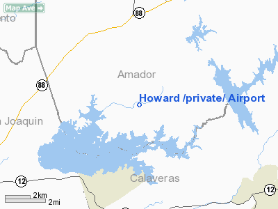
Location
& QuickFacts
|
FAA
Information Effective: |
2006-09-28 |
|
Airport
Identifier: |
5CA8 |
|
Longitude/Latitude: |
120-55-53.7840W/38-15-22.7000N
-120.931607/38.256306 (Estimated) |
|
Elevation: |
480 ft / 146.30 m (Estimated) |
|
Land: |
0 acres |
|
From
nearest city: |
5 nautical miles S of Ione, CA |
|
Location: |
Amador County, CA |
|
Magnetic Variation: |
16E (1985) |
Owner
& Manager
|
Ownership: |
Privately owned |
|
Owner: |
Ormond L. Howard |
|
Address: |
4875 Camanche Pkwy. North
Ione, CA 95640 |
|
Phone
number: |
209-274-4502 |
|
Manager: |
Ormond L. Howard |
|
Address: |
4875 Camanche Pkwy. North
Ione, CA 95640 |
|
Phone number: |
209-274-4502 |
Airport
Operations and Facilities
|
Airport
Use: |
Private |
|
Wind
indicator: |
Yes |
|
Segmented
Circle: |
Yes |
|
Control
Tower: |
No |
|
Attendance
Schedule: |
UNATNDD |
|
Landing
fee charge: |
No |
|
Sectional
chart: |
San Francisco |
|
Region: |
AWP - Western-Pacific |
|
Boundary
ARTCC: |
ZOA - Oakland |
|
Tie-in
FSS: |
RIU - Rancho Murieta |
|
FSS
on Airport: |
No |
|
FSS
Phone: |
916-354-0161 |
|
FSS
Toll Free: |
1-800-WX-BRIEF |
|
Runway Information
Runway 07/25
|
Dimension: |
1481 x 40 ft / 451.4 x 12.2 m |
|
Surface: |
DIRT, |
|
|
Runway 07 |
Runway 25 |
|
Traffic
Pattern: |
Right |
Left |
|
Radio Navigation
Aids
|
ID |
Type |
Name |
Ch |
Freq |
Var |
Dist |
|
TCY |
NDB |
Tracy |
|
203.00 |
15E |
41.7 nm |
|
LV |
NDB |
Reiga |
|
374.00 |
16E |
49.2 nm |
|
SUU |
TACAN |
Travis |
113X |
|
17E |
47.8 nm |
|
TZZ |
VOR |
Travis |
|
116.40 |
17E |
41.8 nm |
|
HNW |
VOR/DME |
Hangtown |
102X |
115.50 |
17E |
29.4 nm |
|
MCC |
VOR/DME |
Mc Clellan |
029X |
109.20 |
17E |
33.2 nm |
|
MOD |
VOR/DME |
Modesto |
093X |
114.60 |
17E |
37.8 nm |
|
LIN |
VORTAC |
Linden |
095X |
114.80 |
17E |
11.4 nm |
|
ECA |
VORTAC |
Manteca |
107X |
116.00 |
17E |
27.8 nm |
|
SAC |
VORTAC |
Sacramento |
099X |
115.20 |
17E |
31.3 nm |
|
SAC |
VOT |
Sacramento Executive |
|
111.40 |
|
30.9 nm |
|
SMF |
VOT |
Sacramento Metropolitan |
|
111.40 |
|
40.5 nm |
Remarks
- RUNWAY
SLOPES CONSIDERABLY DOWNHILL TO WEST.
- VFR;
PRIVATE USE.
Based Aircraft
|
Aircraft
based on field: |
1 |
|
Single
Engine Airplanes: |
1 |
Howard /private/ Airport
Address:
Amador County, CA
Tel:
209-274-4502
Images
and information placed above are from
http://www.airport-data.com/airport/5CA8/
We
thank them for the data!
| General
Info |
| Country |
United
States |
| State |
CALIFORNIA
|
| FAA ID |
5CA8
|
| Latitude |
38-15-22.700N
|
| Longitude |
120-55-53.784W
|
| Elevation |
480 feet
|
| Near City |
IONE
|
We don't guarantee the information is fresh and accurate. The data may
be wrong or outdated.
For more up-to-date information please refer to other sources.
|
|


