 |
|
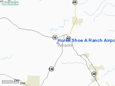
Horse Shoe A Ranch Airport |
Location
& QuickFacts
|
FAA
Information Effective: |
2006-09-28 |
|
Airport
Identifier: |
CA71 |
|
Longitude/Latitude: |
120-53-13.0000W/38-26-24.0000N
-120.886944/38.440000 (Estimated) |
|
Elevation: |
750 ft / 228.60 m (Estimated) |
|
Land: |
360 acres |
|
From
nearest city: |
2 nautical miles W of Drytown, CA |
|
Location: |
Amador County, CA |
|
Magnetic Variation: |
16E (1985) |
Owner
& Manager
|
Ownership: |
Privately owned |
|
Owner: |
Ronald G Matulich |
|
Address: |
7400 Hwy 16
Plymouth, CA 95669 |
|
Phone number: |
209-245-6656 |
|
Manager: |
Ronald Matulich |
|
Address: |
7400 Hwy 16
Plymouth, CA 95669 |
|
Phone number: |
209-245-6656 |
Airport
Operations and Facilities
|
Airport
Use: |
Private |
|
Wind
indicator: |
Yes |
|
Segmented
Circle: |
No |
|
Control
Tower: |
No |
|
Attendance
Schedule: |
ALL/ALL/DALGT |
|
Sectional
chart: |
San Francisco |
|
Region: |
AWP - Western-Pacific |
|
Boundary
ARTCC: |
ZOA - Oakland |
|
Tie-in
FSS: |
RIU - Rancho Murieta |
|
FSS
on Airport: |
No |
|
FSS
Phone: |
916-354-0161 |
|
FSS
Toll Free: |
1-800-WX-BRIEF |
|
Runway Information
Runway 14/32
|
Dimension: |
3000 x 50 ft / 914.4 x 15.2 m |
|
Surface: |
DIRT, |
|
|
Runway 14 |
Runway 32 |
|
Traffic
Pattern: |
Left |
Left |
|
Radio Navigation
Aids
|
ID |
Type |
Name |
Ch |
Freq |
Var |
Dist |
|
BAB |
TACAN |
Beale |
023X |
|
16E |
49.2 nm |
|
TZZ |
VOR |
Travis |
|
116.40 |
17E |
43.9 nm |
|
HNW |
VOR/DME |
Hangtown |
102X |
115.50 |
17E |
18.3 nm |
|
MCC |
VOR/DME |
Mc Clellan |
029X |
109.20 |
17E |
27.9 nm |
|
MOD |
VOR/DME |
Modesto |
093X |
114.60 |
17E |
49.0 nm |
|
LIN |
VORTAC |
Linden |
095X |
114.80 |
17E |
22.6 nm |
|
SAC |
VORTAC |
Sacramento |
099X |
115.20 |
17E |
31.3 nm |
|
ECA |
VORTAC |
Manteca |
107X |
116.00 |
17E |
38.9 nm |
|
SAC |
VOT |
Sacramento Executive |
|
111.40 |
|
29.1 nm |
|
SMF |
VOT |
Sacramento Metropolitan |
|
111.40 |
|
36.4 nm |
Remarks
- PVT
AGRICULTURAL USE ONLY.
- PROVIDED
PVT USE VFR ONLY.
Horse Shoe A Ranch Airport
Address:
Amador County, CA
Tel:
209-245-6656
Images
and information placed above are from
http://www.airport-data.com/airport/CA71/
We
thank them for the data!
| General
Info |
| Country |
United
States |
| State |
CALIFORNIA
|
| FAA ID |
CA71
|
| Latitude |
38-26-24.000N
|
| Longitude |
120-53-13.000W
|
| Elevation |
750 feet
|
| Near City |
DRYTOWN
|
We don't guarantee the information is fresh and accurate. The data may
be wrong or outdated.
For more up-to-date information please refer to other sources.
|
|


