 |
|
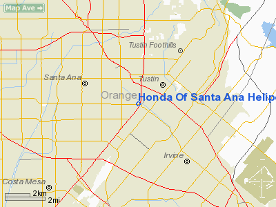
Honda Of Santa Ana Heliport |
Location
& QuickFacts
|
FAA
Information Effective: |
2006-09-28 |
|
Airport
Identifier: |
87CN |
|
Longitude/Latitude: |
117-50-10.4900W/33-43-37.4600N
-117.836247/33.727072 (Estimated) |
|
Elevation: |
113 ft / 34.44 m (Estimated) |
|
Land: |
0 acres |
|
From
nearest city: |
2 nautical miles W of Santa Ana, CA |
|
Location: |
Orange County, CA |
|
Magnetic Variation: |
() |
Owner
& Manager
|
Ownership: |
Privately owned |
|
Owner: |
Ron Vinci, C/o Honda Of Santa Ana |
|
Address: |
1505 Auto Mall Drive
Santa Ana, CA 92705 |
|
Phone
number: |
714-547-3555 |
|
Manager: |
Jen Mcskimming |
|
Address: |
C/o Robinson Helicopter Co., 2901 Airport
Drive
Torrance, CA 90505 |
|
Phone number: |
310-539-0508 |
Airport
Operations and Facilities
|
Airport
Use: |
Private |
|
Wind
indicator: |
Yes |
|
Segmented
Circle: |
No |
|
Control
Tower: |
No |
|
Attendance
Schedule: |
UNATNDD |
|
Region: |
AWP - Western-Pacific |
|
Boundary
ARTCC: |
ZLA - Los Angeles |
|
Responsible
ARTCC: |
ZLA - Los Angeles |
|
Tie-in
FSS: |
RAL - Riverside |
|
FSS
Phone: |
951-351-3020 |
|
FSS
Toll Free: |
1-800-WX-BRIEF |
|
Runway Information
Helipad H1
|
Dimension: |
20
x 20 ft / 6.1 x 6.1 m |
|
Surface: |
MATS, |
|
|
Runway H1 |
Runway |
|
Traffic
Pattern: |
Left |
Left |
|
Radio Navigation
Aids
|
ID |
Type |
Name |
Ch |
Freq |
Var |
Dist |
|
CPM |
NDB |
Compton |
|
378.00 |
15E |
22.7 nm |
|
EMT |
NDB |
El Monte |
|
359.00 |
15E |
23.8 nm |
|
SB |
NDB |
Petis |
|
397.00 |
14E |
30.7 nm |
|
SJY |
NDB |
San Jacinto |
|
227.00 |
14E |
42.0 nm |
|
PAI |
NDB |
Pacoima |
|
370.00 |
15E |
43.0 nm |
|
RIV |
TACAN |
March |
077X |
|
14E |
30.1 nm |
|
NFG |
TACAN |
Camp Pendleton |
055X |
|
13E |
35.3 nm |
|
RAL |
VOR |
Riverside |
|
112.40 |
15E |
23.6 nm |
|
HDF |
VOR |
Homeland |
|
113.40 |
14E |
32.7 nm |
|
ELB |
VOR/DME |
El Toro |
119X |
117.20 |
14E |
6.1 nm |
|
SMO |
VOR/DME |
Santa Monica |
045X |
110.80 |
15E |
35.3 nm |
|
VNY |
VOR/DME |
Van Nuys |
078X |
113.10 |
15E |
44.2 nm |
|
SLI |
VORTAC |
Seal Beach |
104X |
115.70 |
15E |
11.4 nm |
|
PDZ |
VORTAC |
Paradise |
059X |
112.20 |
15E |
19.1 nm |
|
POM |
VORTAC |
Pomona |
041X |
110.40 |
15E |
21.3 nm |
|
LAX |
VORTAC |
Los Angeles |
083X |
113.60 |
15E |
32.2 nm |
|
OCN |
VORTAC |
Oceanside |
100X |
115.30 |
15E |
36.0 nm |
|
SXC |
VORTAC |
Santa Catalina |
051X |
111.40 |
15E |
36.1 nm |
|
SNA |
VOT |
Santa Ana |
|
110.00 |
|
3.5 nm |
|
LAX |
VOT |
San Pedro Hill |
|
113.90 |
|
25.0 nm |
Remarks
- PROVIDED
PRIVATE USE; VFR OPNS; OBSTRUCTION FREE INGRESS/EGRESS ROUTES; LIGHTING
BE INSTALLED IF OPNS CONDUCTED BETWEEN SUNSET AND SUNRISE; COORDINATE
ALL OPNS WITH JOHN WAYNE AIRPORT ATCT; AND ENSURE HELOS APPROACHING
FM THE NORTH OR SOUTH DO NOT OVERFLY SCHOOLS OR PLACES OF HIGH DENSITY
OF PEOPLE.
Honda Of Santa Ana Heliport
Address:
Orange County, CA
Tel:
714-547-3555,
310-539-0508
Images
and information placed above are from
http://www.airport-data.com/airport/87CN/
We
thank them for the data!
We don't guarantee the information is fresh and accurate. The data may
be wrong or outdated.
For more up-to-date information please refer to other sources.
|
|


