 |
|
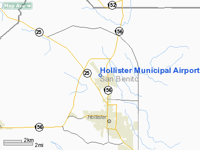
Hollister Municipal Airport |
|
|
Location
& QuickFacts
|
FAA
Information Effective: |
2006-09-28 |
|
Airport
Identifier: |
3O7 |
|
Longitude/Latitude: |
121-24-36.9740W/36-53-36.0430N
-121.410271/36.893345 (Estimated) |
|
Elevation: |
230 ft / 70.10 m (Surveyed) |
|
Land: |
343 acres |
|
From
nearest city: |
3 nautical miles N of Hollister, CA |
|
Location: |
San Benito County, CA |
|
Magnetic Variation: |
15E (1995) |
Owner
& Manager
|
Ownership: |
Publicly owned |
|
Owner: |
City Of Hollister |
|
Address: |
375 5th St.
Hollister, CA 95023 |
|
Phone
number: |
831-636-4365 |
|
Manager: |
Bill Gere |
|
Address: |
90 Skylane Dr Suite 101
Hollister, CA 95023 |
|
Phone number: |
831-636-4365
FAX (831)636-4366. |
Airport
Operations and Facilities
|
Airport
Use: |
Open to public |
|
Wind
indicator: |
Yes |
|
Segmented Circle: |
Yes |
|
Control
Tower: |
No |
|
Attendance Schedule: |
ALL/ALL/0800-1700
AMGR AT ARPT MON-FRI 0800-1500. |
|
Lighting
Schedule: |
DUSK-DAWN
ACTVT MIRL RYS 06/24 & 13/31; REIL RYS 24; 13& 31
AND VASI RY 24; PAPI RYS 13 & 31 - CTAF. |
|
Beacon
Color: |
Clear-Green (lighted land airport) |
|
Landing
fee charge: |
No |
|
Sectional chart: |
San Francisco |
|
Region: |
AWP - Western-Pacific |
|
Traffic
Pattern Alt: |
800 ft |
|
Boundary
ARTCC: |
ZOA - Oakland |
|
Tie-in
FSS: |
OAK - Oakland |
|
FSS
on Airport: |
No |
|
FSS
Phone: |
510-273-6111 |
|
FSS
Toll Free: |
1-800-WX-BRIEF |
|
NOTAMs
Facility: |
OAK (NOTAM-d service avaliable) |
|
Federal Agreements: |
NGPRY |
Airport
Communications
|
CTAF: |
123.000 |
|
Unicom: |
123.000 |
Airport
Services
|
Fuel
available: |
100LLA
FUEL AVBL 24 HRS CREDIT CARD LOCK SYSTEM. |
|
Airframe
Repair: |
MAJOR |
|
Power
Plant Repair: |
MAJOR |
|
Bottled
Oxygen: |
NONE |
|
Bulk
Oxygen: |
NONE |
|
Runway
Information
Runway 06/24
|
Dimension: |
3150 x 100 ft / 960.1 x 30.5 m |
|
Surface: |
ASPH, Good Condition |
|
Weight
Limit: |
Single wheel: 30000 lbs.
Dual wheel: 45000 lbs. |
|
Edge
Lights: |
Medium |
|
|
Runway
06 |
Runway
24 |
|
Longitude: |
121-24-48.2880W |
121-24-11.4440W |
|
Latitude: |
36-53-22.9990N |
36-53-32.6940N |
|
Elevation: |
224.00 ft |
222.00 ft |
|
Alignment: |
72 |
127 |
|
Traffic
Pattern: |
Left |
Left |
|
Markings: |
Basic, Fair Condition |
Basic, Fair Condition |
|
Crossing
Height: |
0.00
ft |
26.00 ft |
|
VASI: |
|
4-box on left side |
|
Visual
Glide Angle: |
0.00� |
3.75� |
|
Runway
End Identifier: |
|
Yes |
|
Centerline
Lights: |
No |
No |
|
Touchdown
Lights: |
No |
No |
|
Obstruction: |
65 ft hill, 1700.0 ft from runway, 100 ft right of centerline,
23:1 slope to clear |
15 ft road, 510.0 ft from runway, 20:1 slope to clear |
|
Runway 13/31
|
Dimension: |
6350 x 100 ft / 1935.5 x 30.5 m |
|
Surface: |
ASPH, Good Condition |
|
Weight
Limit: |
Single wheel: 30000 lbs.
Dual wheel: 45000 lbs. |
|
Edge
Lights: |
Medium |
|
|
Runway
13 |
Runway
31 |
|
Longitude: |
121-25-04.6290W |
121-24-16.3730W |
|
Latitude: |
36-54-04.8080N |
36-53-15.4090N |
|
Elevation: |
202.00 ft |
230.00 ft |
|
Alignment: |
127 |
127 |
|
Traffic
Pattern: |
Left |
Left |
|
Markings: |
Non-precision instrument, Fair Condition |
Non-precision instrument, Fair Condition |
|
Crossing
Height: |
40.00 ft |
40.00 ft |
|
VASI: |
2-light PAPI on left side |
2-light PAPI on left side |
|
Visual
Glide Angle: |
3.00� |
3.00� |
|
Runway
End Identifier: |
Yes |
Yes |
|
Centerline
Lights: |
No |
No |
|
Touchdown
Lights: |
No |
No |
|
Radio
Navigation Aids
|
ID |
Type |
Name |
Ch |
Freq |
Var |
Dist |
|
PDG |
NDB |
Pajar |
|
327.00 |
17E |
19.2 nm |
|
UAD |
NDB |
Chualar |
|
263.00 |
16E |
24.4 nm |
|
TCY |
NDB |
Tracy |
|
203.00 |
15E |
48.1 nm |
|
LV |
NDB |
Reiga |
|
374.00 |
16E |
49.8 nm |
|
NUQ |
TACAN |
Moffett |
123X |
|
17E |
44.8 nm |
|
SJC |
VOR/DME |
San Jose |
088X |
114.10 |
16E |
38.6 nm |
|
MOD |
VOR/DME |
Modesto |
093X |
114.60 |
17E |
49.1 nm |
|
SNS |
VORTAC |
Salinas |
120X |
117.30 |
17E |
16.6 nm |
|
PXN |
VORTAC |
Panoche |
073X |
112.60 |
16E |
32.2 nm |
|
BSR |
VORTAC |
Big Sur |
087X |
114.00 |
16E |
44.2 nm |
Remarks
- MODEL
ACFT CLUB CONDUCTING FLT OPNS 3 MILES WNW OF ARPT HEADING OF 290 DEGREES
FM ARPT SURFACE TO 500' AGL.
-
CAUTION-WATCH FOR FIRE FIGHTING ACFT JUNE THRU OCTOBER.
- RYS
06/24 & 13/31 HAVE 50' ASPH SHOULDERS BOTH SIDES.
- GLIDER
ACTIVITY ON AND INVOF ARPT.
Based
Aircraft
|
Aircraft
based on field: |
145 |
|
Single
Engine Airplanes: |
115 |
|
Multi
Engine Airplanes: |
17 |
|
Helicopters: |
3 |
|
Gliders: |
10 |
Operational
Statistics
|
Aircraft
Operations: |
146/Day |
|
General
Aviation Local: |
40.6% |
|
General
Aviation Itinerant: |
56.6% |
|
Military: |
2.8% |
Hollister Municipal
Airport
Address:
San Benito County, CA
Tel:
831-636-4365
FAX: (831)636-4366
Images
and information placed above are from
http://www.airport-data.com/airport/3O7/
We
thank them for the data!
| General Info |
| Country |
United States |
| State |
CALIFORNIA |
| FAA ID |
3O7 |
| Latitude |
36-53-36.043N |
| Longitude |
121-24-36.974W |
| Elevation |
230 feet |
| Near City |
HOLLISTER |
We don't guarantee the information is fresh and accurate. The data may
be wrong or outdated.
For more up-to-date information please refer to other sources.
|
|


