 |
|
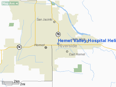
Hemet Valley Hospital Helistop Heliport |
|
|
Location
& QuickFacts
|
FAA
Information Effective: |
2006-06-08 |
|
Airport
Identifier: |
CA74 |
|
Longitude/Latitude: |
116-57-33.0830W/33-45-00.0720N
-116.959190/33.750020 (Estimated) |
|
Elevation: |
1250 ft / 381.00 m (Estimated) |
|
Land: |
0 acres |
|
From
nearest city: |
0 nautical miles E of Hemet, CA |
|
Location: |
Riverside County, CA |
|
Magnetic Variation: |
14E (1985) |
Owner
& Manager
|
Ownership: |
Privately owned |
|
Owner: |
Hemet Valley Hospital District |
|
Address: |
1117 East Devonshire Ave
Hemet, CA 92343 |
|
Phone
number: |
951-652-2811 |
|
Manager: |
John Rufner |
|
Address: |
1117 East Devonshire Ave
Hemet, CA 92343 |
|
Phone number: |
951-595-2824 |
Airport
Operations and Facilities
|
Airport
Use: |
Private
MEDICAL USE. |
|
Wind
indicator: |
Yes |
|
Segmented
Circle: |
No |
|
Control
Tower: |
No |
|
Attendance
Schedule: |
ALL/ALL/ALL |
|
Lighting
Schedule: |
DUSK-DAWN |
|
Sectional
chart: |
Los Angeles |
|
Region: |
AWP - Western-Pacific |
|
Boundary
ARTCC: |
ZLA - Los Angeles |
|
Tie-in
FSS: |
RAL - Riverside |
|
FSS
on Airport: |
No |
|
FSS
Phone: |
951-351-3020 |
|
FSS
Toll Free: |
1-800-WX-BRIEF |
|
Runway Information
Helipad H1
|
Dimension: |
48 x 48 ft / 14.6 x 14.6 m |
|
Surface: |
CONC, |
|
|
Runway H1 |
Runway |
|
Traffic
Pattern: |
Left |
Left |
|
Radio Navigation
Aids
|
ID |
Type |
Name |
Ch |
Freq |
Var |
Dist |
|
SJY |
NDB |
San Jacinto |
|
227.00 |
14E |
3.4 nm |
|
SB |
NDB |
Petis |
|
397.00 |
14E |
27.4 nm |
|
RIV |
TACAN |
March |
077X |
|
14E |
18.3 nm |
|
NFG |
TACAN |
Camp Pendleton |
055X |
|
13E |
35.7 nm |
|
HDF |
VOR |
Homeland |
|
113.40 |
14E |
11.4 nm |
|
RAL |
VOR |
Riverside |
|
112.40 |
15E |
27.3 nm |
|
ELB |
VOR/DME |
El Toro |
119X |
117.20 |
14E |
38.8 nm |
|
PSP |
VORTAC |
Palm Springs |
102X |
115.50 |
13E |
27.4 nm |
|
PDZ |
VORTAC |
Paradise |
059X |
112.20 |
15E |
30.2 nm |
|
OCN |
VORTAC |
Oceanside |
100X |
115.30 |
15E |
38.3 nm |
|
TRM |
VORTAC |
Thermal |
109X |
116.20 |
13E |
40.6 nm |
|
JLI |
VORTAC |
Julian |
087X |
114.00 |
15E |
41.1 nm |
|
POM |
VORTAC |
Pomona |
041X |
110.40 |
15E |
45.8 nm |
|
SNA |
VOT |
Santa Ana |
|
110.00 |
|
45.8 nm |
Remarks
Based Aircraft
|
Aircraft
based on field: |
2 |
|
Multi
Engine Airplanes: |
1 |
|
Helicopters: |
1 |
Hemet Valley Hospital Helistop Heliport
Address:
Riverside County, CA
Tel:
951-652-2811,
951-595-2824
Images
and information placed above are from
http://www.airport-data.com/airport/CA74/
We
thank them for the data!
| General
Info |
| Country |
United
States |
| State |
CALIFORNIA
|
| FAA ID |
CA74
|
| Latitude |
33-45-00.072N
|
| Longitude |
116-57-33.083W
|
| Elevation |
1250 feet
|
| Near City |
HEMET
|
We don't guarantee the information is fresh and accurate. The data may
be wrong or outdated.
For more up-to-date information please refer to other sources.
|
|


